Overland region
Ruta 40 and the Carretera Austral by 4x4 and motorbike: local guides and trips
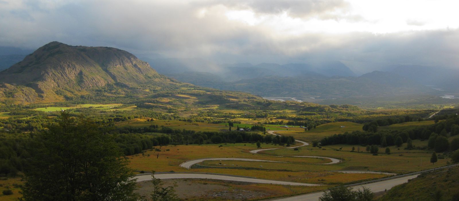
In Patagonia two roads form the classic overland loop. In Argentina, the Ruta Nacional 40 runs east of the Andes from Bariloche to Perito Moreno, and on to El Calafate and El Chaltén in the Parque Nacional Los Glaciares. In Chile, the Carretera Austral (Route 7) covers about 1,240 km from Puerto Montt to Villa O'Higgins, through Chaitén, Coyhaique, Cerro Castillo, Puerto Río Tranquilo and the branch to Caleta Tortel. For anyone travelling with their own vehicle it means gravel sections, ferry crossings on the Chilean side, and temporary import paperwork and separate compulsory insurance at each border: check the current rules before you go. Here are the local guides who work in the area and the trips that cross it.
3 local guides and 4 trips on Ruta 40 and the Carretera Austral on GuideMeet.
On the map
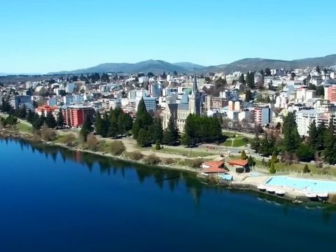 San Carlos de Bariloche — Town. City of 135,755 people (2022 census) at 893 m on the southern shore of Nahuel Huapi Lake, in Río Negro province, near the Chilean border. It was the main settlement of Nahuel Huapi National Park, and the Ruta Nacional 40 runs through it. -41.1500, -71.3000 · Google Maps
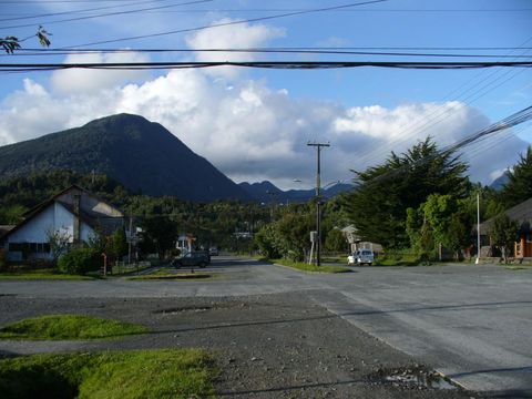 Chaitén — Town. Town near the northern end of the Carretera Austral, where the road turns inland. In May 2008 the Chaitén volcano erupted for the first time in more than 9,000 years; a lahar flooded the town and the Blanco River cut a new course through it. Pictured: Chaitén in 2007. -42.9167, -72.7000 · Google Maps
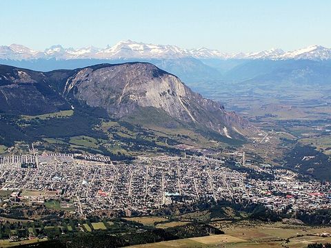 Coyhaique — Town. Capital of the Aysén Region, founded in 1929 under the name Baquedano where the Simpson and Coyhaique rivers meet. With 57,823 inhabitants (2024 census) it is the largest city on the Carretera Austral. -45.5670, -72.0670 · Google Maps
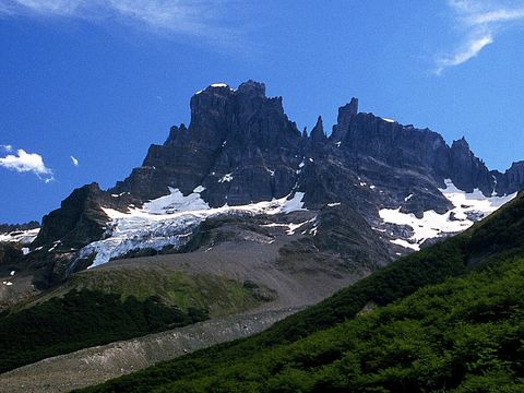 Parque Nacional Cerro Castillo — Park. Protected area of 143,502 ha south of Coyhaique, in the communes of Coyhaique and Río Ibáñez, crossed by the Carretera Austral. Created as a national reserve in 1970, it became a national park in 2018. Pictured: Cerro Castillo from the east. -46.0500, -72.1830 · Google Maps
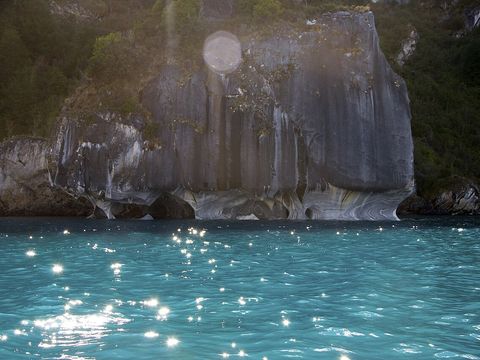 Puerto Río Tranquilo — Village. Village of about 500 people on the western shore of General Carrera Lake, some 220 km south of Coyhaique on the Carretera Austral, with a petrol station and a campsite. From here people visit the marble caves shaped by wind and water; road X-728 leads to the Exploradores valley. Pictured: the marble formations. -46.6241, -72.6766 · Google Maps
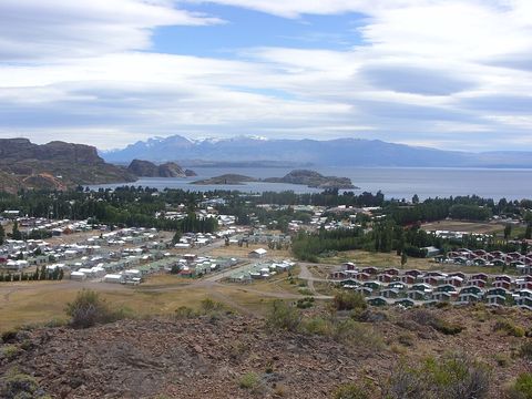 Chile Chico — Town. Town on the southern shore of General Carrera Lake, the lake Argentina calls Lago Buenos Aires. It is 6 km from the border and 8 km from Los Antiguos, linked by a paved road; a car ferry crosses the lake to Puerto Ingeniero Ibáñez on the northern shore. -46.5403, -71.7222 · Google Maps
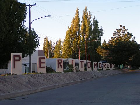 Perito Moreno — Town. Town of 7,812 people (2022 census) in north-western Santa Cruz, 25 km east of Lago Buenos Aires, where the Ruta Nacional 40 meets the RN 43 that runs west to Los Antiguos and the Chilean border. It is the closest town to the Cueva de las Manos and has carried the name of explorer Francisco Moreno since 1952. Pictured: the sculpture with the town's name. -46.5886, -70.9242 · Google Maps
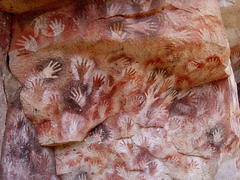 Cueva de las Manos — Rock art. Cave at the foot of a cliff in the Pinturas River canyon, in Santa Cruz, with paintings made in several phases from about 7,300 BC to AD 700; a UNESCO World Heritage Site since 1999. Three gravel roads lead there, one from near Bajo Caracoles and one from Ruta 40. -47.1558, -70.6572 · Google Maps
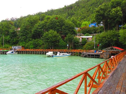 Caleta Tortel — Village. Village founded in 1955 between the mouth of the Baker River and the Baker Channel, with no conventional streets: people walk on boardwalks of Guaitecas cypress. Road X-904, built in 2003, links it to the Carretera Austral; 523 inhabitants in the 2017 census. -47.7830, -73.5330 · Google Maps
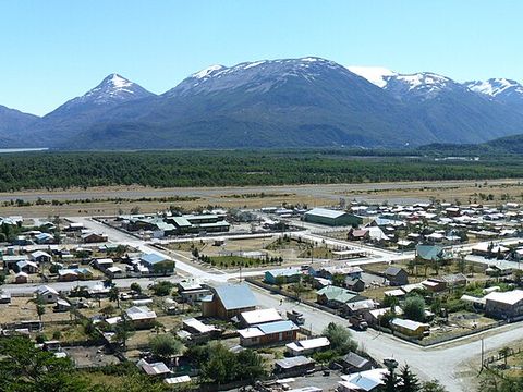 Villa O'Higgins — Village. Village founded in 1966 and reached by the Carretera Austral in 2000, after the ferry between Puerto Yungay and Río Bravo. No road continues into Argentina: from Candelario Mancilla, across the lake, the border is crossed on a footpath. -48.4683, -72.5600 · Google Maps
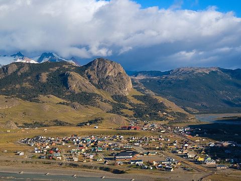 El Chaltén — Village. Village of 1,861 people (2022 census) on the Río de las Vueltas, inside the Los Glaciares National Park, at the foot of the Fitz Roy spires and 220 km north of El Calafate. Francisco Moreno renamed the mountain, until then Chaltén, after Robert FitzRoy in 1877. -49.3314, -72.8861 · Google Maps
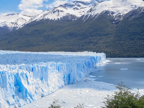 Parque Nacional Los Glaciares — Park. National park created in 1937 and a UNESCO World Heritage Site since 1981, protecting more than 726,000 ha of Patagonian forest and steppe, with its headquarters in El Calafate. In the south the Perito Moreno Glacier, pictured, flows into Lago Argentino, about 80 km from El Calafate. -50.4932, -73.1280 · Google Maps
Local guides on Ruta 40 and the Carretera Austral
 Argentina Campers
Buenos Aires, Argentina · camper / van Crhistian Austin
Santiago de Chile, Chile · 4x4 car, 4x4 truck, offroad motorcycle, adventure motorcycle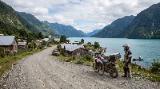 Tomas Karstegl
Punta Arenas, Chile · adventure motorcycle
Argentina: guides by vehicle
Chile: guides by vehicle
Overland trips on Ruta 40 and the Carretera Austral
- Orcas, Condors & Pumas – Patagonia 4x4 Photo Expedition — 12 days · Chile, Argentina
- Rocky Trip – Ruta 40 from the Lakes to Torres del Paine — 11 days · Chile, Argentina
- Carretera Austral & Ruta 40 – Patagonia Loop by Motorcycle or 4x4 — 13 days · Chile, Argentina
- Travel through Argentina freely — 10 days · Argentina
When to go
The driving season is the southern summer. In Coyhaique the mean daily temperature is about 14 °C in January and February and under 3 °C in July, and from May to October it is cold, with snow possible; in El Calafate July averages 0.6 °C, with about six days of snow.
Before you go
- All guides and trips in Argentina
- Do you need a local guide in Argentina?
- Is Argentina safe to travel?
- Driving and local rules in Argentina
Photo credits
Author and licence (or permission) for each photo.
- Patagonia: Ruta 40 and the Carretera Austral: Teo Romera, CC BY-SA 2.0
- 1. San Carlos de Bariloche: Gajes del Youtuber, CC BY 3.0
- 2. Chaitén: betoscopio, CC BY-SA 2.0
- 3. Coyhaique: Rakela, CC BY-SA 3.0
- 4. Parque Nacional Cerro Castillo: Ahti Heinla, CC BY-SA 3.0
- 5. Puerto Río Tranquilo: Lhormazabal, CC BY-SA 3.0
- 6. Chile Chico: Lin linao, CC BY-SA 3.0
- 7. Perito Moreno: Oscar871217, CC BY 3.0
- 8. Cueva de las Manos: Mariano, CC BY-SA 3.0
- 9. Caleta Tortel: Manxuc, CC BY-SA 4.0
- 10. Villa O'Higgins: betoscopio, CC BY-SA 2.0
- 11. El Chaltén: David, CC BY 2.0
- 12. Parque Nacional Los Glaciares: Diego Delso, CC BY-SA 3.0


