Overland region
Murchison Falls by 4x4: local guides and trips
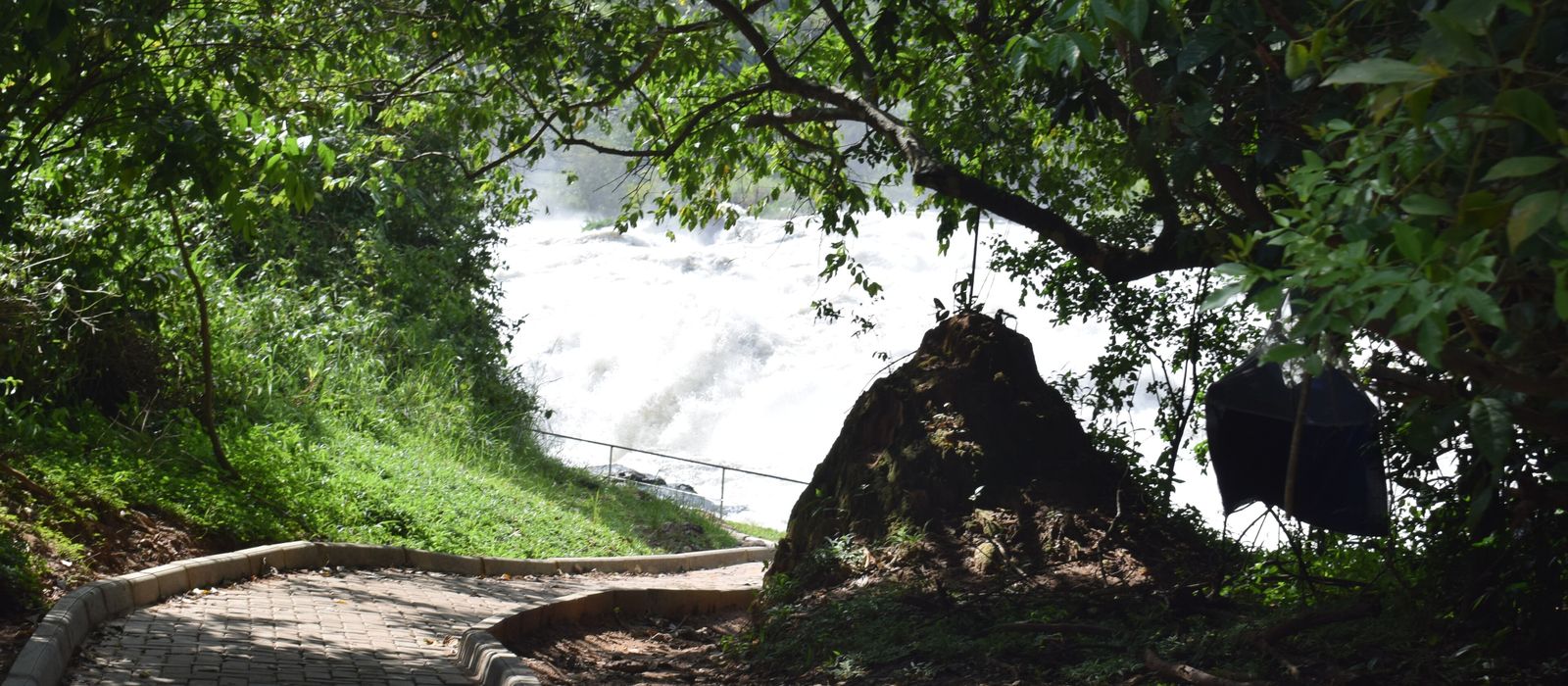
Murchison Falls National Park covers 3,840 km² of north-western Uganda. The Victoria Nile crosses it from east to west and squeezes through a gap about 7 m wide before dropping 43 m. Downstream, Paraa is the hub, with boats to the falls and to the delta on Lake Albert; to the south lie Budongo Forest and Masindi, to the east Karuma, to the north-west Pakwach. For anyone travelling with their own vehicle it means the Paraa ferry between the two banks, basic tracks where 4WD is advised, a 40 km/h speed limit, and the road via Bulisa that descends the escarpment towards Lake Albert. Here are the local guides who work in the area and the trips that cross it.
14 local guides and 19 trips in Murchison Falls on GuideMeet.
On the map
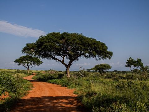 Murchison Falls National Park — Park. Park of 3,840 km², first gazetted as a game reserve in 1926 and a national park since 1952. The north is savanna with borassus palms, acacias and riverine woodland; the south is mostly bush and forest. With the Karuma and Bugungu wildlife reserves it forms a conservation area of 5,072 km². 2.1875, 31.7814 · Google Maps
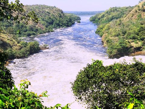 Murchison Falls (Top of the Falls) — Waterfall. The Nile forces its way through a gap in the rocks about 7 m wide and drops 43 m. Samuel Baker named the falls after Roderick Murchison of the Royal Geographical Society. The Top of the Falls viewpoint can be reached by vehicle, or on foot from the launch through Fajao Gorge with a ranger; camping is possible there. 2.2783, 31.6856 · Google Maps
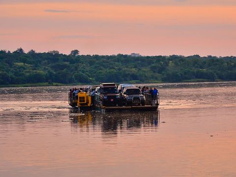 Paraa — Village. The park's tourism hub, whose name means 'home of the hippo' in Luo. A vehicle ferry links the Masindi road on the south bank with the Pakwach road and the Buligi tracks on the north. Boats leave here upriver to the falls (about 3 hours return) and downriver to the delta. 2.3000, 31.5500 · Google Maps
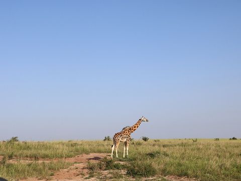 Buligi Peninsula and Delta Point — Park. The park's main game-viewing area: a triangle of grassland between the Victoria Nile entering Lake Albert and the Albert Nile leaving it, with elephants, buffalo, antelopes and giraffes. The tracks meet at Delta Point. In the delta the shoebill is best seen in the December-February and June-September dry seasons. Pictured: a giraffe in the park. 2.2533, 31.3852 · Google Maps
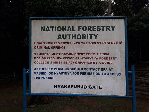 Budongo Forest — Forest. Semi-deciduous forest on the escarpment north-east of Lake Albert, known for its mahogany trees and for about 600 chimpanzees. Its Kaniyo Pabidi section, in the south of the conservation area and 30 km north of Masindi, has a habituated chimp group that can be tracked with forest guides. Pictured: the Royal Mile track. 1.7242, 31.5458 · Google Maps
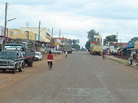 Masindi — Town. Town at about 1,227 m, some 211 km north-west of Kampala on a tarmac highway. The most direct route to Paraa, 86 km, enters the park at Kichumbanyobo Gate, 16 km from town; a longer route of 136 km goes through Budongo Forest and Bulisa. 1.6836, 31.7222 · Google Maps
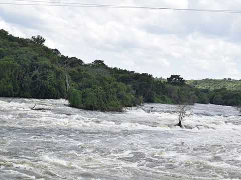 Karuma Falls — Town. Town where the Kampala-Gulu highway crosses the Nile, about 97 km by road north-east of Masindi and 77 km south of Gulu, site of the Karuma power station. From this road the park's northern gates, Chobe, Wankwar and Tangi, are reached. 2.2342, 32.2464 · Google Maps
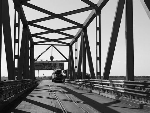 Pakwach — Town. Town on the western bank of the Albert Nile, a few kilometres from the north-western corner of the park, on the Karuma-Pakwach-Nebbi-Arua road. Paraa is about 25 km away by road. Pictured: the Albert Nile bridge at Pakwach. 2.4619, 31.4983 · Google Maps
- Butiaba — Town. Fishing town and landing site on the eastern shore of Lake Albert, at about 622 m, in Buliisa District. In the first half of the 20th century goods from eastern DR Congo and South Sudan crossed the lake by boat to its harbour, then continued overland through Masindi. 1.8189, 31.3258 · Google Maps
- Wanseko — Village. Fishing settlement inside the Bugungu Wildlife Reserve, at the mouth of the Victoria Nile on Lake Albert, about 15 km by road north of Buliisa. It is the northern end of the 111 km Hoima-Butiaba-Wanseko road, and a ferry crosses the river mouth to Panyimur, in Pakwach District. 2.1778, 31.3806 · Google Maps
Local guides in Murchison Falls
 Mugisa Ronald
Fort Portal, Uganda · 4x4 car, 4x4 truck, camper / van, 4x4 van, offroad motorcycle, adventure motorcycle, bicycle / e-bike Mystery Gorilla Safaris
Kabale, Uganda · 4x4 car, 4x4 van Mathias Asiimwe
Kampala, Uganda · 4x4 car, 4x4 van, adventure motorcycle, bicycle / e-bike, 4x4 truck Ababa Uganda safaris
Uganda · 4x4 car Denis Galabuzi
Kampala, Uganda · bicycle / e-bike, 4x4 car, 4x4 van Finito Msituni Safaris
Kampala, Uganda · 4x4 car, 4x4 van, camper / van, 4x4 truck Judith Mirembe
Uganda · 4x4 car Moses Aine
Entebbe International Airport, Uganda · 4x4 car Dianah Legit Holidays
Entebbe, Uganda · 4x4 car, 4x4 van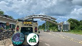 Lena Tours
Kampala, Uganda · 4x4 car, 4x4 van, bicycle / e-bike, camper / van Peku Adventures
Kampala, Uganda · 4x4 car, 4x4 truck, camper / van, 4x4 van, bicycle / e-bike Oyer Charles
Murchison Falls National Park, Uganda · 4x4 car
More local guides (2)
 Car Hire Africa - Drive Your Own Safari
Kampala, Uganda Ssebunya Araphat
Kampala, Uganda
Uganda: guides by vehicle
Overland trips in Murchison Falls
- 6 Day Best of Uganda and wildlife viewing — Uganda
- Uganda Rwanda safari — 10 days · Uganda, Rwanda
- Birds of Uganda — 18 days · Uganda
- UGANDA BY BIKE & SAFARI A 17-DAY JOURNEY THROUGH WILDLIFE, CULTURE & COMMUNITY — 18 days · Uganda
- 3-Day Murchison Falls Wildlife Safari — Big Game & Nile Boat Cruise — 3 days · Uganda
- Explore Uganda — 14-Day Wildlife Overland Adventure — 14 days · Uganda
- Uganda–Rwanda Odyssey — 15-Day Overland Safari — 15 days · Uganda, Rwanda
- Ultimate Uganda–Rwanda — 20-Day Cross-Border Expedition — 20 days · Uganda, Rwanda
- Rhinos & Primates Uganda — 10-Day Overland Safari — 10 days · Uganda
- Uganda Overland Circuit: Wildlife, Forests and Scenic Landscapes — 12 days · Uganda
- Uganda Grand Safari: Murchison Falls to Bwindi — 10 days · Uganda
- 3 DAYS MURCHISON FALLS EXPERIENCE — 3 days · Uganda
- 6 Days Murchison Falls — 6 days · Uganda
- 3 DAYS MURCHISON FALLS SAFARI — 3 days · Uganda
- 14 Uganda Self Drive Advventure — 16 days · Uganda, Rwanda
- 7 DAYS UGANDA SAFARI ADVENTURE — 7 days · Uganda
- 15 DAYS UGANDA SAFARI EXPERIENCE — 15 days · Uganda
- 3-Day Murchison Falls Wildlife & Nile Safari – Uganda — 3 days · Uganda
- 15-Day Uganda Self Drive Safari Adventure | Explore Uganda with Car Hire Africa – Drive Your Own… — 15 days · Uganda
When to go
The dry seasons run from December to late February and from June to September, when animals gather around water; in Budongo Forest annual rainfall is between 1,200 and 2,200 mm. Daytime temperatures in the park are around 25-32 °C, dropping to about 18 °C at night.
Before you go
- All guides and trips in Uganda
- Do you need a local guide in Uganda?
- Is Uganda safe to travel?
- Driving and local rules in Uganda
Photo credits
Author and licence (or permission) for each photo.
- Murchison Falls: NANTUMBWEJ, CC BY-SA 4.0
- 1. Murchison Falls National Park: Vanmulondo, CC BY-SA 4.0
- 2. Murchison Falls (Top of the Falls): Jingo Faizal, CC BY-SA 4.0
- 3. Paraa: Rod Waddington, CC BY-SA 2.0
- 4. Buligi Peninsula and Delta Point: Kateregga1, CC BY-SA 4.0
- 5. Budongo Forest: Josefito123, CC BY-SA 4.0
- 6. Masindi: Daryona, CC BY-SA 3.0
- 7. Karuma Falls: Bruno ashimwe winks, CC BY-SA 4.0
- 8. Pakwach: Jim Joel, CC BY-SA 4.0


