Overland region
Kibale and Fort Portal by 4x4: local guides and trips
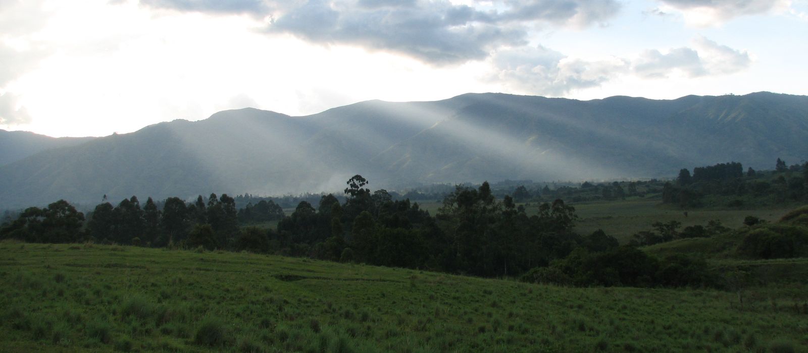
Fort Portal, historic seat of the Tooro Kingdom, lies 296 km west of Kampala on an all-tarmac highway. To the south are the Ndali–Kasenda crater lakes and Kibale National Park: 795 km² of forest with 13 primate species and about 1,450 chimpanzees, tracked from Kanyanchu, with the Bigodi wetland just outside. To the west the Bundibugyo road crosses the northern Rwenzori and drops 700 m to Semuliki National Park and the Sempaya hot springs; the Toro-Semliki reserve reaches Lake Albert. For anyone travelling with their own vehicle it means tarmac to Kanyanchu and Sempaya, then a 40 km dirt road from Karugutu to Ntoroko. Here are the local guides who work in the area and the trips that cross it.
12 local guides and 15 trips in Kibale and Fort Portal on GuideMeet.
On the map
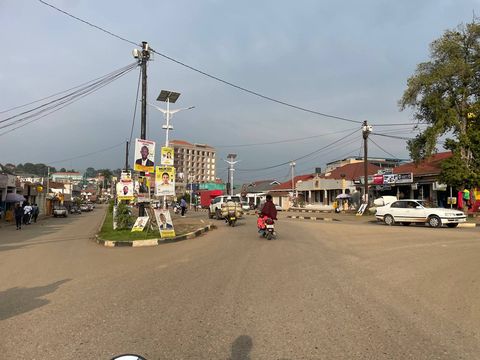 Fort Portal — Town. City at 1,523 m, seat of Kabarole District and historically of the Tooro Kingdom, named after the British diplomat Sir Gerald Portal. Kampala is 296 km east on an all-tarmac road through Mubende. 0.6544, 30.2744 · Google Maps
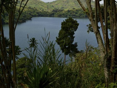 Ndali–Kasenda crater lakes — Lake. Volcanic crater lakes along the western edge of Kibale, south of Fort Portal, with lodges and campsites around many of them. Rwaihamba, the largest village and trading centre of the area, is 40 km from Fort Portal. Pictured: Lake Nyinambuga. 0.4805, 30.2903 · Google Maps
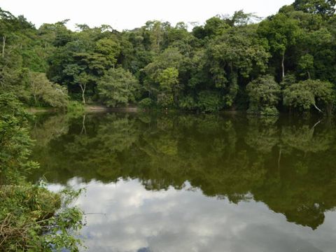 Lake Nkuruba — Lake. Crater lake in Kabarole District, in the lakes area around Rwaihamba. On its shore the Lake Nkuruba Nature Reserve & Community Campsite has pitches and basic bandas, with its own access to the water. 0.5170, 30.3030 · Google Maps
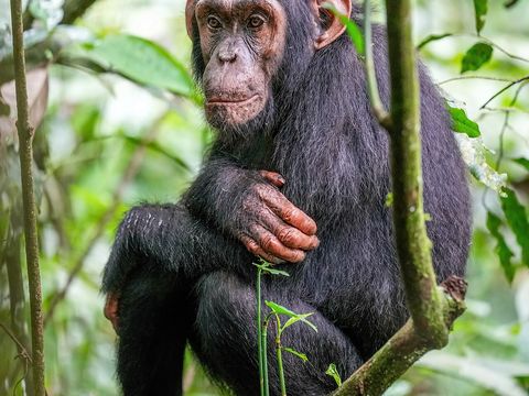 Kibale National Park — Park. Forest park of 795 km², a national park since 1993. The north lies on the Fort Portal plateau at 1,590 m; to the south the land drops to the rift valley floor, 500 m lower. 13 primate species, including about 1,450 chimpanzees, and 372 bird species. A second visitor site is at Sebitoli, 16 km east of Fort Portal. 0.4496, 30.4301 · Google Maps
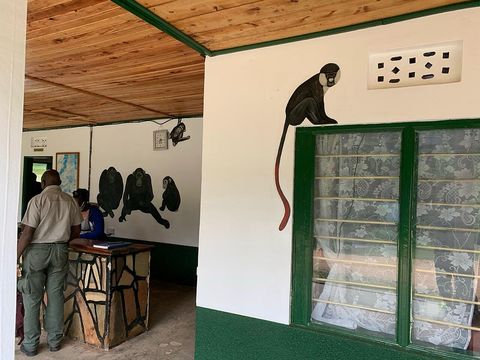 Kanyanchu — Park. Main visitor hub of Kibale, 35 km south-east of Fort Portal on the tarmac road to Kamwenge and Ibanda. Chimpanzee walks leave from the visitor centre in groups of up to six; advance booking is essential. 0.4370, 30.3933 · Google Maps
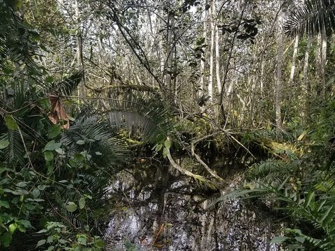 Bigodi Wetland Sanctuary — Reserve. Community-run wetland just outside the park, 5 km south of Kanyanchu, visited for forest-edge and swamp birds. Around Bigodi village there is accommodation for every budget. 0.3916, 30.4034 · Google Maps
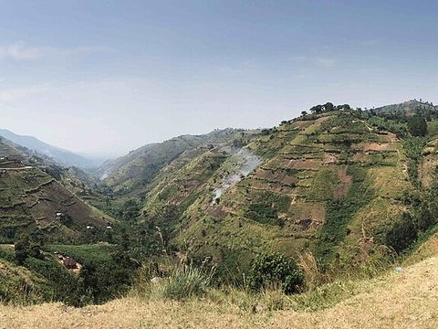 Fort Portal–Bundibugyo road — Mountain pass. Road of about 104 km that crosses the Rwenzori range from Fort Portal to Bundibugyo and the Lamia River on the DR Congo border; gravel until 2010, asphalted between 2010 and 2014. It descends 700 m to Semuliki, and Sempaya is 60 km, about an hour, from Fort Portal. 0.7243, 30.1886 · Google Maps
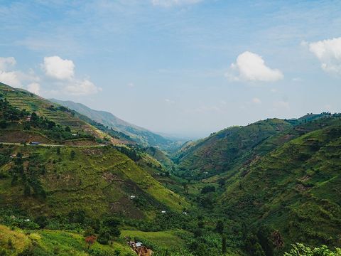 Semuliki National Park — Park. Park of 220 km² on the floor of the Albertine Rift at 670–760 m, on the DR Congo border, a national park since 1993. Its lowland rainforest is the eastern edge of the Congo's Ituri forest; 441 bird species have been recorded. The 6 km public road between Sempaya and Ntandi gives views into the canopy. Pictured: the valley from the highway. 0.8088, 30.1482 · Google Maps
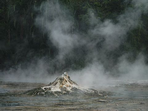 Sempaya Hot Springs — Spring. Two hot springs near the Sempaya park office. The 'female' one, Nyansimbi, is a boiling geyser that throws water and steam up to two metres, 15 minutes' walk through palm forest; the 'male' one, Bintente, is a steaming pool 12 m across, an hour away on a forest trail and swamp boardwalk. 0.8353, 30.1655 · Google Maps
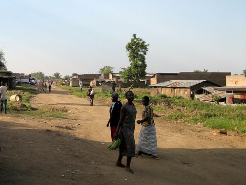 Bundibugyo — Town. Chief town of Bundibugyo District, 85 km by road west of Fort Portal, and the only Ugandan district capital west of the Rwenzori. It has a small choice of basic hotels; the road goes on to the Lamia River on the DR Congo border. 0.7125, 30.0600 · Google Maps
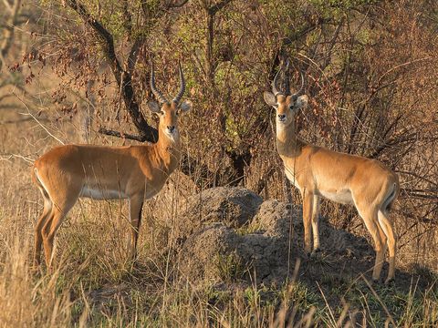 Toro-Semliki Wildlife Reserve — Reserve. One of Uganda's oldest game reserves, created in 1926: 545 km² of rift valley floor between the Kijura escarpment and Lake Albert. From Karugutu, 27 km along the Bundibugyo road, a 40 km dirt road runs to Ntoroko on the lake; three game tracks loop around Semuliki Safari Lodge. Boat trips from Ntoroko go looking for the shoebill. Pictured: Uganda kob. 0.9088, 30.3560 · Google Maps
Local guides in Kibale and Fort Portal
 Mugisa Ronald
Fort Portal, Uganda · 4x4 car, 4x4 truck, camper / van, 4x4 van, offroad motorcycle, adventure motorcycle, bicycle / e-bike Mystery Gorilla Safaris
Kabale, Uganda · 4x4 car, 4x4 van Mathias Asiimwe
Kampala, Uganda · 4x4 car, 4x4 van, adventure motorcycle, bicycle / e-bike, 4x4 truck Ababa Uganda safaris
Uganda · 4x4 car Denis Galabuzi
Kampala, Uganda · bicycle / e-bike, 4x4 car, 4x4 van Finito Msituni Safaris
Kampala, Uganda · 4x4 car, 4x4 van, camper / van, 4x4 truck Judith Mirembe
Uganda · 4x4 carSsempijja Geofrey
Entebbe, Uganda · 4x4 car, 4x4 van Moses Aine
Entebbe International Airport, Uganda · 4x4 car Lena Tours
Kampala, Uganda · 4x4 car, 4x4 van, bicycle / e-bike, camper / van Car Hire Africa - Drive Your Own Safari
Kampala, Uganda · 4x4 car, 4x4 truck, camper / van, 4x4 van, offroad motorcycle, adventure motorcycle, bicycle / e-bike Ssebunya Araphat
Kampala, Uganda
Uganda: guides by vehicle
Overland trips in Kibale and Fort Portal
- Uganda Rwanda safari — 10 days · Uganda, Rwanda
- Birds of Uganda — 18 days · Uganda
- UGANDA BY BIKE & SAFARI — 10 days · Uganda
- UGANDA BY BIKE & SAFARI A 17-DAY JOURNEY THROUGH WILDLIFE, CULTURE & COMMUNITY — 18 days · Uganda
- Explore Uganda — 14-Day Wildlife Overland Adventure — 14 days · Uganda
- Uganda–Rwanda Odyssey — 15-Day Overland Safari — 15 days · Uganda, Rwanda
- Ultimate Uganda–Rwanda — 20-Day Cross-Border Expedition — 20 days · Uganda, Rwanda
- A Journey to the Pearl of Africa — 8-Day Uganda Road Expedition — 8 days · Uganda
- Rhinos & Primates Uganda — 10-Day Overland Safari — 10 days · Uganda
- Pearl of Africa: 16-Day Uganda Wildlife Overland Expedition — 16 days · Uganda
- Uganda Grand Safari: Murchison Falls to Bwindi — 10 days · Uganda
- Uganda Primate Tracking and Wildlife Overland Adventure — 6 days · Uganda
- 14 Uganda Self Drive Advventure — 16 days · Uganda, Rwanda
- 15 DAYS UGANDA SAFARI EXPERIENCE — 15 days · Uganda
- 15-Day Uganda Self Drive Safari Adventure | Explore Uganda with Car Hire Africa – Drive Your Own… — 15 days · Uganda
When to go
Rain falls mostly in March–May and September–November (to December in Semuliki); northern Kibale receives up to 1,700 mm a year and Semuliki about 1,250 mm, and parts of Semuliki flood in the wet season. June–July and December–February are drier but not rainless: plan the dirt tracks towards Lake Albert for June–July or January–February.
Before you go
- All guides and trips in Uganda
- Do you need a local guide in Uganda?
- Is Uganda safe to travel?
- Driving and local rules in Uganda
Photo credits
Author and licence (or permission) for each photo.
- Kibale and Fort Portal: sarahemcc, CC BY 2.0
- 1. Fort Portal: Owobusingye, CC BY 4.0
- 2. Ndali–Kasenda crater lakes: Diego Tirira from Quito, Ecuador, CC BY-SA 2.0
- 3. Lake Nkuruba: Diego Tirira from Quito, Ecuador, CC BY-SA 2.0
- 4. Kibale National Park: Giles Laurent, CC BY-SA 4.0
- 5. Kanyanchu: Schau99, CC0
- 6. Bigodi Wetland Sanctuary: Tebba Christopher, CC BY-SA 4.0
- 7. Fort Portal–Bundibugyo road: Jim Joel, CC BY-SA 4.0
- 8. Semuliki National Park: Mgslee, CC BY-SA 4.0
- 9. Sempaya Hot Springs: Mgslee, CC BY-SA 4.0
- 10. Bundibugyo: Ingo Wölbern, Public domain
- 11. Toro-Semliki Wildlife Reserve: Charles J. Sharp, CC BY-SA 4.0


