Overland region
Erg Chigaga and M'Hamid by 4x4: local guides and trips
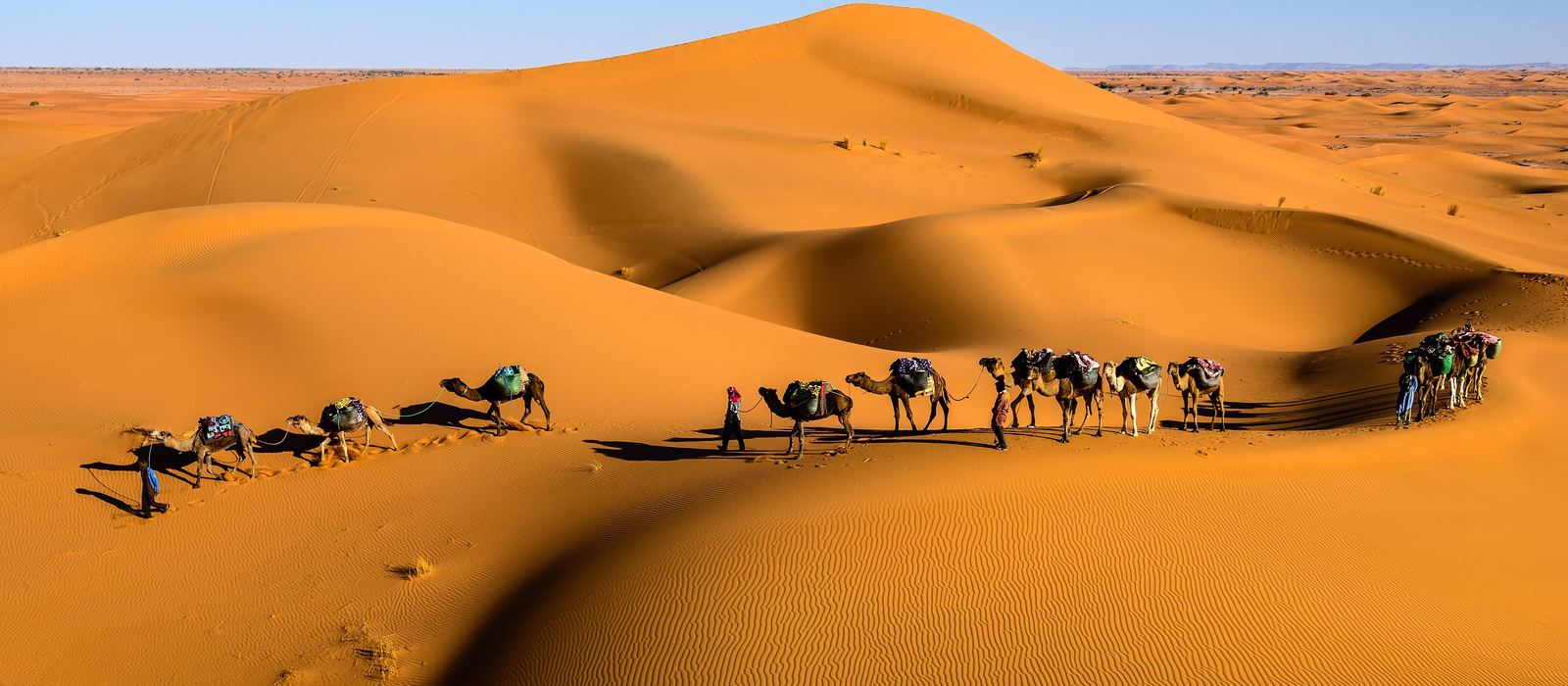
M'Hamid El Ghizlane sits at the end of the N9, where the Draa valley meets the Sahara, not far from the Algerian border. From here tracks lead west to Erg Chigaga, the largest of Morocco's big ergs, and on to the dry Lake Iriki and Foum Zguid, while to the north the valley runs back through Tamegroute to Zagora. For anyone travelling with their own vehicle it means sand and hamada tracks, palm groves and old ksars along the Draa, and the dunes of Erg Lihoudi and Erg Smar. Here are the local guides who work in the area and the trips that cross it.
12 local guides and 13 trips in Erg Chigaga and M'Hamid on GuideMeet.
On the map
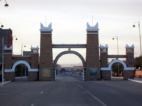 Zagora — Town. Provincial capital in the Draa valley and the starting point for trips to the oases and the Sahara. A well-known sign, now a mural, gives Timbuktu as 52 days away by camel. 30.3306, -5.8381 · Google Maps
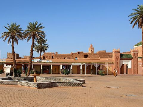 Tamegroute — Village. Village on the old road to Timbuktu, known for the Nasiriyya zawiya with its library of old manuscripts, and for its green-glazed pottery. 30.2612, -5.6820 · Google Maps
- Tinfou — Dunes. Dunes beside the village of Tinfou, in the Draa valley near Tamegroute, south of Zagora. 30.2409, -5.6011 · Google Maps
- Tagounite — Village. On the Draa, which from here flows west and is dry for most of the year. The area is known for its abandoned kasbahs and for meteorite finds. 29.9780, -5.5822 · Google Maps
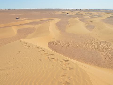 Erg Lihoudi — Dunes. Dune field about 12 km north of M'Hamid, reachable by road, so a short outing from the town. 29.9128, -5.6799 · Google Maps
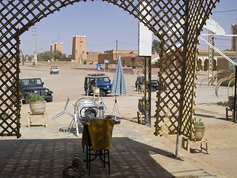 M'Hamid El Ghizlane — Town. Oasis town at the end of the N9, about 24 km from the Algerian border; the starting point for camel and 4x4 trips into the desert. Weekly souk on Mondays. 29.8222, -5.7208 · Google Maps
- Ksar Ksebt el-Allouj — Ksar. Fortified village from the Saadian era (late 16th century), just south-east of M'Hamid, tied to the old caravan trade with Timbuktu. 29.8050, -5.6921 · Google Maps
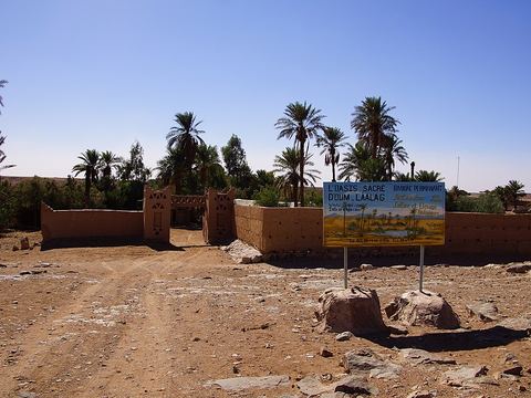 Oum Lâalag — Oasis. The 'sacred oasis' of Oum Lâalag, around a spring west of M'Hamid, on the way towards Erg Chigaga. 29.8827, -6.1186 · Google Maps
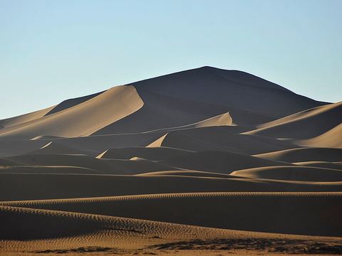 Erg Chigaga — Dunes. The largest of Morocco's big ergs, some 50–60 km from M'Hamid; the dried Iriki lake lies to its west. Reached by tracks, in a 4x4, by camel or on foot. 29.8278, -6.2500 · Google Maps
- Erg Smar — Dunes. Dune field south-east of Erg Chigaga, next to Erg Ezzahar, in the desert south-west of M'Hamid. 29.7135, -6.0860 · Google Maps
- Lake Iriki — Lake. Dried lake in the Iriqui National Park (created in 1994); in wet periods it becomes a temporary wetland where flamingos, coots and geese stop. 29.8169, -6.4989 · Google Maps
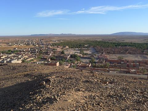 Foum Zguid — Town. Town on the N12 north-east of Tata, the second largest in Tata Province (9,630 inhabitants in 2004). Iriqui National Park lies to the south. 30.0862, -6.8737 · Google Maps
Local guides in Erg Chigaga and M'Hamid
- Zaid Ramlia — Marrakesh, Morocco · 4x4 car, offroad motorcycle, 4x4 truck, bicycle / e-bike, adventure motorcycle
- MAURIZIO TURCO — Roma, Italia · 4x4 car, 4x4 truck, 4x4 van, offroad motorcycle, adventure motorcycle, bicycle / e-bike
- Morocco Merzougatour — Merzouga, Morocco · 4x4 car, 4x4 truck, 4x4 van, offroad motorcycle, adventure motorcycle, bicycle / e-bike, camper / van
- Lahsan El Gasmi — M'Hamid El Ghizlane, Maroc · 4x4 car, camper / van, 4x4 van, adventure motorcycle, offroad motorcycle, bicycle / e-bike
- Mustapha Hamouidate — محاميد الغزلان, محاميد الغزلان، المغرب · 4x4 car
- Abdelhak Lahmidi — Foum Zguid, Morocco · 4x4 car
- Mohamed Tfil — Marrakesh, Morocco · 4x4 car
- Ismail Mter — Zagora Desert Travel & Morocco Desert Tours, Maroc · 4x4 car, 4x4 truck, offroad motorcycle, adventure motorcycle, bicycle / e-bike
- Brahim Labdaa — Mhamid, Morocco · 4x4 car
- Younes Mter — Zagora, Morocco
- Mohammed Amdyaz — Marrakesh, Morocco · 4x4 van, 4x4 car
- Aziz Ennaji — Mhamid, Morocco · 4x4 car, 4x4 van, 4x4 truck, camper / van, offroad motorcycle, adventure motorcycle, bicycle / e-bike
Overland trips in Erg Chigaga and M'Hamid
- MAROCCO 4x4 ESTATE - Sahara Mare & Citta' Imperiali — 19 days · Morocco
- Marocco 4x4 - Il grande sud — 14 days · Morocco
- deep Sahahara — 7 days · Morocco
- 8-Day Morocco Desert & Atlantic Coast Adventure — 9 days · Morocco
- New Years 2027 in Morocco / Capodanno nel deserto. — 10 days · Morocco
- Desert tours — 3 days · Morocco
- 🇮🇹 🏜️ Spedizione nel Sahara in Marocco di 8 giorni — Viaggio nel deserto remoto con Lahsan — 8 days · Morocco
- 🇬🇧🏜️ 8-Day Sahara Overland Expedition Morocco — Remote Desert Journey with Lahsan — 8 days · Morocco
- 🇬🇧🏜️ 6-Day Sahara 4x4 Overland Expedition Morocco — Remote Desert Journey with Lahsan — 6 days · Morocco
- 🇬🇧🚙 1-Day Sahara 4x4 Expedition with a Nomadic Desert Guide — 1 days · Morocco
- 🇬🇧🏜️ 3-Day Sahara 4x4 Expedition Morocco — M’Hamid to Erg Chigaga with Lahsan — 3 days · Morocco
- Tour 5 Days From Marrakech to Erg Chegaga Tour 4 Days-Marrakech-adventuresdesert TOUR 3 DAYS FROM MARRAKECH To Erg Chegaga — 3 days · Morocco
Trips already run here
- 3 days from Merzouga to Foum Zguid by off-road. — 4 days · Morocco
When to go
Winter is the comfortable season: at Zagora average highs stay above 20 °C and nights fall to about 4 °C. In June, July and August average highs are above 40 °C, and rain is very scarce all year.
Before you go
- All guides and trips in Morocco
- Do you need a local guide in Morocco?
- Is Morocco safe to travel?
- Driving and local rules in Morocco
Photo credits
Photos from Wikimedia Commons, under the licences shown.
- Erg Chigaga and M'Hamid: Sergey Pesterev, CC BY-SA 4.0
- 1. Zagora: Bernard Gagnon, CC BY-SA 3.0
- 2. Tamegroute: Stegop, CC BY-SA 4.0
- 5. Erg Lihoudi: Hammou bakkass, CC BY-SA 4.0
- 6. M'Hamid El Ghizlane: ArishG, CC BY-SA 3.0
- 8. Oum Lâalag: NearEMPTiness, CC BY-SA 3.0
- 9. Erg Chigaga: NikbarteMedia, CC BY-SA 4.0
- 12. Foum Zguid: Dromedar61, CC BY-SA 3.0


.JPG)

