Overland region
The Tassili n'Ajjer and Djanet by 4x4: local guides and trips
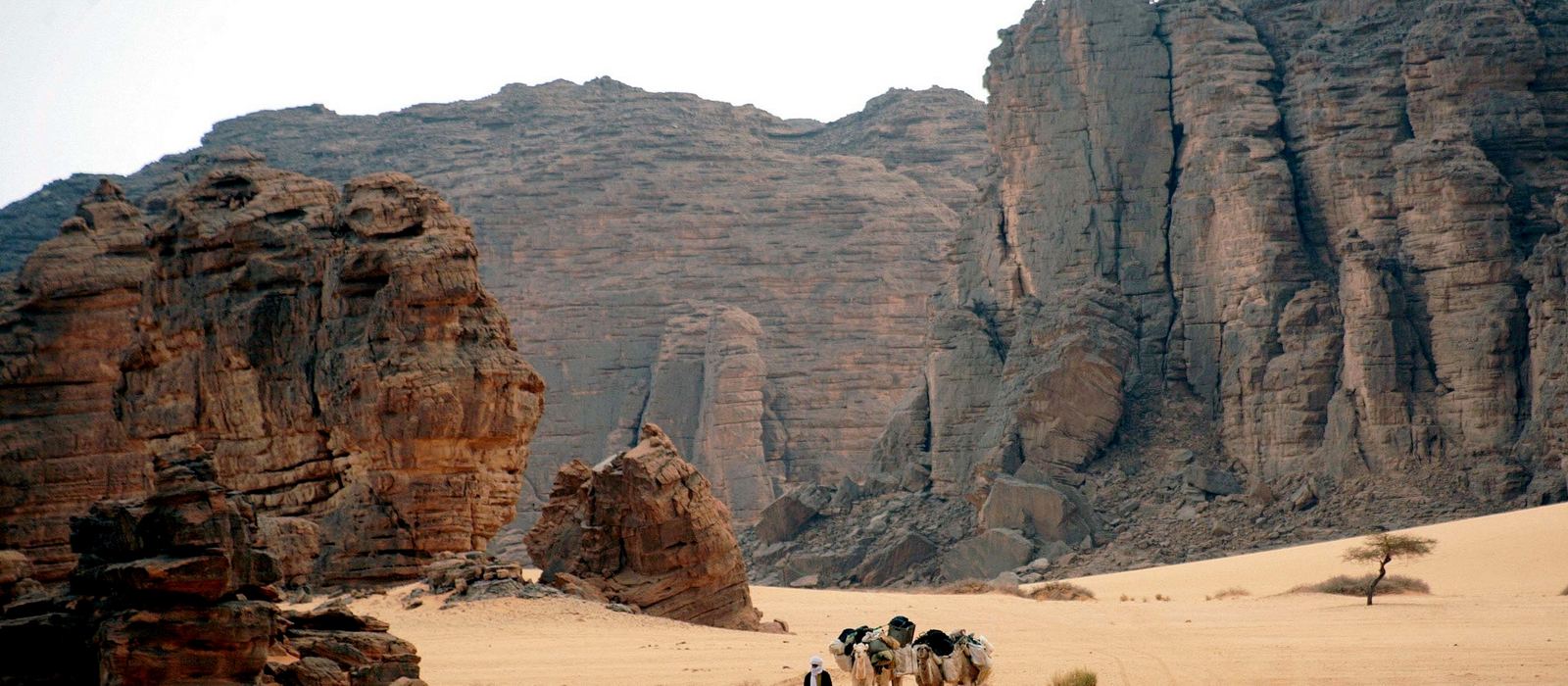
The Tassili n'Ajjer is a sandstone plateau in south-eastern Algeria, on the borders with Libya and Niger, with one of the most important groups of prehistoric rock art in the world; it has been a UNESCO World Heritage Site since 1982. Djanet, the oasis town of the Kel Ajjer Tuareg, is the gateway. For anyone travelling with their own vehicle it means tracks along the Erg Admer and the Tigharghart region, canyons like Essendilène and Tikoubaouine and the oasis of Iherir, while some sites, like Jabbaren, are reached on foot. Here are the local guides who work in the area and the trips that cross it.
6 local guides and 7 trips in the Tassili n'Ajjer and Djanet on GuideMeet.
On the map
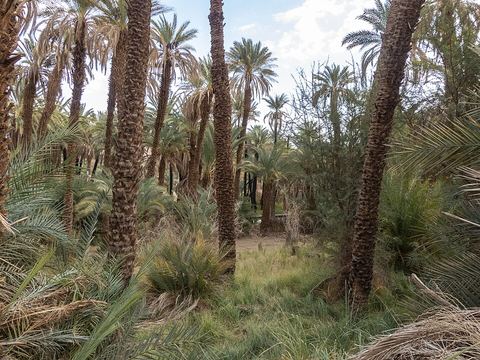 Djanet — Town. Oasis town of the Kel Ajjer Tuareg at 1,035 m, on the south-west edge of the Tassili and the usual gateway to the plateau, the Erg Admer and the Tadrart Rouge. Pictured: Adjahil's palm grove. 24.5550, 9.4853 · Google Maps
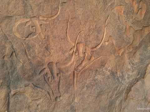 La vache qui pleure — Rock art. Neolithic engravings of a herd of cattle, over 7,000 years old, on a rock about 25 km from Djanet, in the Tigharghart region; the name comes from the tear on one of the cows. 24.3803, 9.4323 · Google Maps
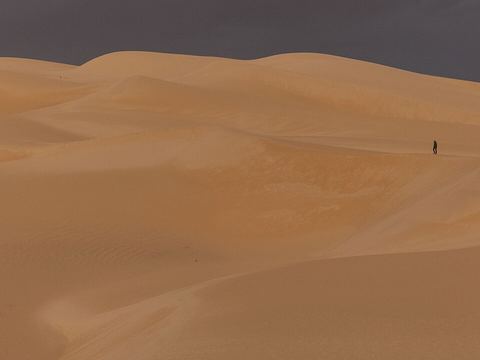 Erg Admer — Dunes. Sea of dunes west of Djanet, about 20 km wide and 100 km long from north to south; it starts in the heart of the Tassili, towards Essendilène, and runs south towards the Ténéré. 24.2167, 9.2333 · Google Maps
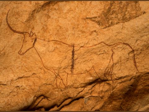 Jabbaren — Rock art. Rock-art site about 20 km south-east of Djanet, with over 5,000 paintings and engravings in the Round Head and Bovidian styles; reached on foot by the Aghoum pass. 24.4724, 9.7132 · Google Maps
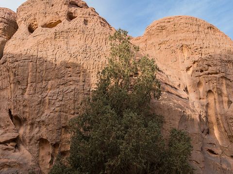 Tamrit — Plateau. High plateau of the Tassili, where some of the rare Saharan cypresses (tarout) survive, a species found only in the Tassili and a relic of a wetter climate. 24.6250, 9.6465 · Google Maps
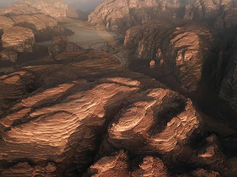 Séfar — Rock art. Massif about 20 km from Djanet with many rock shelters decorated with paintings, reached by Henri Lhote's expedition in March 1957. 24.6870, 9.6510 · Google Maps
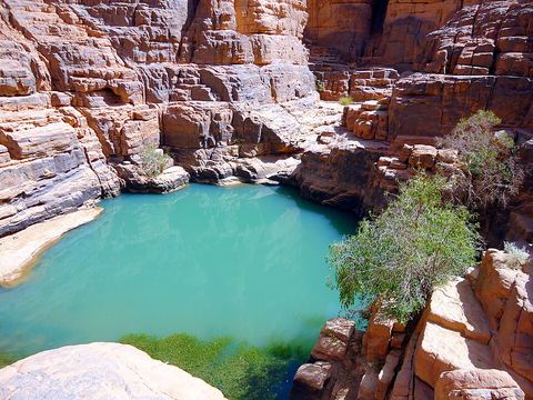 Tikoubaouine — Canyon. Canyon with a guelta, a natural rock pool, on the Tassili plateau north-west of Djanet. 24.8379, 9.0763 · Google Maps
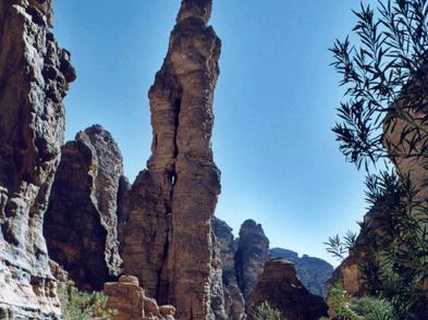 Essendilène — Canyon. Uninhabited oasis in a canyon of the Tassili, north-west of Djanet; the disused French fort at its mouth inspired Frison-Roche's 1954 novel. Pictured: the Needle of Essendilène. 24.9515, 9.0018 · Google Maps
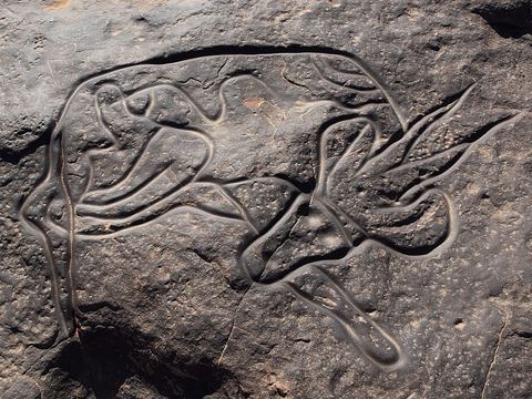 Tin Taghirt — Rock art. Archaeological site between Dider and Iherir, known for engravings of animals such as an ostrich and a resting antelope. Pictured: the antelope. 25.1487, 8.5058 · Google Maps
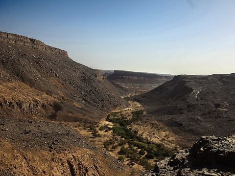 Iherir — Oasis. Oasis village at 1,070 m in a valley between high cliffs, some 150 km north-west of Djanet; its valley is a Ramsar wetland of international importance since 2001. 25.4119, 8.4131 · Google Maps
Local guides in the Tassili n'Ajjer and Djanet
- MAURIZIO TURCO — Roma, Italia · 4x4 car, 4x4 truck, 4x4 van, offroad motorcycle, adventure motorcycle, bicycle / e-bike
- La Route du Tassili N’azjjer Voyages — Djanet, Algérie · 4x4 car, 4x4 truck, offroad motorcycle, adventure motorcycle, camper / van
- Laïd Biou Sahara Africa Tours — Djanet, Algeria · 4x4 car
- Desert Magic tours — Djanet, Algeria · 4x4 car, 4x4 truck, adventure motorcycle, offroad motorcycle, camper / van
- ACTIVE 4X4 ADVENTURES — United Kingdom · 4x4 car, 4x4 truck, 4x4 van
- The Pleiades Travel — 4x4 car, 4x4 truck, 4x4 van, adventure motorcycle, offroad motorcycle
Overland trips in the Tassili n'Ajjer and Djanet
- DISCOVER DJANET & THE MAGIC OF THE ALGERIAN SAHARA — 10 days · Algeria
- ALGERIA 4X4 2026 - Terra Tuareg — 17 days · Tunisia, Algeria
- Tadrart 2027 new year — 8 days · Algeria
- Algeria 4X4 Overland Expedition — 15 days · Algeria
- Challenge Autisme Sahara — Algeria
Trips already run here
- Tadrart rouge — 6 days · Algeria
- Sebeiba — Algeria
When to go
At Djanet June is the hottest month and January the coldest, with very hot summers and mild winters; rain is very irregular, only about 15 mm a year, so the cooler months are the more comfortable.
Before you go
- All guides and trips in Algeria
- Do you need a local guide in Algeria?
- Is Algeria safe to travel?
- Driving and local rules in Algeria
Photo credits
Photos from Wikimedia Commons, under the licences shown.
- Tassili n'Ajjer and Djanet: magharebia, CC BY 2.0
- 1. Djanet: Camille Gillet, CC BY-SA 4.0
- 2. La vache qui pleure: zobeidi mohammed khemisti, CC BY-SA 3.0
- 3. Erg Admer: Camille Gillet, CC BY-SA 4.0
- 4. Jabbaren: Yangar, CC BY-SA 3.0
- 5. Tamrit: IssamBarhoumi, CC BY-SA 4.0
- 6. Séfar: Oussama Hamdi, CC BY 4.0
- 7. Tikoubaouine: Extraanis, CC BY-SA 3.0
- 8. Essendilène: Said Fortin, CC BY-SA 3.0
- 9. Tin Taghirt: Linus Wolf, CC BY-SA 3.0
- 10. Iherir: Clemens Schmillen, CC BY-SA 4.0


