Overland region
Song-Kul and Issyk-Kul by 4x4: local guides and trips
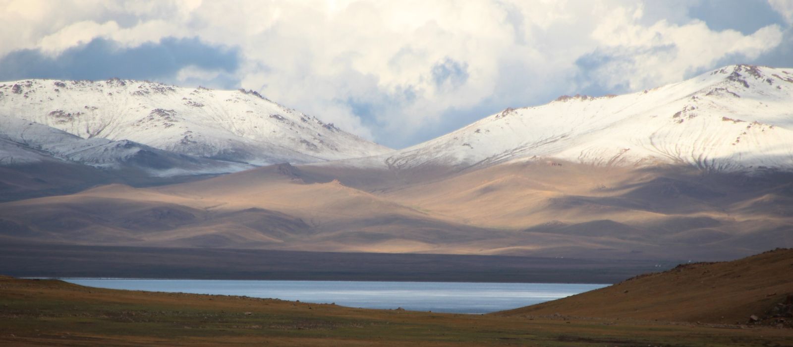
Song-Kul, an alpine lake at 3,016 m in Naryn Region, is ringed by summer pastures where herders graze sheep and horses and set up their yurts; the area is accessible only from June to September. To the north-east, past Kochkor, lies Lake Issyk-Kul, 6,236 km² at 1,607 m, which rarely freezes because of its salinity; around it are Cholpon-Ata, Karakol, the red rocks of Jeti-Ögüz, Skazka Canyon and the Barskoon valley. For anyone with their own vehicle, the easiest way up to Song-Kul is the road from Sary-Bulak over the Kalmak-Ashuu pass, at 3,446 m; other routes need a 4x4. Here are the local guides who work in the area and the trips that cross it.
4 local guides and 6 trips around Song-Kul and Issyk-Kul on GuideMeet.
On the map
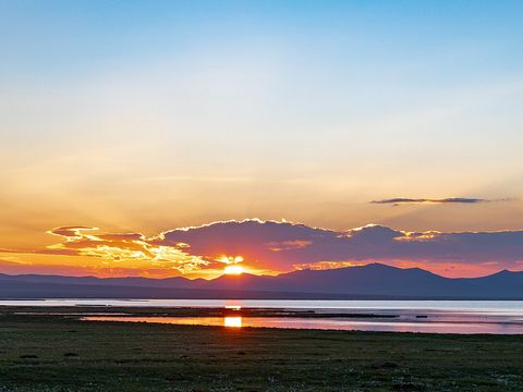 Song-Kul — Lake. Alpine lake in northern Naryn Region at 3,016 m, about 29 km long and up to 18 km wide, with a maximum depth of 13.2 m. A Ramsar wetland since 2011, partly protected in the Karatal-Japyryk reserve. In summer herders set up their yurts around it; there is no mobile signal. Pictured: a yurt camp. 41.8330, 75.1670 · Google Maps
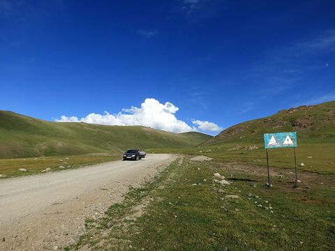 Kalmak-Ashuu Pass — Mountain pass. Pass at 3,446 m on the road that leaves the A365 south of Sary-Bulak and runs about 85 km west through the Tölök valley to Song-Kul: the easiest approach with your own vehicle. 41.9143, 75.4218 · Google Maps
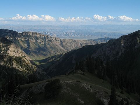 Moldo-Ashuu Pass — Mountain pass. Pass on the southern approach to Song-Kul, a difficult road from Ak-Tal on the Naryn side across the Moldo-Too range. Pictured: the view south from the pass. 41.6686, 75.0366 · Google Maps
- Kyzart Pass — Mountain pass. Pass at 2,664 m between the Kum-Bel and Baba-Ata ranges, linking the Kochkor and Jumgal valleys. It carries the EM-18 highway between Kochkor, Chaek and Suusamyr, north of Song-Kul. 42.0939, 75.1383 · Google Maps
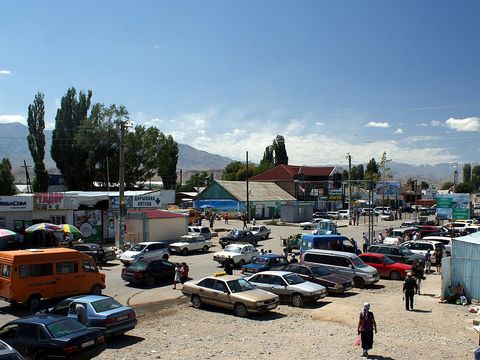 Kochkor — Village. Large village of 11,373 people (2021), centre of Kochkor District, on the A365 about 45 km from Balykchy on Lake Issyk-Kul. A base for trips to Song-Kul; the women's cooperative Altyn Kol makes shyrdak felt carpets here. 42.2158, 75.7556 · Google Maps
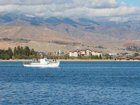 Lake Issyk-Kul — Lake. Lake of 6,236 km² at 1,607 m, up to 668 m deep, which rarely freezes because of its salinity. A Ramsar site and part of the Issyk-Kul Biosphere Reserve, created in 2000. Balykchy, the railhead, is at its western end. Pictured: the shore near Cholpon-Ata. 42.4170, 77.2500 · Google Maps
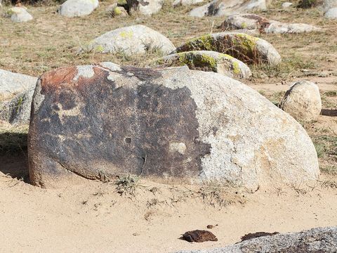 Cholpon-Ata — Town. Resort town on the north shore of Lake Issyk-Kul, at 1,633 m. Its open-air site holds about 2,000 rock carvings dated between 800 BC and AD 1200. The first three World Nomad Games were held here, in 2014, 2016 and 2018. Pictured: the petroglyphs. 42.6500, 77.0830 · Google Maps
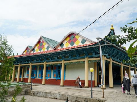 Karakol — Town. Capital of Issyk-Kul Region, near the eastern end of the lake at 1,745 m and 380 km from Bishkek. Formerly Przhevalsk, after the explorer Nikolai Przhevalsky, who is buried near the town, on the lakeshore. The wooden Holy Trinity cathedral was completed in 1895 and the Dungan mosque built in 1904–1910. Pictured: the Dungan mosque. 42.4903, 78.3917 · Google Maps
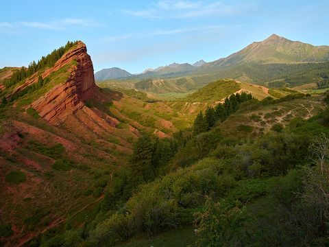 Jeti-Ögüz Rocks — Rock formation. Cliffs of red Tertiary conglomerate, protected as a nature monument since 1975; the name means 'seven bulls'. Nearby are the rock called Broken Heart and the old Jeti-Ögüz spa with its hot springs, about 35 km from Karakol. 42.3371, 78.2309 · Google Maps
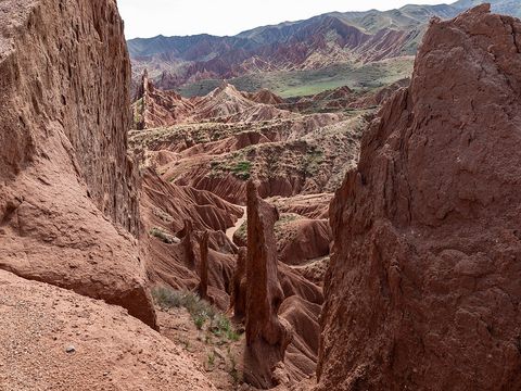 Skazka Canyon — Canyon. Also called Fairy Tale Canyon: red and yellow rock formations shaped by erosion, on the south shore about 4 km from the village of Tosor, with views over Lake Issyk-Kul. An entrance fee is charged. 42.1564, 77.3541 · Google Maps
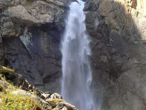 Barskoon — Village. Village at 1,753 m at the mouth of the Barskoon valley, which links the south shore of Issyk-Kul to the Ala-Bel plateau. Since the Kumtor gold mine opened in 1997, the valley road has been the mine's main access. Up the valley are the Barskoon waterfall and a bust of Yuri Gagarin. Pictured: the waterfall. 42.1561, 77.6039 · Google Maps
Local guides around Song-Kul and Issyk-Kul
Kyrgyz Wow Travel
Бишкек, Кыргызстан · 4x4 car Sergei Netreba
город Бишкек, Кыргызстан · 4x4 car, 4x4 truck Im-Nomad.kg
Каракол, Кыргызстан · 4x4 car, offroad motorcycle, adventure motorcycle- Rustam Rustambaev
Каракол, Кыргызстан · 4x4 car, 4x4 truck
Kyrgyzstan: guides by vehicle
Overland trips around Song-Kul and Issyk-Kul
- 6-Day Kyrgyzstan Winter Tour | Karakol, Issyk-Kul & Snow Adventures — 6 days · Kyrgyzstan
- 11 Days Group Tour: Kyrgyzsatan — 11 days · Kyrgyzstan
- Kazakhstan & Kyrgyzstan 11 Days Tour — 11 days · Kyrgyzstan, Kazakhstan
- 7 Days Kyrgyzstan Highlights Loop — 7 days · Kyrgyzstan
- ENDLESS VIEWS AND ROADS IN KYRGYZSTAN — 8 days · Kyrgyzstan
Trips already run here
- 3-day — Horseback riding tour to song-kol lake — 3 days · Kyrgyzstan
When to go
Song-Kul is inhabited and accessible only from June to September. In winter the lake freezes, with ice up to 1–1.2 m thick that starts to thaw in mid or late April and is gone by late May; at the lake the average is about −20 °C in January and 11 °C in July, and snow lies 180–200 days a year. Issyk-Kul, lower down, rarely freezes.
Before you go
- All guides and trips in Kyrgyzstan
- Do you need a local guide in Kyrgyzstan?
- Is Kyrgyzstan safe to travel?
- Driving and local rules in Kyrgyzstan
Photo credits
Author and licence (or permission) for each photo.
- Song-Kul and Issyk-Kul: Thomas Holbach, CC BY 4.0
- 1. Song-Kul: Ninara from Helsinki, Finland, CC BY 2.0
- 2. Kalmak-Ashuu Pass: ThomasG, CC BY-SA 3.0
- 3. Moldo-Ashuu Pass: Firespeaker, CC BY-SA 3.0
- 5. Kochkor: Kondephy, CC BY-SA 4.0
- 6. Lake Issyk-Kul: Bgag, CC0 1.0
- 7. Cholpon-Ata: Bgag, CC0 1.0
- 8. Karakol: Adam Harangozó, CC BY-SA 4.0
- 9. Jeti-Ögüz Rocks: Jiří Komárek, CC BY-SA 4.0
- 10. Skazka Canyon: Ninara from Helsinki, Finland, CC BY 2.0
- 11. Barskoon: Ondřej Žváček, CC BY 2.5


