Overland region
The Serengeti by 4x4: local guides and trips
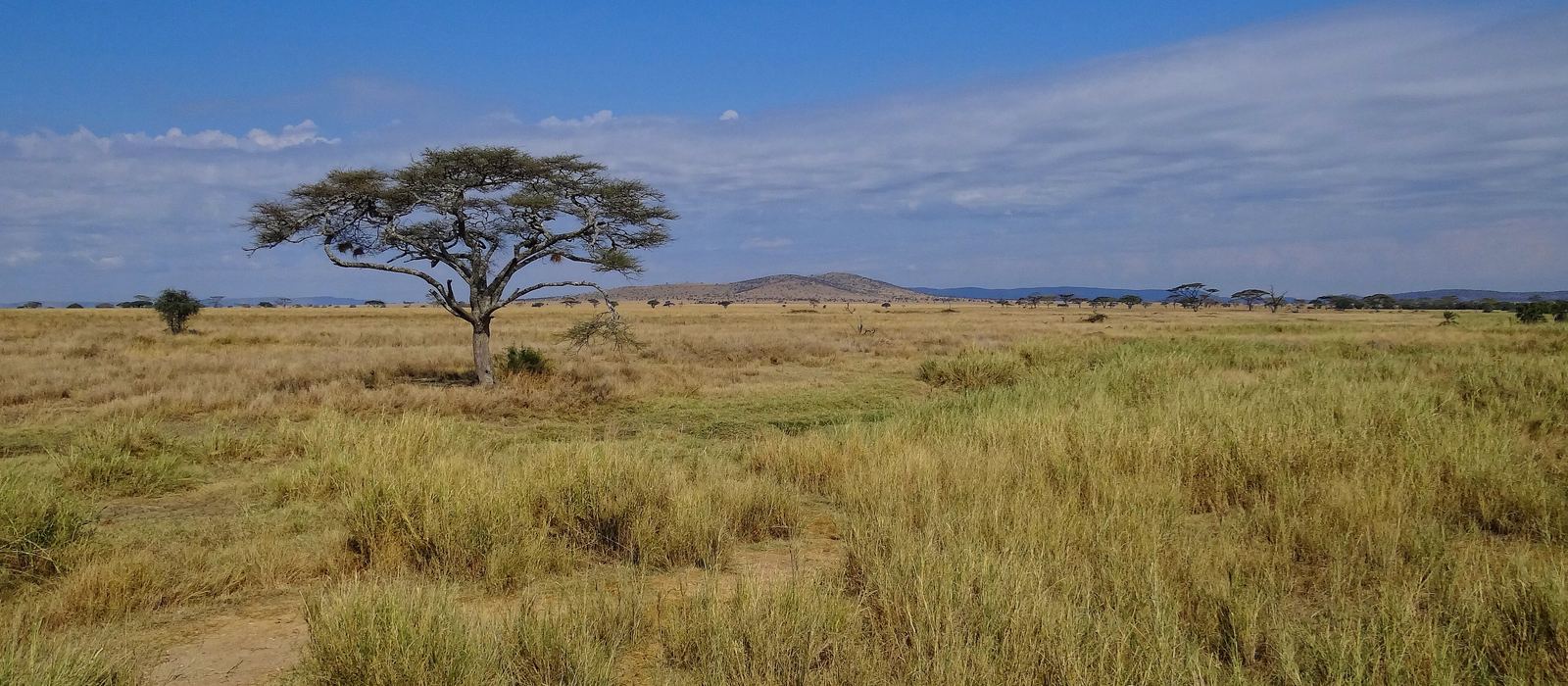
The Serengeti is a region of northern Tanzania, centred on the Serengeti National Park (14,763 km², a UNESCO World Heritage Site) and the game reserves around it. It is known for the annual migration of wildebeest and zebra, which continues north into Kenya's Masai Mara. For anyone travelling with their own vehicle it means open grass plains with granite kopjes in the south, the rivers and riverine forest of the Western Corridor, and the woodland and hills of the north, up to the Mara River on the Kenyan border. Here are the local guides who work in the area and the trips that cross it.
16 local guides and 33 trips in the Serengeti on GuideMeet.
On the map
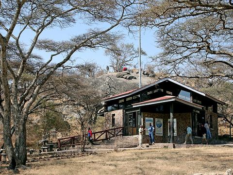 Naabi Hill Gate — Park. Gate on a hill at the south-eastern edge of the park, where the southern plains open out. The Ngorongoro Conservation Area lies just beyond. -2.8331, 34.9979 · Google Maps
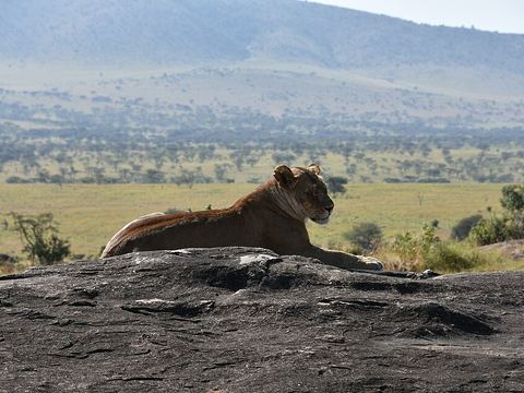 Serengeti National Park — Park. Created in 1940 and covering 14,763 km², it is known for the wildebeest and zebra migration and for its lions. Pictured: a lioness on a kopje, a granite lookout for predators. -2.4000, 34.6000 · Google Maps
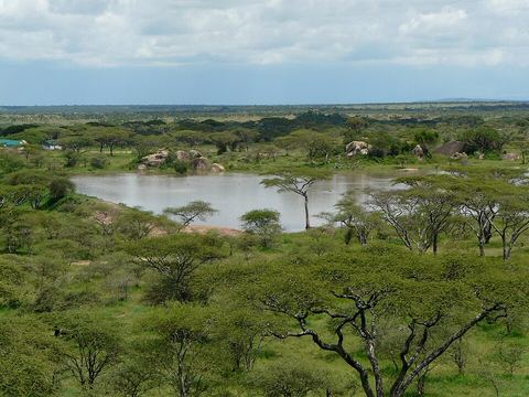 Seronera — Village. Main settlement in the park, with its main airstrip and the oldest lodge. The Serengeti Research Institute was set up here in 1966 to study the Great Migration. -2.4361, 34.8211 · Google Maps
- Klein's Gate — Park. Entrance on the park's north-eastern edge, on the side that borders the Loliondo Game Control Area. -1.8563, 35.2453 · Google Maps
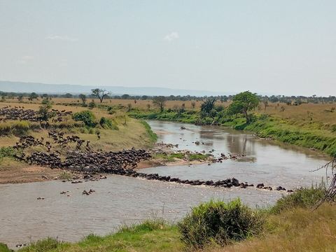 Kogatende — Camp. Ranger post and airstrip in the north of the park, in open woodland and hills that run up to the Mara River and the Kenyan border. -1.5644, 34.8860 · Google Maps
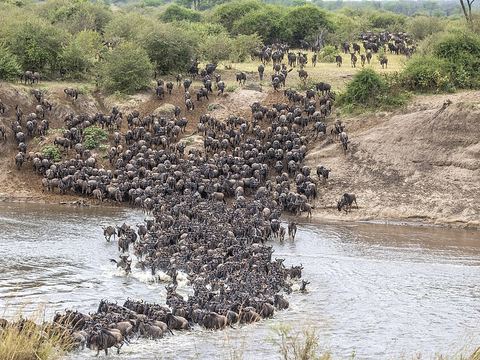 Mara River — River. The only permanently flowing river in the ecosystem, crossed by the herds on their way to the Masai Mara, with Nile crocodiles waiting. Pictured: a crossing. -1.5658, 34.9024 · Google Maps
- Mugumu — Town. Town on the western side of the park and seat of Serengeti District; it had 16,851 inhabitants at the 2012 census. -1.8398, 34.6741 · Google Maps
- Fort Ikoma — Village. Village on the western side of the park, next to the Ikorongo reserve. -2.0874, 34.6337 · Google Maps
- Ikorongo Game Reserve — Reserve. Reserve of about 600 km² on the western side of the northern park, established in 1993 and crossed by several rivers. -2.0260, 34.7609 · Google Maps
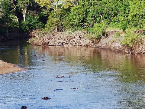 Grumeti Game Reserve — Reserve. Reserve of about 412 km² on the north-western border of the park, created in 1993, a corridor for the migrating herds. Pictured: hippos in the Grumeti River. -2.0206, 34.2110 · Google Maps
Local guides in the Serengeti
- Finito Msituni Safaris — Kampala, Uganda · 4x4 car, 4x4 van, camper / van, 4x4 truck
- Innocent Chalamila — Arusha, Tanzania · 4x4 car, 4x4 truck, camper / van, 4x4 van, offroad motorcycle, adventure motorcycle, bicycle / e-bike
- Jambo Masai Tours — Arusha, Tanzania · 4x4 car, 4x4 truck, 4x4 van, offroad motorcycle
- Nata Travel Tanzania — Arusha, Tanzania · 4x4 car, 4x4 van
- Aardvark Expeditions Limited — Arusha, Tanzania · 4x4 car
- ANAPA Travel Africa Tours — Arusha, Tanzania · 4x4 car
- Charel Schreuder — Cape Town, South Africa · 4x4 car, camper / van, 4x4 van, 4x4 truck
- Jonas Ndunguru — Arusha, Tanzania · 4x4 car
- Anthony Milinga — Arusha, Tanzania · 4x4 car
- MERU SLOPES TOURS & SAFARIS — Arusha, Tanzania · 4x4 car
- Felix Kiwia — Safari Masters, Tanzania · 4x4 truck, camper / van, 4x4 car
- BIENVENIDO SAFARIS — Nairobi, Kenya · 4x4 van
More local guides (4)
- Kevin Bulger — Arusha, Tanzania
- Robert Murigi — Nairobi, Kenya
- Adabert Pondamali — Tanzania
- Salema Tours & Safaris — Arusha, Tanzania
Overland trips in the Serengeti
- 7-Day Masai Mara, Serengeti, Ngorongoro, Kenya Tanzania $1340 — 7 days · Tanzania, Kenya
- 8 Days Tanzania Classic Safari – Arusha, Manyara, Serengeti, Ngorongoro & Tarangire — 8 days · Tanzania, Kenya
- 5-Day Tanzania Ultimate Luxury Safari Experience — 1181 days · Tanzania
- 5-Day Shared Balloon Camping Safari from Nairobi — 1181 days · Tanzania
- 5-Day Serengeti Tarangire Ngorongoro and Lake Eyasi Tour — 1181 days · Tanzania
- 3-Day Quick Fly-in Safari from Arusha — 1181 days · Tanzania
- 5-Day Private Walking Safari, Wildlife & Coffee Tour — 1181 days · Tanzania
- 3-Day Fly-in Serengeti & Ngorongoro Escape — 1182 days · Tanzania
- 5-Day Private Epic Safari Adventure — 1181 days · Tanzania
- 5-Day Ndutu Great Migration Safari from Zanzibar — 1181 days · Tanzania
- 5-Day Mid Range Safari Explore the Northern Circuit — 1181 days · Tanzania
- 5-Day Flight from and Back to Zanzibar to Serengeti NP — 1181 days · Tanzania
- 5-Day Experience Big Five & Foothills of Mt Kilimanjaro — 1181 days · Tanzania
- 3-Day Tarangire, Ngorongoro & Manyara Group Safari — 1175 days · Tanzania
- 5-Day Wildebeest Calving Adventure in Ndutu — 1182 days · Tanzania
- 5-Day Blended Wildlife &Walking Among Nature's Wonders — 1182 days · Tanzania
- 3-Day Ndutu Calving Safari – Wildlife Spectacle — 1181 days · Tanzania
- 4-Day Classic Safari Fly in and out Zanzibar to 3 Parks — 1182 days · Tanzania
- 3-Day Luxury Honeymoon Safari with Balloon Experience — 1181 days · Tanzania
- 4-Day Balloon Experience & Wildlife Adventure — 1182 days · Tanzania
- 4-Day 3-Parks Safari-Lodges & Camping Experience — 1182 days · Tanzania
- 3-Day Fly-in Serengeti & Ngorongoro Escape — 1179 days · Tanzania
- 7-Day The Big Five Safari in Tanzania — 453 days · Tanzania
- 4 Days Tanzania Safari - Tarangire, Serengeti & Ngorongoro Crater — 4 days · Tanzania
- 5-Day Ndutu Expedition Private Safari Mix Lodge & Camp — 453 days · Tanzania
- 5-Day Safari Tarangire, Serengeti, Ngorongoro & Manyara group Tour — 5 days · Tanzania
- Come Explore Africa With Me — 1282 days · Tanzania, Kenya, Uganda, Rwanda, Ethiopia, Zambia, Zimbabwe, Botswana
- BEST OF TANZANIA WILDEBEEST MIGRATION CALVING SEASON FLY OUT SAFARI — 8 days · Tanzania
- 8-Days Wildebeest Tanzania Migration Safari — 8 days · Tanzania
- Tanzania Northern Circuit — 10 days · Tanzania
Trips already run here
When to go
The herds move with the seasons: in the Western Corridor from about May to July, in the north and across the Mara River towards Kenya from July to October, and back south from late October. Your route depends on where they are.
Before you go
- All guides and trips in Tanzania
- Do you need a local guide in Tanzania?
- Is Tanzania safe to travel?
- Driving and local rules in Tanzania
Photo credits
Photos from Wikimedia Commons, under the licences shown.
- Serengeti: Bjørn Christian Tørrissen, CC BY-SA 3.0
- 1. Naabi Hill Gate: Banja-Frans Mulder, CC BY 3.0
- 2. Serengeti National Park: Richard Mortel from Riyadh, Saudi Arabia, CC BY 2.0
- 3. Seronera: xorge, CC BY-SA 2.0
- 5. Kogatende: Reginald Victor Runyoro, CC BY-SA 4.0
- 6. Mara River: Charles J. Sharp, CC BY-SA 4.0
- 10. Grumeti Game Reserve: Harvey Barrison from Massapequa, NY, USA, CC BY-SA 2.0


_(28340872970).jpg)


_Mara_River_crossing_2c.jpg)
.jpg)