Overland region
Ngorongoro, Tarangire and Manyara by 4x4: local guides and trips
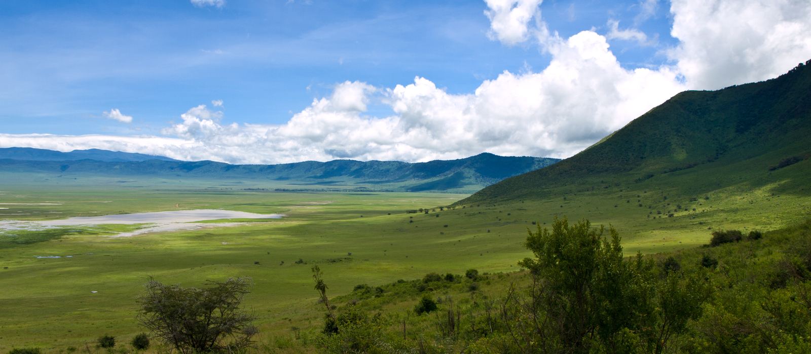
This part of northern Tanzania gathers the Ngorongoro Conservation Area, a UNESCO World Heritage Site with the Ngorongoro Crater and the Olduvai Gorge, and the national parks of Lake Manyara, at the foot of the rift escarpment, and Tarangire, known for its elephants and baobabs. To the north the volcano Ol Doinyo Lengai and Lake Natron mark the Gregory Rift; to the south-west lies Lake Eyasi. For anyone travelling with their own vehicle it means the highlands around the crater, the plains of Olduvai and Ndutu, and towns like Karatu and Mto wa Mbu as bases. Here are the local guides who work in the area and the trips that cross it.
12 local guides and 37 trips in Ngorongoro, Tarangire and Manyara on GuideMeet.
On the map
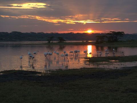 Ndutu — Lake. Small seasonal soda lake in the southern Serengeti, surrounded by plains and woodland. From January to March wildebeest and zebras gather here to calve. -3.0033, 34.9970 · Google Maps
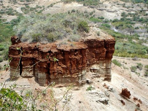 Olduvai Gorge — Gorge. A ravine about 48 km long on the eastern Serengeti plains, one of the most important sites for the study of early human evolution. Mary and Louis Leakey dug here. -2.9936, 35.3512 · Google Maps
- Lodoare Gate — Park. Entrance to the Ngorongoro Conservation Area, south of the crater, with the visitors' reception centre. -3.2987, 35.5924 · Google Maps
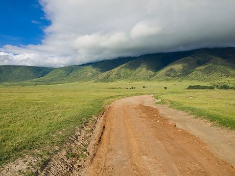 Ngorongoro Crater — Crater. The world's largest inactive, intact and unfilled volcanic caldera: 610 m deep, with a 260 km² floor at 1,800 m. The conservation area has been a UNESCO site since 1979. -3.1766, 35.5788 · Google Maps
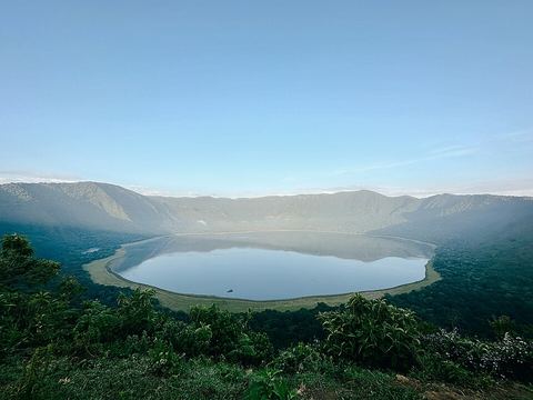 Empakaai Crater — Crater. Caldera in the north-eastern highlands, 6 km wide with walls about 300 m high; a deep soda lake covers about three quarters of the floor. -2.9092, 35.8279 · Google Maps
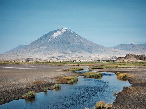 Ol Doinyo Lengai — Peak. Active volcano 16 km south of Lake Natron, the Maasai's "Mountain of God". Uniquely on Earth, it has erupted natrocarbonatite lava; big eruptions came in 2007–2008. -2.7640, 35.9140 · Google Maps
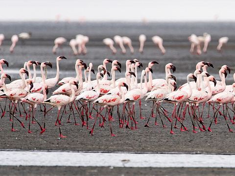 Lake Natron — Lake. Highly alkaline salt lake in the Gregory Rift, up to 57 km long and 22 km wide, the only regular breeding area in East Africa for lesser flamingos. -2.4167, 36.0000 · Google Maps
- Engaruka — Archaeological site. Ruins of an Iron Age farming community built from the 15th century at the foot of the rift escarpment, with stone canals and terraces. Abandoned by the mid-18th century at the latest. -2.9830, 35.9500 · Google Maps
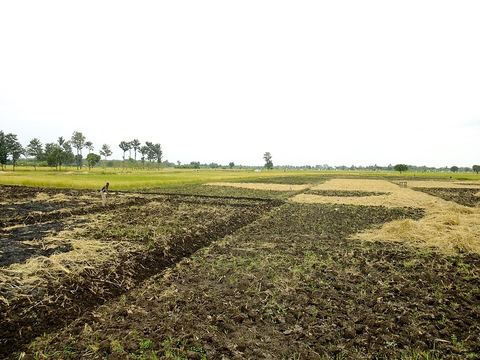 Mto wa Mbu — Town. "River of mosquitoes" in Swahili: a town midway between Karatu and Makuyuni, with lodges and camp sites for visitors to Lake Manyara; bananas are the main crop. -3.3500, 35.8500 · Google Maps
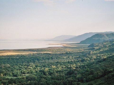 Lake Manyara — Lake. Shallow alkaline lake of 470 km² in the rift, below an escarpment about 600 m high. Its north-west quarter lies inside Lake Manyara National Park. -3.5833, 35.8333 · Google Maps
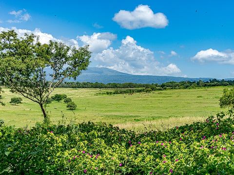 Karatu — Town. Capital of Karatu District, between Lake Manyara, Lake Eyasi and the Ngorongoro Crater rim; the area is known in Tanzania for growing onions. -3.3387, 35.6733 · Google Maps
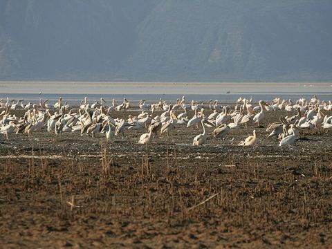 Lake Eyasi — Lake. Shallow seasonal salt lake on the rift floor, south-west of the Ngorongoro Crater. It can almost dry up in the dry season; the Hadza, hunter-gatherers, live along its shores. -3.5924, 35.1280 · Google Maps
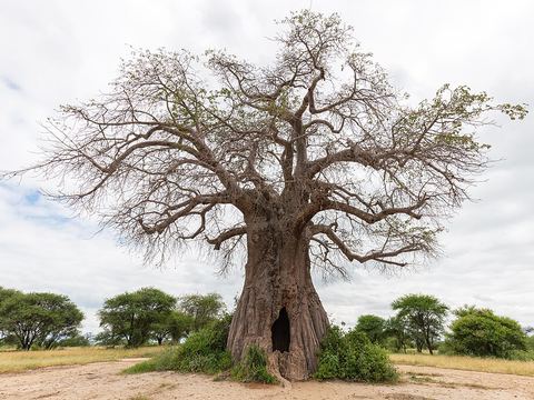 Tarangire National Park — Park. About 2,850 km² in the Manyara Region, famous for its dense elephant population and its baobabs. In the dry season thousands of animals gather along the Tarangire River. -3.8333, 36.0000 · Google Maps
Local guides in Ngorongoro, Tarangire and Manyara
- Innocent Chalamila — Arusha, Tanzania · 4x4 car, 4x4 truck, camper / van, 4x4 van, offroad motorcycle, adventure motorcycle, bicycle / e-bike
- Jambo Masai Tours — Arusha, Tanzania · 4x4 car, 4x4 truck, 4x4 van, offroad motorcycle
- Nata Travel Tanzania — Arusha, Tanzania · 4x4 car, 4x4 van
- Aardvark Expeditions Limited — Arusha, Tanzania · 4x4 car
- ANAPA Travel Africa Tours — Arusha, Tanzania · 4x4 car
- Charel Schreuder — Cape Town, South Africa · 4x4 car, camper / van, 4x4 van, 4x4 truck
- Jonas Ndunguru — Arusha, Tanzania · 4x4 car
- MERU SLOPES TOURS & SAFARIS — Arusha, Tanzania · 4x4 car
- Felix Kiwia — Safari Masters, Tanzania · 4x4 truck, camper / van, 4x4 car
- BIENVENIDO SAFARIS — Nairobi, Kenya · 4x4 van
- Robert Murigi — Nairobi, Kenya · 4x4 car, 4x4 truck, 4x4 van
- Salema Tours & Safaris — Arusha, Tanzania
Overland trips in Ngorongoro, Tarangire and Manyara
- 7-Day Masai Mara, Serengeti, Ngorongoro, Kenya Tanzania $1340 — 7 days · Tanzania, Kenya
- 8 Days Tanzania Classic Safari – Arusha, Manyara, Serengeti, Ngorongoro & Tarangire — 8 days · Tanzania, Kenya
- 5-Day Tanzania Ultimate Luxury Safari Experience — 1181 days · Tanzania
- 5-Day Shared Balloon Camping Safari from Nairobi — 1181 days · Tanzania
- 5-Day Serengeti Tarangire Ngorongoro and Lake Eyasi Tour — 1181 days · Tanzania
- 3-Day Quick Fly-in Safari from Arusha — 1181 days · Tanzania
- 5-Day Private Walking Safari, Wildlife & Coffee Tour — 1181 days · Tanzania
- 3-Day Fly-in Serengeti & Ngorongoro Escape — 1182 days · Tanzania
- 5-Day Private Epic Safari Adventure — 1181 days · Tanzania
- 5-Day Ndutu Great Migration Safari from Zanzibar — 1181 days · Tanzania
- 3-Day Ngorongoro, Cofee Tour (Mid-Range Escape ) — 1181 days · Tanzania
- 5-Day Mid Range Safari Explore the Northern Circuit — 1181 days · Tanzania
- 5-Day Flight from and Back to Zanzibar to Serengeti NP — 1181 days · Tanzania
- 3-Day Family & Couple Safari – Lakes, Crater & Savannah — 1180 days · Tanzania
- 5-Day Experience Big Five & Foothills of Mt Kilimanjaro — 1181 days · Tanzania
- 3-Day Tarangire, Ngorongoro & Manyara Group Safari — 1175 days · Tanzania
- 5-Day Wildebeest Calving Adventure in Ndutu — 1182 days · Tanzania
- 2-Day Budget Group Safari Tarangire & Ngorongoro Crater — 1183 days · Tanzania
- 5-Day Blended Wildlife &Walking Among Nature's Wonders — 1182 days · Tanzania
- 3-Day Ndutu Calving Safari – Wildlife Spectacle — 1181 days · Tanzania
- 4-Day Classic Safari Fly in and out Zanzibar to 3 Parks — 1182 days · Tanzania
- 3-Day Luxury Honeymoon Safari with Balloon Experience — 1181 days · Tanzania
- 4-Day Balloon Experience & Wildlife Adventure — 1182 days · Tanzania
- 4-Day 3-Parks Safari-Lodges & Camping Experience — 1182 days · Tanzania
- 3-Day Fly-in Serengeti & Ngorongoro Escape — 1179 days · Tanzania
- 7-Day The Big Five Safari in Tanzania — 453 days · Tanzania
- 4 Days Tanzania Safari - Tarangire, Serengeti & Ngorongoro Crater — 4 days · Tanzania
- 5-Day Ndutu Expedition Private Safari Mix Lodge & Camp — 453 days · Tanzania
- 3 Days Tanzania Safari - Lake Manyara, Ngorongoro and Tarangire Tational Park — 3 days · Tanzania
- 5-Day Safari Tarangire, Serengeti, Ngorongoro & Manyara group Tour — 5 days · Tanzania
Trips already run here
- 4-DAY TARANGIRE & NGORONGORO CRATER SAFARI — 4 days · Tanzania
When to go
From June to November, the dry season, big herds gather in Tarangire. At Lake Manyara the long rains fall from March to May, with April the wettest month, and the short rains in November and December. From January to March the herds gather around Ndutu to calve.
Before you go
- All guides and trips in Tanzania
- Do you need a local guide in Tanzania?
- Is Tanzania safe to travel?
- Driving and local rules in Tanzania
Photo credits
Photos from Wikimedia Commons, under the licences shown.
- Ngorongoro, Tarangire and Manyara: William Warby from London, England, CC BY 2.0
- 1. Ndutu: Therealjozbert, CC BY-SA 4.0
- 2. Olduvai Gorge: gailhampshire from Cradley, Malvern, U.K, CC BY 2.0
- 4. Ngorongoro Crater: William Warby from London, England, CC BY 2.0
- 5. Empakaai Crater: Halidtz, CC BY-SA 4.0
- 6. Ol Doinyo Lengai: Clem23, CC BY-SA 3.0
- 7. Lake Natron: Christoph Strässler, CC BY-SA 2.0
- 9. Mto wa Mbu: lecucurbitacee, CC BY 2.0
- 10. Lake Manyara: Clem23, CC BY-SA 3.0
- 11. Karatu: Nina R from Africa, CC BY 2.0
- 12. Lake Eyasi: kiwiexplorer, CC BY-SA 2.0
- 13. Tarangire National Park: Diego Delso, CC BY-SA 4.0
.jpg)


.jpg)


.jpg)

,_parque_nacional_de_Tarangire,_Tanzania,_2024-05-24,_DD_78.jpg)