Overland region
The Mongolian Altai by 4x4: local guides and trips
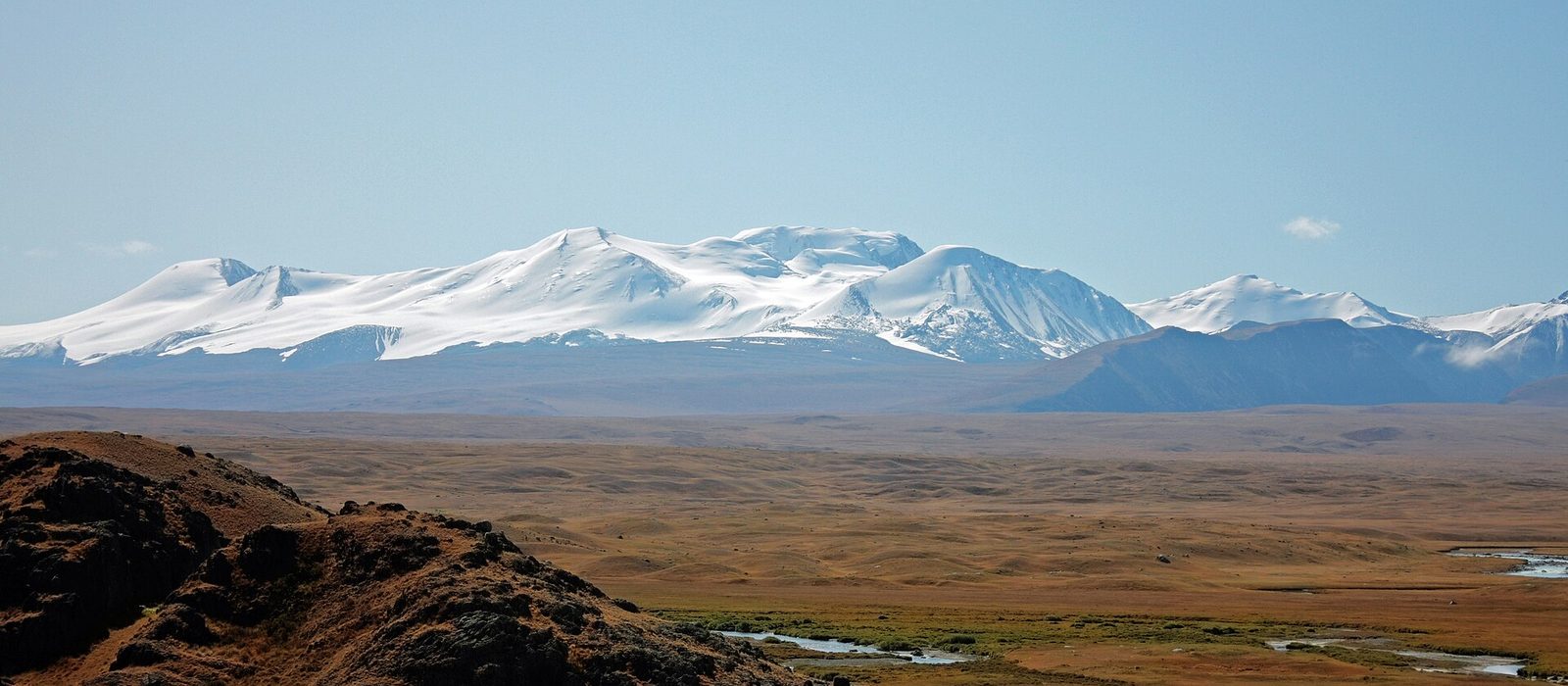
The Mongolian Altai rises in the far west of the country, and its highest part is in Bayan-Ölgii, the highest province of Mongolia and its only one with a Kazakh majority, between Russia and China, with its capital Ölgii on the Khovd River. To the west, Altai Tavan Bogd National Park, 6,362 km², covers the Mongolian side of the Tavan Bogd massif, where Khüiten Peak is the highest point in the country and the Potanin Glacier its longest glacier, together with the Khoton, Khurgan and Dayan lakes and part of the petroglyphs of a UNESCO World Heritage Site. Every October the Kazakh eagle hunters meet in Ölgii for the Golden Eagle Festival. For anyone travelling with their own vehicle it means tracks, high passes and rivers without bridges: the park is about 180 km from Ölgii, some 5 hours of driving without stops, and you need a park permit and, near the borders, a border zone permit. Here are the local guides who work in the area and the trips that cross it.
3 local guides and 1 trip in the Mongolian Altai on GuideMeet.
On the map
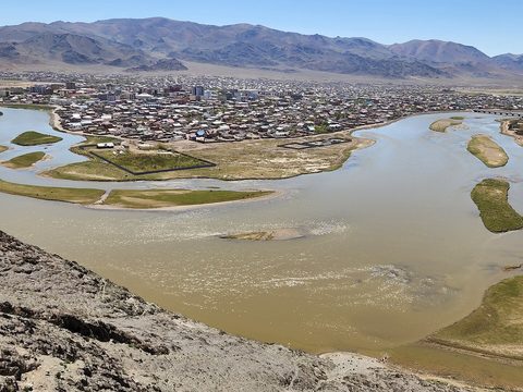 Ölgii — Town. Capital of Bayan-Ölgii, on the Khovd River at about 1,710 m, with some 50,000 inhabitants (2024). Its airport has regular flights to Ulaanbaatar, and the park permits and the permits for the Chinese border zone are issued here. Village shops on the way to the park have little choice, so stock up here. Every October it hosts the Golden Eagle Festival. 48.9683, 89.9686 · Google Maps
- Tsagaannuur — Border crossing. Village of about 1,700 people (2024) near the Russian border, 70 km north of Ölgii, where the road to Russia starts. The permits for the Russian border zone, needed to go north of the Potanin Glacier and to Khüiten Peak, are issued only here. 49.5069, 89.7311 · Google Maps
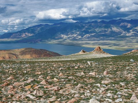 Tolbo Lake — Lake. Lake of 185 km² at 2,080 m, about 50 km south of Ölgii on the main road to Khovd, with a treeless shore. Many families camp here in summer, above all in mid-July, when the water is warmest. 48.5600, 90.0500 · Google Maps
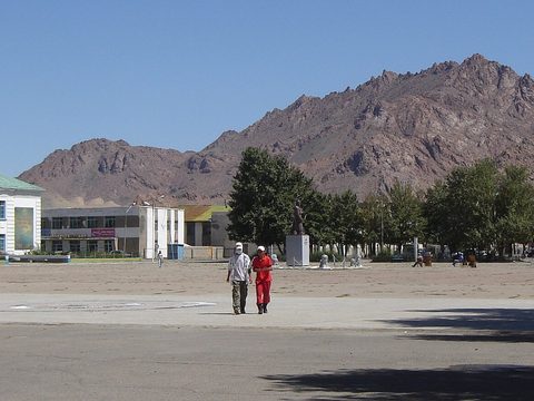 Khovd — Town. Capital of Khovd Province, at the foot of the Altai on the Buyant River. It was founded in 1685 and moved to its present site after 1757. Khar-Us Lake, the site of the Mankhan strictly protected area, lies about 25 km to the east. 48.0042, 91.6406 · Google Maps
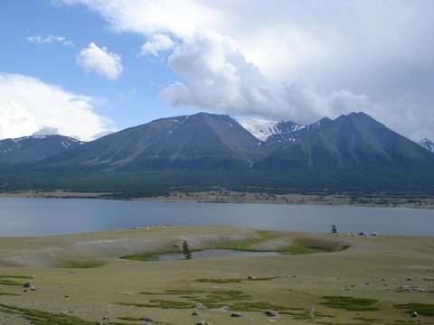 Khoton Lake — Lake. Freshwater lake of 50 km² at about 2,000 m in the national park, near the Chinese border, fed by the Khuiten River; it is up to 8.6 m deep. There is a campsite on its southern shore. It is reached by heading south from Tsengel along the Khovd River. Fishing in the park is allowed from 15 June to 15 April, with a permit issued in Ölgii or Tsengel. 48.6500, 88.3000 · Google Maps
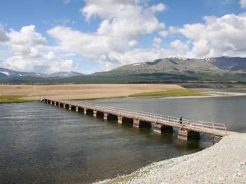 Khurgan Lake — Lake. Joined to Khoton Lake by a short, wide channel of about 2 km; together with Dayan Lake they feed the Khovd River. A bridge crosses between the two lakes, where the Syrgil ranger station stands. The climate is cold: −4 °C on average over the year, 14 °C in July. 48.5461, 88.6061 · Google Maps
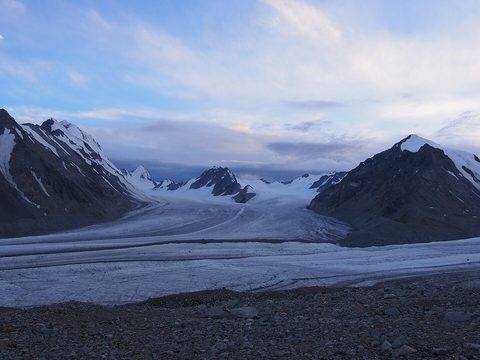 Potanin Glacier — Glacier. Mongolia's longest glacier, about 14 km, on the Tavan Bogd massif, named after the explorer Grigory Potanin; between 2003 and 2009 it retreated by about 90 m. The base camp is 20 km from the northern ranger station. The highest peaks, Khüiten among them, need ice axes, crampons and ropes, and going north of the glacier and to Khüiten Peak needs the Russian border zone permit. 49.1400, 87.9200 · Google Maps
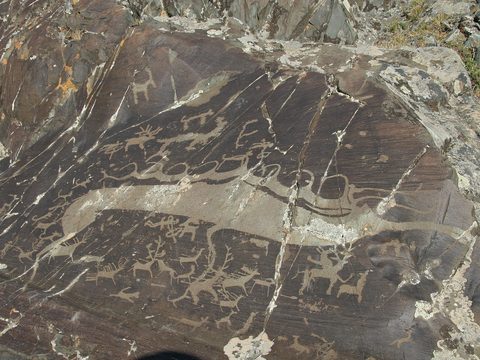 Tsagaan Salaa — Rock art. Valley also called Baga Oigor, north of the national park, in Ulaankhus district, near the Russian border. With Upper Tsagaan Gol and Aral Tolgoi it forms the UNESCO World Heritage Site of the Petroglyphic Complexes of the Mongolian Altai: rock carvings and funerary monuments that span 12,000 years. Over 10,000 petroglyphs line 15 km of the valley, where Kazakh families live. 49.3340, 88.3950 · Google Maps
Local guides in the Mongolian Altai
 Daurenbek Sakhuan
Ölgii, Mongolia · 4x4 car, adventure motorcycle Samar Magic Tours Mongolia
Ulán Bator, Mongolia · 4x4 car, 4x4 vanVacations Mongolia
Bayan-Ölgii, Mongolia · 4x4 car, 4x4 truck, camper / van, 4x4 van, offroad motorcycle, adventure motorcycle, bicycle / e-bike
Mongolia: guides by vehicle
Overland trips in the Mongolian Altai
- The eagle hunting tour in western Mongolia — Mongolia
When to go
In Ölgii the average high is 17 °C in May, 24 °C in July and 16 °C in September (1991–2020), and most of the little rain of the year, 122 mm in all, falls from June to August. In the national park snow lasts until the end of May; the busy season runs from June to October, when the tour camps and shuttles operate, and August and September are the busiest months. In January the average low in Ölgii is −22 °C, and the record is −40 °C.
Before you go
- All guides and trips in Mongolia
- Do you need a local guide in Mongolia?
- Is Mongolia safe to travel?
- Driving and local rules in Mongolia
Photo credits
Author and licence (or permission) for each photo.
- Mongolian Altai: Michael Karavanov, CC BY-SA 3.0
- 1. Ölgii: BatboldDorjgurkhem, CC BY 4.0
- 3. Tolbo Lake: Alexandr frolov, CC BY-SA 4.0
- 4. Khovd: Nahcamuk, CC BY-SA 3.0
- 5. Khoton Lake: Mongolia Expeditions…, CC BY 3.0
- 6. Khurgan Lake: Mongolia Expeditions…, CC BY 3.0
- 7. Potanin Glacier: FanousF, CC BY-SA 4.0
- 8. Tsagaan Salaa: Altaihunters, CC BY-SA 3.0


