Overland region
The Hoggar and Tamanrasset by 4x4: local guides and trips
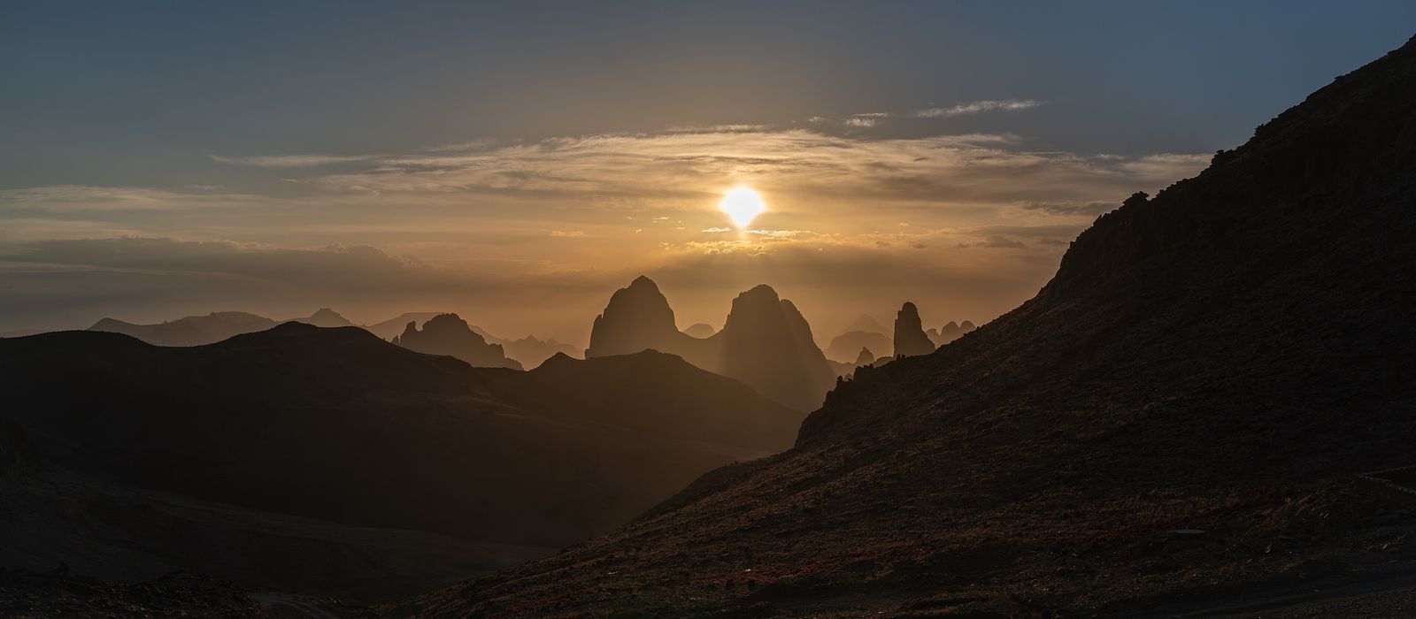
The Hoggar, or Ahaggar, is a mountain massif of the central Sahara in southern Algeria and the land of the Kel Ahaggar Tuareg; it lies within the Ahaggar Cultural Park, a national park from 1987 and a cultural park since 2011. Tamanrasset, on the Trans-Sahara Highway, is the gateway. At its heart lies the Atakor volcanic field, with Mount Tahat, the highest peak in Algeria, and the Assekrem plateau, where Charles de Foucauld settled in his hermitage in 1911. For anyone travelling with their own vehicle it means the N55 road past Hirafok and Idlès, the road down to Tazrouk and the tomb of Tin Hinan at Abalessa. In Algeria, desert excursions by 4x4 or motorbike are only possible with an authorised local guide and prior agreement from the authorities, who clear only routes that are kept under surveillance; around Tamanrasset and on the Assekrem, trips are arranged with agencies recognised by the Algerian government. Here are the local guides who work in the area and the trips that cross it.
2 local guides and 1 trip in the Hoggar and Tamanrasset on GuideMeet.
On the map
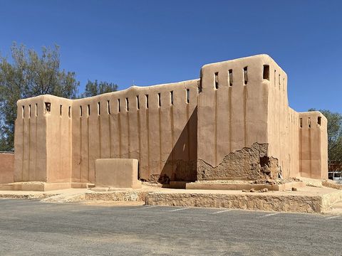 Tamanrasset — Town. Chief city of the Algerian Tuareg, served by an airport and the Trans-Sahara Highway; Charles de Foucauld arrived here on 13 August 1905. Pictured: the bordj he built in 1915-1916 as a refuge for the population. 22.7889, 5.5256 · Google Maps
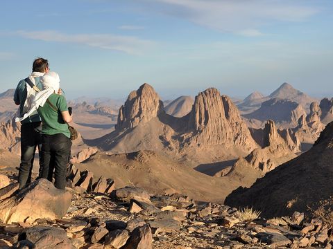 Assekrem — Viewpoint. High plateau rising from the Atakor, inside the Ahaggar park; the refuge stands at the pass below the hermitage. Pictured: the Tezouai peaks seen from the Assekrem. 23.2581, 5.6366 · Google Maps
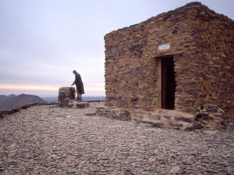 Ermitage de l'Assekrem — Monastery. Charles de Foucauld's hermitage at the top of the plateau: he discovered the Assekrem in September 1909 and moved up here in July 1911. A few religious brothers still live there. 23.2599, 5.6320 · Google Maps
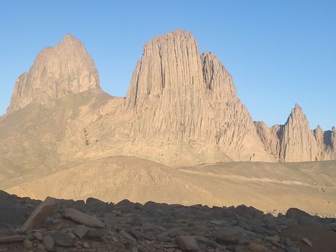 Atakor — Plateau. Volcanic field of about 2,500 km² at the centre of the Hoggar, with about 450 volcanic centres: some 400 lava domes and 50 small stratovolcanoes. Pictured: the Assekrem peaks at sunset. 23.3300, 5.8300 · Google Maps
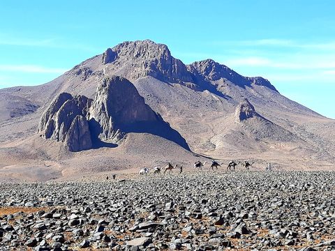 Tahat — Peak. The highest mountain in Algeria, of volcanic origin, about 56 km north of Tamanrasset; first climbed in 1931. 23.2889, 5.5336 · Google Maps
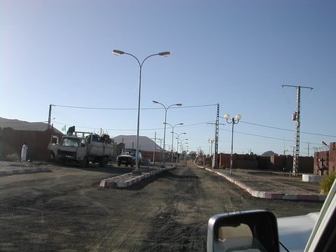 Idlès — Village. Village at 1,399 m on the northern edge of the Hoggar, just north of the N55, which runs west to In Amguel; from here a road branches south to Tazrouk. 23.8203, 5.9364 · Google Maps
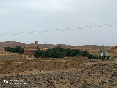 Tazrouk — Village. Village at 1,850 m, 180 km north-east of Tamanrasset, where the altitude and the Oued Tazrouk allow vines, apple, pear and pomegranate trees; it has hosted an annual Tuareg music festival. 23.4161, 6.2639 · Google Maps
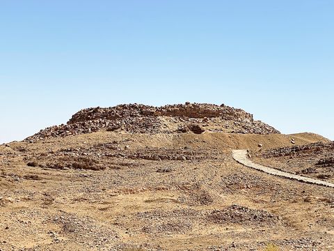 Tin Hinan — Archaeological site. Tumulus near Abalessa, 80 km west of Tamanrasset, where in 1925 archaeologists found the vault of a woman they identified as Tin Hinan, the ancestor queen of the Tuareg; the skeleton is now in the Bardo museum in Algiers. 22.8856, 4.8681 · Google Maps
Local guides in the Hoggar and Tamanrasset
 Active 4X4 Adventures
United Kingdom · 4x4 car, 4x4 truck, 4x4 van Adnane Benmessaoud
Tamanrasset, Algérie · 4x4 car
Algeria: guides by vehicle
Overland trips in the Hoggar and Tamanrasset
- Algeria 4X4 Overland Expedition — 15 days · Algeria
When to go
At Tamanrasset June and July are the hottest months, with average highs of about 36 °C, and January the coldest, with average lows of about 5 °C; rain is scarce, about 58 mm a year, with August the wettest month. The town draws visitors in the cooler months. In Algeria the authorities can close tourist routes.
Before you go
- All guides and trips in Algeria
- Do you need a local guide in Algeria?
- Is Algeria safe to travel?
- Driving and local rules in Algeria
Photo credits
Author and licence (or permission) for each photo.
- Hoggar and Tamanrasset: IssamBarhoumi, CC BY-SA 4.0
- 1. Tamanrasset: Bernard Gagnon, CC BY 4.0
- 2. Assekrem: Guillaume Lecoquierre, CC BY 2.0
- 3. Ermitage de l'Assekrem: Albert Backer, CC BY-SA 3.0
- 4. Atakor: Rachid Hamatou, CC BY-SA 4.0
- 5. Tahat: Yshak6.9, CC BY-SA 4.0
- 6. Idlès: Bertrand Devouard ou Florence Devouard (User:Anthere), CC BY-SA 3.0
- 7. Tazrouk: Samiha22samo, CC BY-SA 4.0
- 8. Tin Hinan: Bernard Gagnon, CC BY 4.0


