Overland region
The Mongolian Gobi by 4x4: local guides and trips
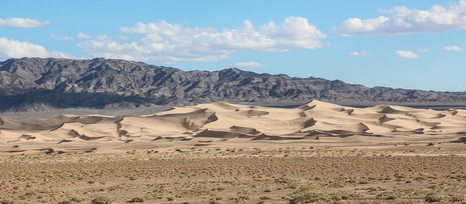
The Gobi covers the southern third of Mongolia, and most of its sights lie in Ömnögovi, the largest province, entered through its capital Dalanzadgad. To the west, Gobi Gurvansaikhan National Park, nearly 27,000 km², stretches 380 km: the ice of Yolyn Am, the Khongoryn Els dunes and the red canyon of Khermen Tsav. Bayanzag, the Flaming Cliffs, yielded the first dinosaur eggs ever found; to the north lie Tsagaan Suvarga and Ongi monastery. For anyone travelling with their own vehicle it means a paved road from Ulaanbaatar to Dalanzadgad and Yolyn Am, then desert tracks: Khongoryn Els is about 180 km from town. Here are the local guides who work in the area and the trips that cross it.
2 local guides and 2 trips in the Mongolian Gobi on GuideMeet.
On the map
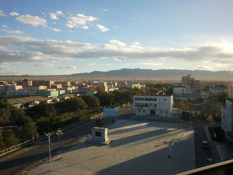 Dalanzadgad — Town. Capital of Ömnögovi, at about 1,470 m; the name means 'seventy springs'. It has a paved road to Ulaanbaatar and an airport with flights to the capital, and it is the place to stock up before the desert: leave with more than enough fuel and water. 43.5700, 104.4258 · Google Maps
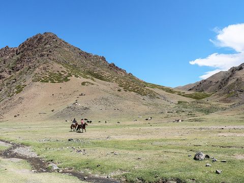 Yolyn Am — Gorge. Deep, narrow gorge in the Zuun Saikhan, the Eastern Beauty range, named after the lammergeier, 'yol' in Mongolian. Its ice field reaches several metres thick by the end of winter and now tends to disappear by September. A paved road links it to Dalanzadgad. 43.4938, 104.0824 · Google Maps
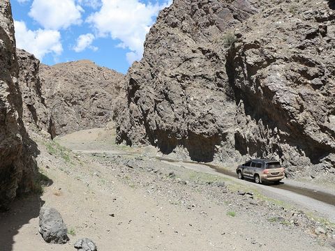 Dungenee Am — Gorge. Valley 12 km long in the south-western part of the Zuun Saikhan, in Bayandalai district, with cliffs, canyons, caves and rivers; mountain sheep and mountain goats can be seen here. Pictured: a 4x4 in the canyon. 43.4909, 103.8575 · Google Maps
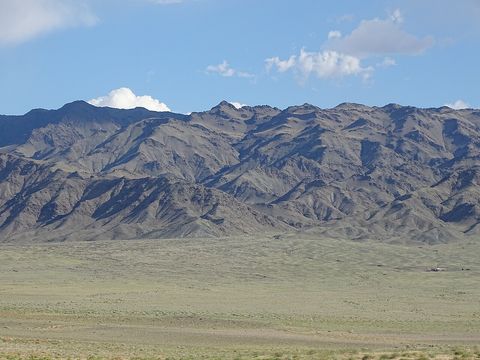 Gobi Gurvansaikhan National Park — Park. Mongolia's largest national park, nearly 27,000 km², 380 km from east to west and 80 km from north to south. Established in 1993 and enlarged in 2000, it is named after the Gurvan Saikhan, the 'Three Beauties' mountains, which rise to 2,600 m; snow leopard and argali live here. 43.8027, 101.5897 · Google Maps
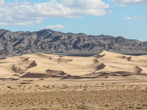 Khongoryn Els — Dunes. The 'Singing Sands', also called Duut Mankhan: dunes covering more than 965 km² inside the national park, which make a strong sound when the sand slides. They lie about 180 km from Dalanzadgad; the small Khongoryn Gol river runs along their northern edge. 43.7708, 102.1719 · Google Maps
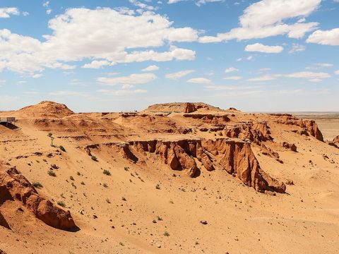 Bayanzag (Flaming Cliffs) — Rock formation. Red sandstone cliffs in Ömnögovi, named Flaming Cliffs by the American palaeontologist Roy Chapman Andrews in the 1920s. The first dinosaur eggs ever discovered came from here, along with Velociraptor specimens. Removing fossils without a permit is illegal. 44.1385, 103.7278 · Google Maps
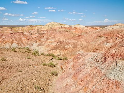 Tsagaan Suvarga — Rock formation. Site in Ölziit district of Dundgovi province, north of the border with Ömnögovi. 44.5769, 105.7173 · Google Maps
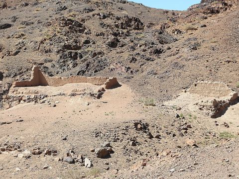 Ongi Monastery — Monastery. Ruins of two monasteries facing each other across the Ongi River, about 18 km south of Saikhan-Ovoo in Dundgovi. The complex, founded in 1660, housed over 1,000 monks; it was destroyed in 1939, and the first rebuilt temple opened in 2004. 45.3398, 104.0043 · Google Maps
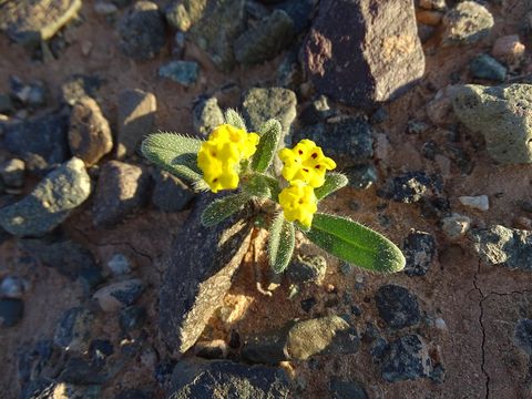 Nemegt Basin — Valley. Basin in the north-western Gobi, in Ömnögovi, known locally as the 'Valley of the Dragons' for its many fossil finds, among them dinosaurs and dinosaur eggs. 43.5000, 101.0000 · Google Maps
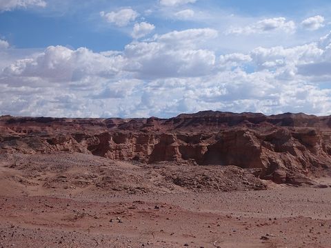 Khermen Tsav — Canyon. Red canyon 15–20 km long in Gurvantes district, about 450 km from Dalanzadgad. Its red beds, part of the Baruungoyot Formation, are known for dinosaur fossils and eggs. 43.4668, 99.8329 · Google Maps
Local guides in the Mongolian Gobi
Barhas Ganbold
Royal Enfield Mongolia, Mongolia · offroad motorcycle, adventure motorcycle Samar Magic Tours Mongolia
Ulán Bator, Mongolia · 4x4 car, 4x4 van
Mongolia: guides by vehicle
Overland trips in the Mongolian Gobi
- 13 DÍAS-DESCUBRA MONGOLIA EN GRUPO EN LAND CRUISER TOYOTA 4X4 A LAS TRES MARAVILLAS NATURALES EN… — 13 days · Mongolia
- Gobi Raid — 9 days · Mongolia
When to go
In Dalanzadgad the average high is 21 °C in May, 29 °C in July and 21 °C in September (1991–2020). In July rainfall averages about 33 mm. Trips in September and October are still possible, while spring often brings sandstorms. In January the average low is −19 °C, and desert crossings in winter and at night are especially risky.
Before you go
- All guides and trips in Mongolia
- Do you need a local guide in Mongolia?
- Is Mongolia safe to travel?
- Driving and local rules in Mongolia
Photo credits
Author and licence (or permission) for each photo.
- Mongolian Gobi: Bernard Gagnon, CC0
- 1. Dalanzadgad: Yastanovog, CC BY-SA 4.0
- 2. Yolyn Am: Bernard Gagnon, CC0
- 3. Dungenee Am: Bernard Gagnon, CC0
- 4. Gobi Gurvansaikhan National Park: Ljuba brank, CC BY-SA 4.0
- 5. Khongoryn Els: Bernard Gagnon, CC0
- 6. Bayanzag (Flaming Cliffs): Bernard Gagnon, CC0
- 7. Tsagaan Suvarga: Rob Oo from NL, CC BY 2.0
- 8. Ongi Monastery: Bernard Gagnon, CC0
- 9. Nemegt Basin: Ljuba brank, CC BY-SA 4.0
- 10. Khermen Tsav: Ljuba brank, CC BY-SA 4.0


