Overland region
The Danakil Depression by 4x4: local guides and trips
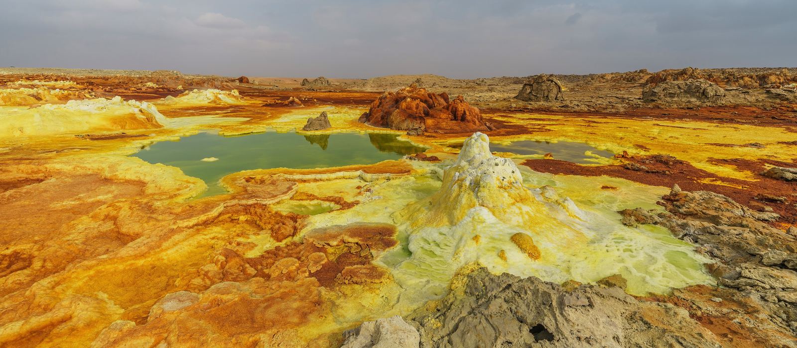
The Danakil Depression is a rift valley in the north of Ethiopia's Afar Region, about 125 m below sea level, with salt plains, hot springs and volcanoes: the coloured acid pools of Dallol, the salt flats of Lake Karum, the lava lake of Erta Ale and the hypersaline Lake Afdera. For anyone travelling with their own vehicle it means dirt tracks across the salt crust, a base camp at Hamed Ela and walks to the craters. Government travel advisories warn against travel to the Afar Region, and foreigners may need prior authorisation: check the current situation before planning. Here are the local guides who work in the area and the trips that cross it.
2 local guides and 3 trips in the Danakil Depression on GuideMeet.
On the map
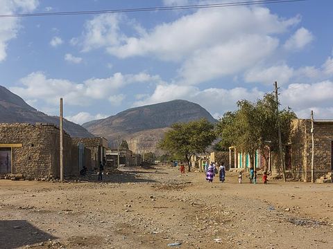 Abala — Town. Market town at 1,465 m, the administrative centre of Kilbet Rasu, with a goat market on Thursdays. The road to Erta Ale starts here. 13.3555, 39.7549 · Google Maps
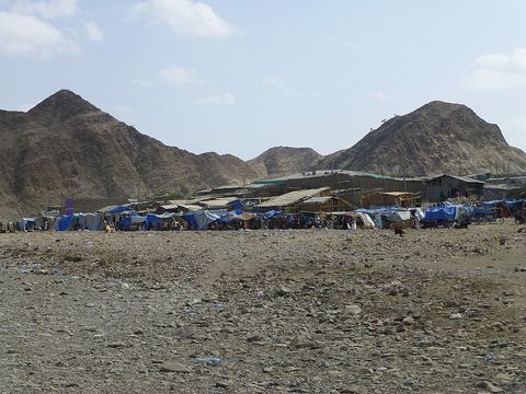 Berhale — Town. Town at 639 m in a valley below two rocky peaks, where the highlands give way to the Afar desert. It is the closest town to Dallol. 13.8619, 40.0214 · Google Maps
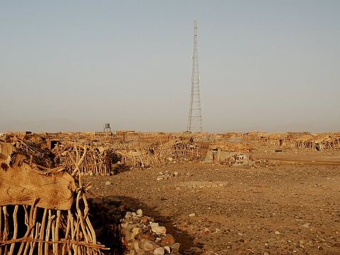 Hamed Ela — Village. Afar settlement that works as a base camp for Dallol and Lake Karum. Salt cut on the lake is carried here by camel, then trucked on to Mekele. 14.0856, 40.2776 · Google Maps
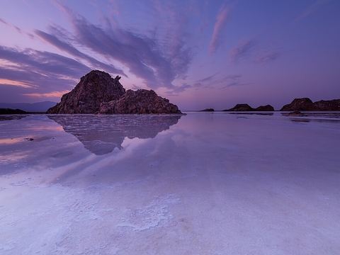 Lake Karum — Lake. Salt lake 120 m below sea level, ringed by a salt pan that is still mined. The salt leaves by camel caravan. Also known as Lake Assale. 14.0316, 40.3981 · Google Maps
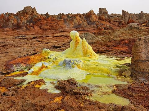 Dallol — Crater. Hydrothermal field around a small volcano: acid springs, fumaroles and salts in yellow, green and ochre. The mountain is about 3 km by 1.5 km and rises 60 m above the salt plain. 14.2425, 40.2997 · Google Maps
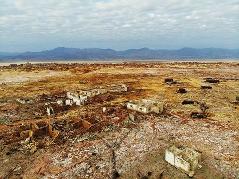 Dallol ghost town — Archaeological site. Mining settlement turned ghost town, with the highest annual average temperature recorded for an inhabited place: 35 °C, between 1960 and 1966. Some buildings of salt blocks still stand. 14.2386, 40.2936 · Google Maps
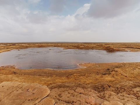 Gaet'ale Pond — Lake. Crescent-shaped pond about 60 m across, 4 km south-east of Dallol, with a salinity of 43% and water at 50–55 °C. Locals say it appeared after an earthquake in January 2005. 14.2133, 40.3214 · Google Maps
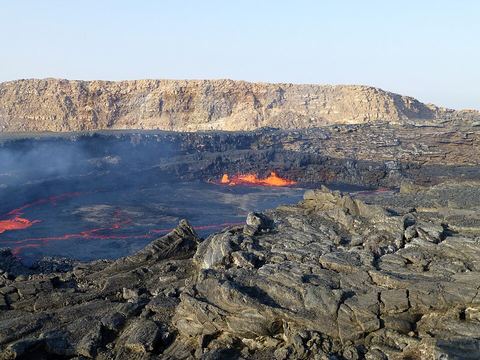 Erta Ale — Crater. Shield volcano, 613 m, with a lava lake present since at least 1906; "smoking mountain" in Afar. The crater is reached on foot from a base camp. 13.6064, 40.6614 · Google Maps
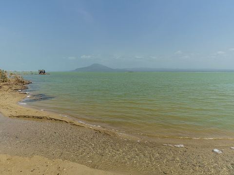 Lake Afdera — Lake. Hypersaline lake of 117 km², fed by hot springs. Franchetti Island, in the south, is considered the lowest-lying island in the world. Salt has been mined here for centuries. 13.2833, 40.9167 · Google Maps
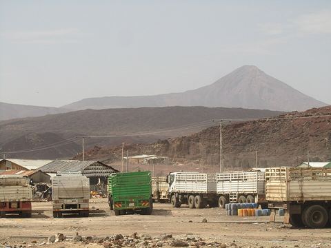 Afdera — Town. Largest town of the Afdera district, in a salt-mining area by the lake of the same name. An all-weather road built in the 1990s links the district to the Awash–Assab highway. 13.2073, 40.8604 · Google Maps
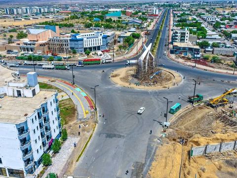 Semera — Town. Capital of the Afar Region: a town planned and built on the Awash–Assab highway, served by Sultan Ali Mirah Airport. 11.7922, 41.0086 · Google Maps
Local guides in the Danakil Depression
 4x4 Ethiopia Tours
Addis Ababa, Ethiopia · 4x4 car, camper / van, adventure motorcycle, offroad motorcycle Aone Ethiopia Tours
Addis Ababa, Ethiopia · 4x4 car, 4x4 van
Ethiopia: guides by vehicle
Overland trips in the Danakil Depression
- 3~Days Danakil Depression & Erta Ale Volcano Adventure. — 3 days · Ethiopia
- Viaggio combinato di 12 giorni in Etiopia — 12 days · Ethiopia
Trips already run here
- 3 Days Danakil Depression Tour — 3 days · Ethiopia
When to go
The cooler months are roughly November to February; the rest of the year the heat is extreme, and Dallol has recorded 49 °C. Rain is rare.
Before you go
- All guides and trips in Ethiopia
- Do you need a local guide in Ethiopia?
- Is Ethiopia safe to travel?
- Driving and local rules in Ethiopia
Photo credits
Photos from Wikimedia Commons, under the licences shown.
- Danakil Depression: A.Savin, FAL
- 1. Abala: A.Savin, FAL
- 2. Berhale: Ji-Elle, CC BY-SA 3.0
- 3. Hamed Ela: Jan Markiewicz, CC BY-SA 3.0
- 4. Lake Karum: Thomas Fuhrmann, CC BY-SA 4.0
- 5. Dallol: A.Savin, FAL
- 6. Dallol ghost town: Evan Williams, CC BY-SA 4.0
- 7. Gaet'ale Pond: A.Savin, FAL
- 8. Erta Ale: Ji-Elle, CC BY-SA 3.0
- 9. Lake Afdera: A.Savin, FAL
- 10. Afdera: Ondřej Hanousek, CC BY-SA 4.0
- 11. Semera: Alawi10, CC BY 4.0


