Overland region
The White Desert by 4x4: local guides and trips
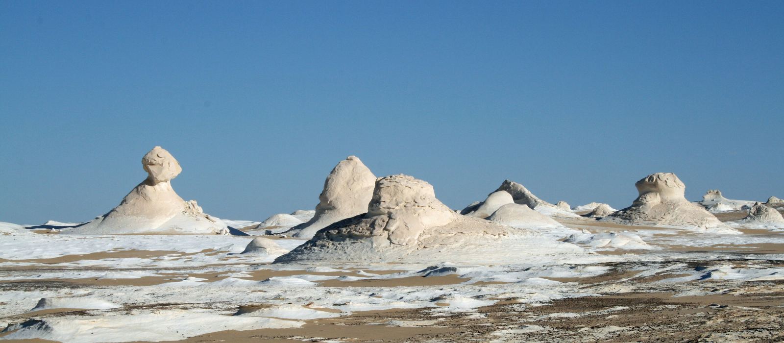
The White Desert is a stretch of Egypt's Western Desert between the Bahariya and Farafra oases, known for its white chalk rock formations carved by wind and sand. From Bawiti, the main town of Bahariya, the way south crosses the dark hills of the Black Desert and the Crystal Mountain before reaching the White Desert National Park, north of Farafra. For anyone travelling with their own vehicle it means desert tracks, camping among the rocks and springs in the middle of the sand. Here are the local guides who work in the area and the trips that cross it.
6 local guides and 4 trips in the White Desert on GuideMeet.
On the map
- Bawiti — Town. Largest town of the Bahariya Oasis (about 16,000 inhabitants) and a base for trips to the Black and White Deserts. On a ridge above it are two tombs of the 26th Dynasty. 28.3500, 28.8667 · Google Maps
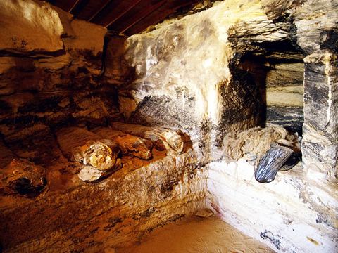 Valley of the Golden Mummies — Archaeological site. Large Greco-Roman burial ground in the Bahariya Oasis, discovered in 1996. About 250 mummies have been recovered, some with gilded masks. 28.3268, 28.8261 · Google Maps
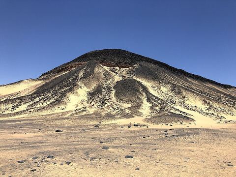 Black Desert — Reserve. Field of dark, volcano-shaped mounds up to 100 m high, spread over about 30 km between Bahariya and the White Desert. Basalt caps give them their colour; a natural reserve since 2010. 28.1507, 28.7286 · Google Maps
- El Heiz — Oasis. Oasis village at the southern end of the Bahariya depression, about 50 km south of Bawiti. Mummies and a prehistoric hunter-gatherer settlement have been found here. 28.0075, 28.6972 · Google Maps
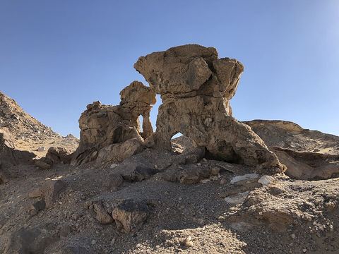 Crystal Mountain — Rock formation. Ridge and small arch of barite and calcite crystals set in eroded chalk limestone, on the way between the Bahariya and Farafra oases. 27.6620, 28.4293 · Google Maps
- Agabat Valley — Valley. Valley on the White Desert track, south of the Crystal Mountain, dotted with mushroom-shaped limestone rocks. 27.4698, 28.4359 · Google Maps
- Wadi Hennis — Valley. Wadi inside the White Desert National Park, at 32 m above sea level the lowest point of the park. The oases of Ain el Maqfi and Ain el Wadi are in the same park. 27.4000, 28.2667 · Google Maps
- Ain el Wadi — Oasis. Oasis with a spring in the north of the Farafra depression, inside the White Desert National Park, close to Wadi Hennis. 27.3718, 28.2200 · Google Maps
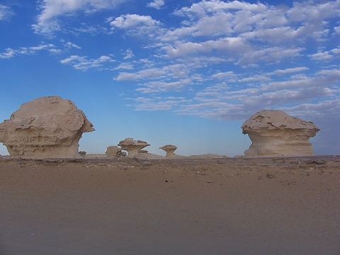 White Desert National Park — Park. Protected area since 2002, covering 300 km², known for its white chalk formations sculpted by wind and sand. It lies 45 km north of the town of Farafra. 27.2773, 28.2004 · Google Maps
- Bir Sitta — Spring. Hot spring (the 'sixth well') near Farafra: the warm water, with a little sulphur, is used for swimming and relaxing. 27.0806, 27.9215 · Google Maps
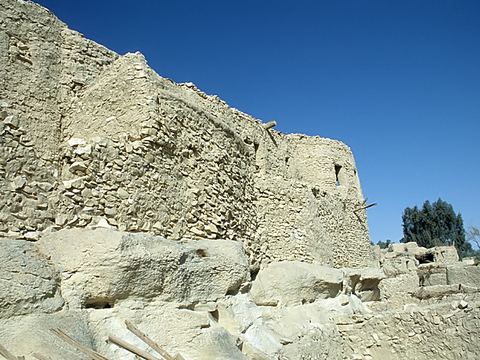 Farafra — Town. Main town of the Farafra depression, with about 5,000 inhabitants in 2002 and quarters of traditional mud architecture. The Roman spring of Ain Bishay lies on its north-west edge. 27.0583, 27.9700 · Google Maps
Local guides in the White Desert
- Mohamed Safieldin — White Desert National Park, Egypt · 4x4 car, 4x4 truck, 4x4 van, camper / van, offroad motorcycle, adventure motorcycle
- Mohamed Mahmoud — Egypt Desert Dunes, الواحات البحرية، محافظة الجيزة 12935، مصر · 4x4 car, camper / van, 4x4 van, offroad motorcycle, adventure motorcycle, 4x4 truck
- Alice Grollier — Égypte · 4x4 car, bicycle / e-bike, 4x4 van, camper / van, adventure motorcycle
- Mahmoud Melady — Giza, Egypt
- ahmed diyab — Bahariya Oasis, Egypt
- Joanne Clayton — Bahariya Oasis, Egypt
Overland trips in the White Desert
- White desert camping tour — 2 days · Egypt
- 4x4 Adventure in Egypt’s Western Desert — 3 days · Egypt
- White Desert & Black Desert 4x4 Safari — 3 days · Egypt
- Séjour entre filles - Désert & Culture — 10 days · Egypt
When to go
Winter is the most comfortable season: the average temperature at Farafra is about 12 °C in January, but nights can drop below freezing. From April to September it is very hot, with records above 43 °C. Rain is almost absent.
Before you go
- All guides and trips in Egypt
- Do you need a local guide in Egypt?
- Is Egypt safe to travel?
- Driving and local rules in Egypt
Photo credits
Photos from Wikimedia Commons, under the licences shown.
- White Desert: Daniel Fafard, Public domain
- 2. Valley of the Golden Mummies: Roland Unger, CC BY-SA 3.0
- 3. Black Desert: Viktor Lazić, CC BY-SA 4.0
- 5. Crystal Mountain: Viktor Lazić, CC BY-SA 4.0
- 9. White Desert National Park: Silviapef, CC BY 2.0
- 11. Farafra: Roland Unger, CC BY-SA 3.0


