Overland region
The Spiti Valley by 4x4 and motorbike: local guides and trips
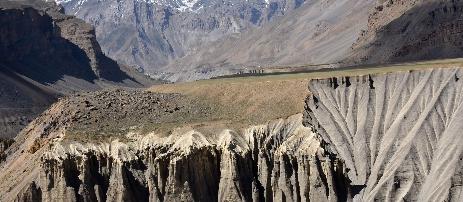
The Spiti Valley is a high, arid valley in the north-east of Himachal Pradesh, bordering Ladakh and Tibet, with Kaza, at about 3,650 m, as its main town and Key monastery, Kibber, Langza, Dhankar, Tabo and the Pin valley around it. For anyone travelling with their own vehicle it means two ways in: from Manali through the Atal Tunnel and over Kunzum La, on a largely unpaved stretch between Gramphu and Batal that in places runs on the Chandra riverbed, or the road of about 412 km from Shimla through Kinnaur. Foreigners need a Protected Area Permit for places such as Tabo, Dhankar and Nako: check the current rules before you go. Here are the local guides who work in the area and the trips that cross it.
4 local guides and 1 trip in the Spiti Valley on GuideMeet.
On the map
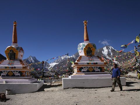 Kunzum La — Mountain pass. Pass at 4,551 m linking Lahaul and Spiti, 79 km from Kaza. From Batal the road climbs in fifteen hairpin bends; many drivers stop for the blessing of Kunzum Mata. 32.4158, 77.6485 · Google Maps
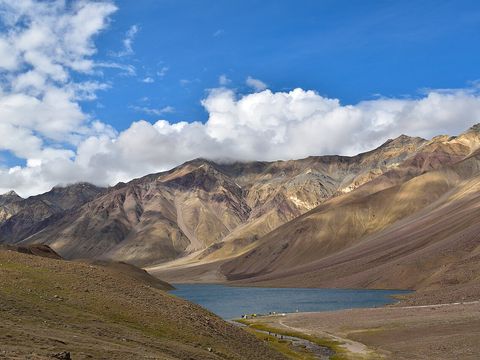 Chandra Taal — Lake. Lake on the Lahaul side of Kunzum La, a Ramsar wetland since 2005. A 12 km road branches off NH505 near Batal and ends at a car park; the last kilometre is on foot. The lake is frozen from December to March. 32.4752, 77.6171 · Google Maps
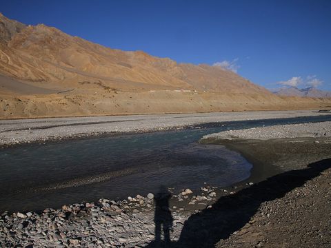 Kaza — Town. Main town and commercial centre of the Spiti Valley, at 3,650 m on the Spiti River. In 2022 its fuel station was the only one in the valley. 32.2256, 78.0714 · Google Maps
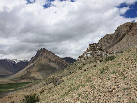 Key Monastery — Monastery. The largest monastery of the Spiti Valley, of the Gelug school, at 4,166 m about 12 km north of Kaza. Its walls are covered with murals. 32.2978, 78.0119 · Google Maps
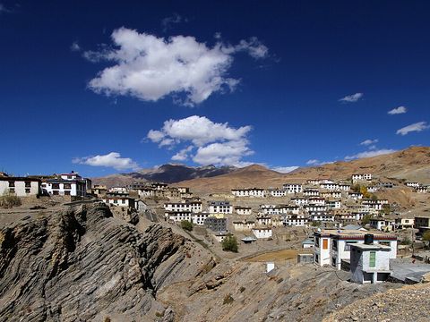 Kibber — Village. Village at 4,270 m, 19 km from Kaza, described as one of the highest villages in the world inhabited year round. It gives its name to the Kibber Wildlife Sanctuary, enlarged in 2013 to 2,220 km². 32.3317, 78.0089 · Google Maps
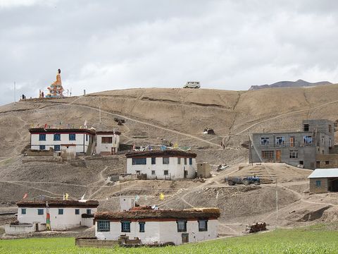 Langza — Village. Village at about 4,420 m at the foot of Chau Chau Kang Nilda, known as the 'fossil village' of the Spiti Valley. Pictured: the village and its Buddha statue. 32.2738, 78.0816 · Google Maps
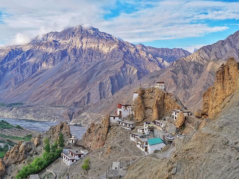 Dhankar — Monastery. Monastery at 3,894 m on a spur above the meeting of the Spiti and Pin rivers; Dhankar was the capital of the Spiti kingdom in the 17th century. An 8 km road, suitable only for small vehicles, leaves the Kaza–Samdo road about 24 km from Kaza. 32.0906, 78.2119 · Google Maps
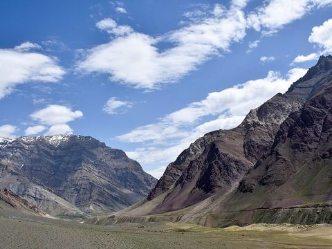 Pin Valley National Park — Park. Park of 675 km² south of Dhankar, part of the Cold Desert Biosphere Reserve, from about 3,500 m to more than 6,000 m. Its animals include the snow leopard, the Siberian ibex and the bharal. Pictured: the Pin River towards Mudh. 32.0000, 77.8800 · Google Maps
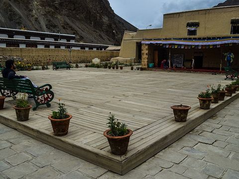 Tabo Monastery — Monastery. Monastery at 3,050 m on the left bank of the Spiti, founded in 996 by the translator Rinchen Zangpo for King Yeshe-Ö of Guge. It stands on the valley floor, and its murals have earned it the name 'Ajanta of the Himalayas'. 32.0800, 78.3800 · Google Maps
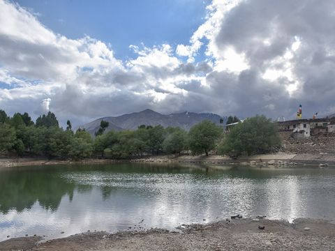 Nako — Village. Largest village of the Hangrang valley, in Kinnaur, reached by a 7 km branch road from NH505. Nako Lake lies at 3,636 m, and the monastery dates from 1025. 31.8815, 78.6275 · Google Maps
Local guides in the Spiti Valley
 Ritesh Sood
Manali, India · 4x4 car, offroad motorcycle, adventure motorcycle Spiti Valley Packages
Spiti Valley, Himachal Pradesh, India · 4x4 car, adventure motorcycle Hiren Patel
Leh, Leh 194101 · camper / van, offroad motorcycle, adventure motorcycle, 4x4 car- Sonam Anchuk
Leh · adventure motorcycle
India: guides by vehicle
Overland trips in the Spiti Valley
- THE GREAT HIMALAYAN CHALLENGE TO UMLING LA PASS — 15 days · India
When to go
According to the Lahaul and Spiti district administration, the road over Kunzum La generally stays closed in winter, roughly from October/November to June/July, while the road from Shimla through Kinnaur is an almost all-weather route to Kaza. The valley is arid, with an average of about 50 mm of rain a year.
Before you go
- All guides and trips in India
- Do you need a local guide in India?
- Is India safe to travel?
- Driving and local rules in India
Photo credits
Author and licence (or permission) for each photo.
- Spiti Valley: Timothy A. Gonsalves, CC BY-SA 4.0
- 1. Kunzum La: Gerd Eichmann, CC BY 4.0
- 2. Chandra Taal: Adarsh Patel, CC BY-SA 4.0
- 3. Kaza: Gerd Eichmann, CC BY 4.0
- 4. Key Monastery: Mike Shaw, CC BY-SA 4.0
- 5. Kibber: Gerd Eichmann, CC BY-SA 4.0
- 6. Langza: Sumita Roy Dutta, CC BY-SA 4.0
- 7. Dhankar: Deepank Ranka, CC BY-SA 4.0
- 8. Pin Valley National Park: Timothy Gonsalves, CC BY-SA 4.0
- 9. Tabo Monastery: Mdipa, CC BY-SA 4.0
- 10. Nako: Timothy A. Gonsalves, CC BY-SA 4.0


