Overland region
The Erg Tifernine by 4x4: local guides and trips
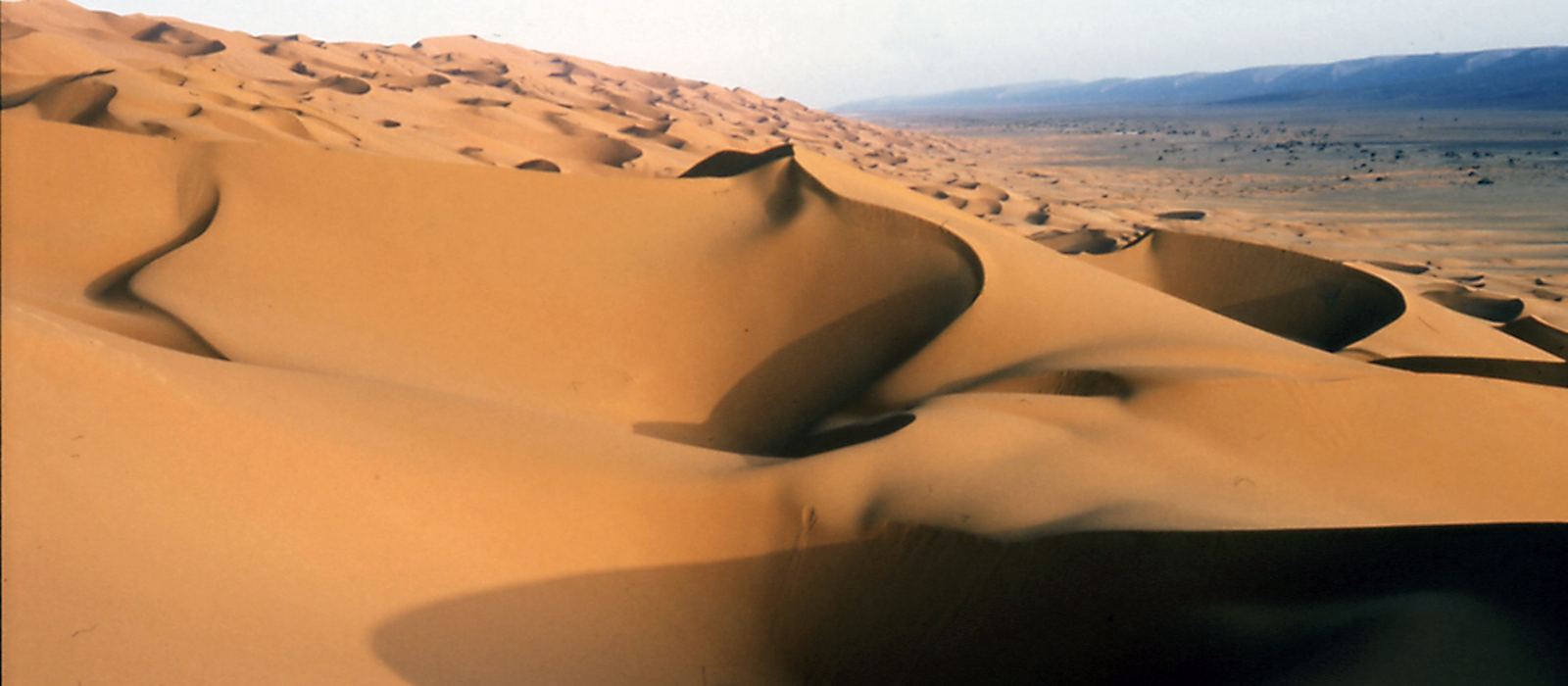
The Erg Tifernine is a sand sea in Illizi Province, in south-eastern Algeria, about 150 km long from north to south, with dunes up to 420 m high, among the tallest in the Sahara. It is framed to the south and east by the westernmost foothills of the Tassili n'Ajjer and has no settlements or roads inside it; a track for off-road vehicles runs along its east and south sides. For anyone travelling with their own vehicle it means the Gräberpiste out of Illizi, with its dune crossings and rocky stretches, and the road from Bordj Omar Driss. In Algeria, desert excursions by 4x4 or motorbike are only possible with an authorised local guide and prior agreement from the authorities, who clear only routes that are kept under surveillance. Here are the local guides who work in the area and the trips that cross it.
1 local guide and 1 trip in the Erg Tifernine on GuideMeet.
On the map
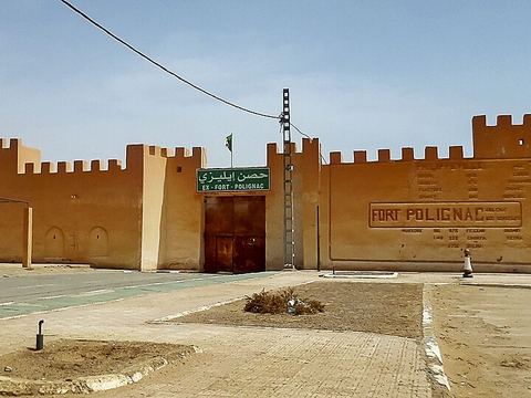 Illizi — Town. Capital of Illizi Province, called Fort Polignac until 1962, on the N3 highway. One of the gates to the Tassili n'Ajjer National Park and the start of the Gräberpiste. Pictured: the fort. 26.5050, 8.4822 · Google Maps
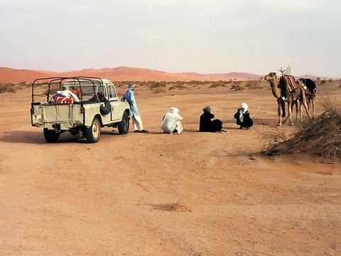 Gräberpiste — Track. Track from Illizi to Amguid, named in 1981 after the burial fields along it. Parts of it are hard going and only for off-road vehicles; in English it is the Graveyard Piste. 26.5000, 7.0000 · Google Maps
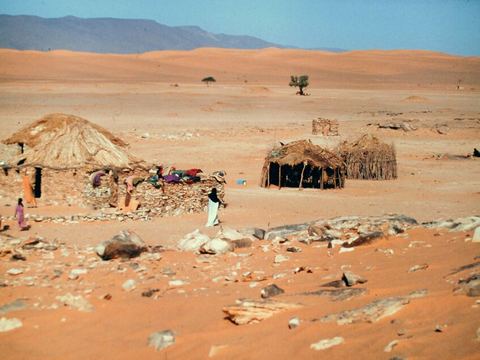 Tanarine — Village. Main village of the Oued Samene, a dry valley where the dunes of the Erg Samene run for almost 40 km; it has a well, a school, a few permanent houses and reed huts. 26.4570, 7.4030 · Google Maps
- Ain el Hadjadj — Spring. A well in the Oued Irarraren, where the road from Bordj Omar Driss meets the Gräberpiste. In early 1917 it was the last French outpost in the south-east of the Algerian Sahara. 26.8308, 7.2560 · Google Maps
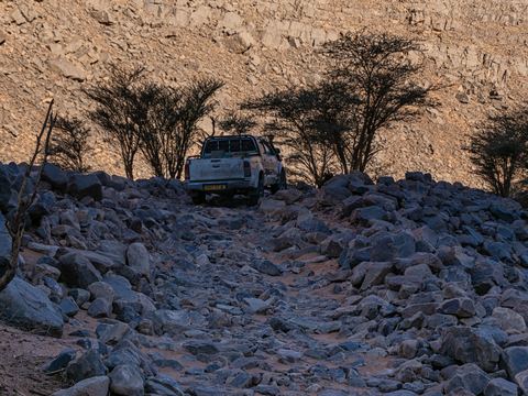 Djebel Essaoui Mellene — Gorge. Range that continues the Tassili n'Ajjer, between the Samene valley and the erg. The Gräberpiste crosses it at walking pace over stream-bed ground; then comes the very soft fech-fech dust. 26.8314, 6.9775 · Google Maps
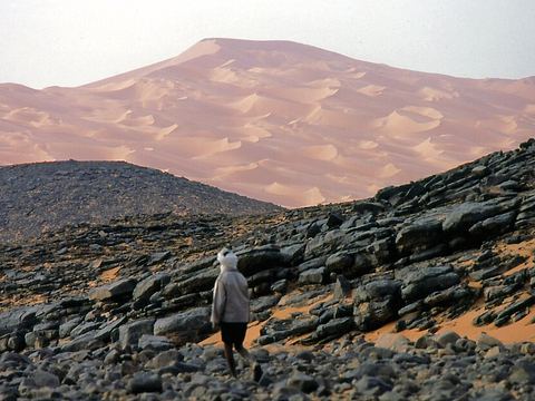 Erg Tifernine — Dunes. Amphora-shaped from space. On the east flank, along the track, dune crests can appear suddenly after gentle climbs, sometimes hard to see, with steep drops behind them. 26.7500, 6.6667 · Google Maps
- Khannfoussa — Peak. A dark rock hill rising from the dunes at the narrow passage between the Erg Issaouane and the Erg Tifernine, a landmark for crossing the sand; neolithic burial mounds lie at its foot. 27.5886, 6.7942 · Google Maps
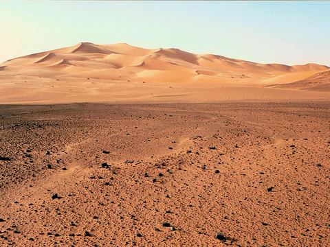 Erg Issaouane — Dunes. The much larger sand sea beside the Erg Tifernine, joined to it by a narrow passage. No settlements inside; tracks lead to oil fields, some already covered by sand again. 27.8333, 7.2500 · Google Maps
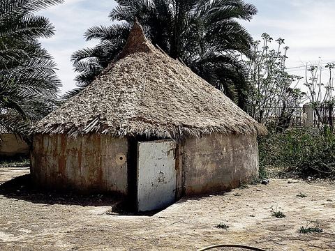 Bordj Omar Driss — Town. The former Fort Flatters, on the edge of the Erg Issaouane, with a hospital and fuel stations. From here the CW2 road runs south across the erg to Ain el Hadjadj and the Gräberpiste. 28.1233, 6.8217 · Google Maps
Local guides in the Erg Tifernine
 Maurizio Turco
Roma, Italia · 4x4 car, 4x4 truck, 4x4 van, offroad motorcycle, adventure motorcycle, bicycle / e-bike
Algeria: guides by vehicle
Overland trips in the Erg Tifernine
- ALGERIA 4X4 2026 - Terra Tuareg — 17 days · Tunisia, Algeria
When to go
Summers are extremely hot: at Bordj Omar Driss the average highs stay well above 40 °C from June to August, and rain is scarce, about 25 mm a year, so the cooler months are the more comfortable for the dunes. In Algeria the authorities can close tourist routes, and desert trips are arranged with an authorised local guide.
Before you go
- All guides and trips in Algeria
- Do you need a local guide in Algeria?
- Is Algeria safe to travel?
- Driving and local rules in Algeria
Photo credits
Photos from Wikimedia Commons, under the licences shown.
- Erg Tifernine: Heribertus2, CC BY-SA 4.0
- 1. Illizi: habib kaki, CC BY 3.0
- 2. Gräberpiste: Heribertus2, CC BY-SA 4.0
- 3. Tanarine: Heribertus2, CC BY-SA 4.0
- 5. Djebel Essaoui Mellene: Martin Steininger, CC BY-SA 4.0
- 6. Erg Tifernine: Heribertus2, CC BY-SA 4.0
- 8. Erg Issaouane: Heribertus2, CC BY-SA 4.0
- 9. Bordj Omar Driss: Hydrosami, CC BY-SA 4.0


