Overland region
Erg Chebbi and Merzouga by 4x4 and motorbike: local guides and trips
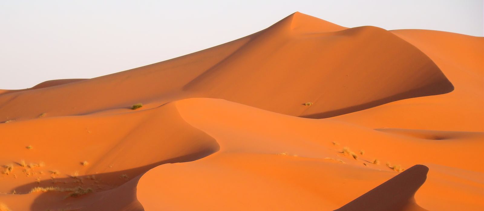
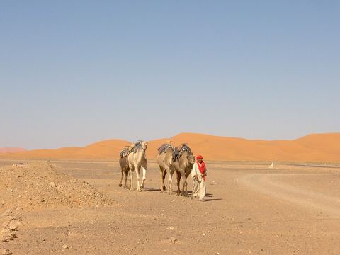
Erg Chebbi is a great sea of dunes in the south-east of Morocco, on the Algerian border, with dunes rising up to 150 m above the stony desert around them. Merzouga and the villages of Hassilabied and Khamlia sit along its edge, while Rissani and Erfoud, in the Tafilalet, are the nearest towns. For anyone travelling with their own vehicle it means sand and hamada tracks towards Taouz and Ramlia, the Gara Medouar massif, the seasonal lake of Dayet Srji and the ruins of the old caravan city of Sijilmasa. Here are the local guides who work in the area and the trips that cross it.
16 local guides and 12 trips in Erg Chebbi and Merzouga on GuideMeet.
On the map
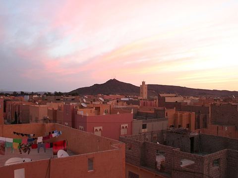 Erfoud — Town. Oasis town of the Drâa-Tafilalet region, with hotels and restaurants for visitors heading to the Merzouga dunes; its desert has been a film location. 31.4361, -4.2328 · Google Maps
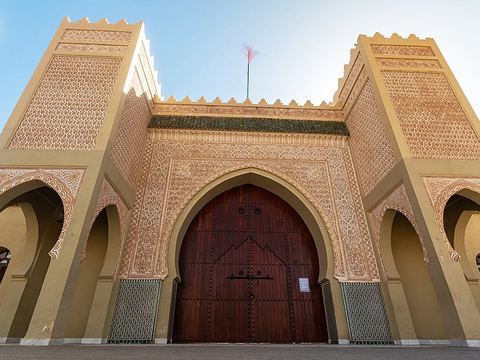 Rissani — Town. Old capital of the Tafilalet and a caravan crossroads, with a large souk, liveliest on Tuesdays, Thursdays and Sundays. Pictured: the Moulay Ali Cherif mausoleum. 31.2859, -4.2751 · Google Maps
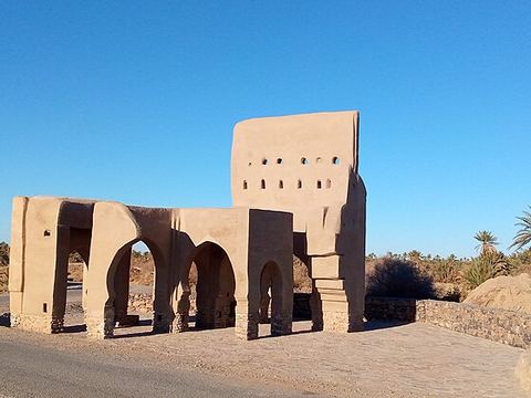 Sijilmasa — Archaeological site. Ruins of a medieval trading city on the Ziz, near Rissani: until the 14th century it was the northern end of the western trans-Saharan route. Pictured: the northern gate. 31.2765, -4.2895 · Google Maps
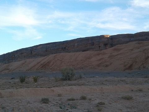 Gara Medouar — Rock formation. Horseshoe-shaped limestone massif, fortified in the 11th century and later a film set (The Mummy, Spectre); now popular with off-roaders. 31.3008, -4.4006 · Google Maps
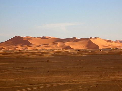 Erg Chebbi — Dunes. Sea of dunes on the Algerian border, rising up to 150 m above the stony desert around it. Merzouga, on its western side, is the tourist hub. 31.1667, -3.9833 · Google Maps
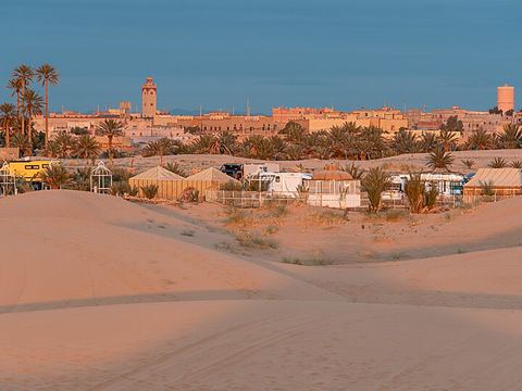 Hassilabied — Village. Village just north of Merzouga, on the edge of the Erg Chebbi dunes, where many camel trips into the dunes start. 31.1344, -4.0261 · Google Maps
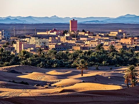 Merzouga — Village. The local tourist hub, on the western side of the dunes, with hotels and auberges strung along them. Pictured: Merzouga on the edge of the Sahara. 31.0992, -4.0117 · Google Maps
- Dayet Srji — Lake. Seasonal lake just west of Merzouga: water is there only some of the time, so what you find depends on the year. 31.0958, -4.0540 · Google Maps
 Khamlia — Village. Small village on the edge of the dunes, near the Algerian border, known for its Gnawa music festival held in summer. 31.0351, -4.0073 · Google Maps
- Taouz — Village. Village about 21 km by road south of Merzouga, close to the Algerian border, where the road from Merzouga ends. Stone tumuli and rock engravings are found around it. 30.9069, -3.9958 · Google Maps
- Ramlia — Village. Desert village south-west of Taouz, reached from Merzouga by an unpaved piste; other tracks lead on west towards Foum Mharech. 30.6854, -4.4155 · Google Maps
Local guides in Erg Chebbi and Merzouga
- Taghlaoui Hassan — Merzouga Desierto, Marruecos · 4x4 car, camper / van, 4x4 truck, 4x4 van, offroad motorcycle, adventure motorcycle
- Zaid Ramlia — Marrakesh, Morocco · 4x4 car, offroad motorcycle, 4x4 truck, bicycle / e-bike, adventure motorcycle
- MAURIZIO TURCO — Roma, Italia · 4x4 car, 4x4 truck, 4x4 van, offroad motorcycle, adventure motorcycle, bicycle / e-bike
- Morocco Merzougatour — Merzouga, Morocco · 4x4 car, 4x4 truck, 4x4 van, offroad motorcycle, adventure motorcycle, bicycle / e-bike, camper / van
- Trek desert Morocco — Merzouga, Morocco · 4x4 car, offroad motorcycle, adventure motorcycle
- Morocco Enduro Ride — Merzouga, Morocco · 4x4 car, offroad motorcycle, adventure motorcycle
- Moto Travel Dude — London, UK · adventure motorcycle
- Lahcen Seggaoui — Merzouga Desierto, Morocco · 4x4 car, 4x4 truck, camper / van, 4x4 van, offroad motorcycle, adventure motorcycle, bicycle / e-bike
- Ali Oubassidi — Merzouga, Morocco · 4x4 car, 4x4 truck, 4x4 van, offroad motorcycle, adventure motorcycle
- Aziz Merzougaoutdoors — Merzouga, Maroc · 4x4 car, 4x4 truck, camper / van, 4x4 van, offroad motorcycle, bicycle / e-bike, adventure motorcycle
- Plan To Morocco — Marrakesh, Morocco · 4x4 van
- Aalla Mohammed — Merzouga, Morocco · 4x4 car, 4x4 truck, offroad motorcycle, adventure motorcycle
More local guides (4)
- Mohammed Amdyaz — Marrakesh, Morocco
- Mohammed Aalla — Merzouga, Morocco
- Trek desert Morocco — Erg Znaigui, Errachidia, Morocco
- Mustafa Boulaaouane — Ouzina, Morocco
Overland trips in Erg Chebbi and Merzouga
- MAROCCO 4x4 ESTATE - Sahara Mare & Citta' Imperiali — 19 days · Morocco
- Marocco 4x4 - Il grande sud — 14 days · Morocco
- 4×4 Adventure Through the Moroccan Desert — 1 days · Morocco
- Nov 2027 - Morocco Roads & Desert - Portsmouth to Sahara Desert and back - Early Booking Discount Available. — 18 days · Spain, Morocco
- March 27 - Morocco Desert Raid -19 Days — 19 days · Morocco, Spain
- New Years 2027 in Morocco / Capodanno nel deserto. — 10 days · Morocco
- 10 days from Marrakech to Merzouga desert — 366 days · Morocco
- Tour guide — 4 days · Morocco
- Merzouga 4x4 Tours of Erg Chebbi — Morocco
- Merzouga Quad Bike Tour — Morocco
Trips already run here
- 3 days from Merzouga to Foum Zguid by off-road. — 4 days · Morocco
- 6 Days / 5 Nights Morocco Tour Casablanca → Chefchaouen → Fes → Sahara Desert → Dades Valley → Marrakech — Morocco
When to go
The most comfortable months are October to April, when temperatures are milder; summer is hot and winter nights are cold. Rain is rare, but sudden floods can damage the roads, as in May 2006, and heavy rain in October 2024 left temporary lakes in normally dry areas.
Before you go
- All guides and trips in Morocco
- Do you need a local guide in Morocco?
- Is Morocco safe to travel?
- Driving and local rules in Morocco
Photo credits
Photos from Wikimedia Commons, under the licences shown.
- Erg Chebbi and Merzouga: Bjørn Christian Tørrissen, CC BY-SA 3.0
- 1. Erfoud: Joaoleitao, CC BY-SA 3.0
- 2. Rissani: Houssain tork, CC BY-SA 4.0
- 3. Sijilmasa: Hmidanix, CC BY-SA 4.0
- 4. Gara Medouar: IsmailFaroui.90, CC BY-SA 4.0
- 5. Erg Chebbi: Bernard Gagnon, CC BY-SA 3.0
- 6. Hassilabied: Jorge Franganillo, CC BY 2.0
- 7. Merzouga: Holger Uwe Schmitt, CC BY-SA 4.0
- 9. Khamlia: Khamlia, CC BY-SA 4.0


.jpg)

