Overland region
The Darvaza crater and the Karakum by 4x4: local guides and trips
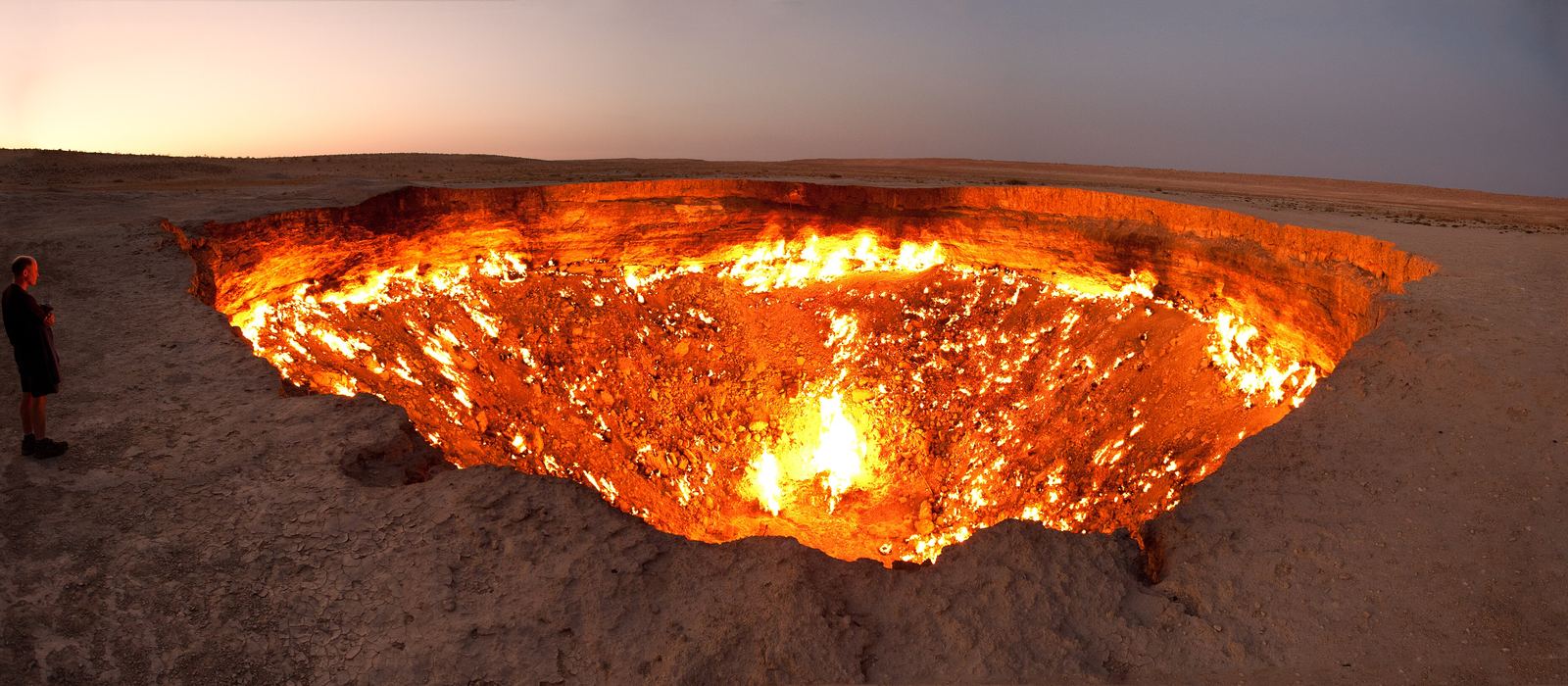
The Darvaza gas crater, the Door to Hell, is a collapsed natural-gas cavern burning for decades in the Karakum Desert, about 260 km north of Ashgabat. It is reached by a rough road from the Ashgabat–Dashoguz highway, which also passes Derweze and Yerbent, and two other craters, one of mud and one of water, are nearby. For anyone travelling with their own vehicle it means desert tracks and nights in yurts beside the crater. In 2025 the authorities said the fire had been reduced, so check its state before planning around it. Here are the local guides who work in the area and the trips that cross it.
4 local guides and 12 trips at the Darvaza crater on GuideMeet.
On the map
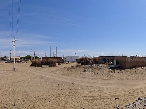 Ýerbent — Village. Village in the Karakum and the second-largest settlement on the road between Ashgabat and Dashoguz; single-storey houses stand beside yurts. 39.3132, 58.5960 · Google Maps
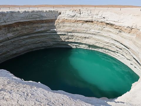 Water crater — Crater. Crater holding a pool of turquoise water, south of the village of Derweze. 40.0450, 58.4286 · Google Maps
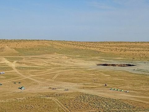 Derweze — Village. Village in the Karakum, about 260 km north of Ashgabat and served by the Ashgabat–Dashoguz highway; its name comes from the Persian for gateway. 40.0987, 58.3481 · Google Maps
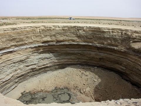 Mud crater — Crater. Crater with a muddy floor, between Derweze and the gas crater, marked on maps as the Mud crater. 40.1682, 58.4110 · Google Maps
- White dune with sulphur — Dunes. White sand dune with exposed sulphur next to the mud crater, marked on maps as an attraction. 40.1727, 58.4090 · Google Maps
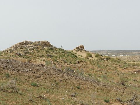 Old Derweze — Archaeological site. Site of the original Derweze, a town about 8 km north of today's village that was disbanded in 2004 and later destroyed. 40.1765, 58.4084 · Google Maps
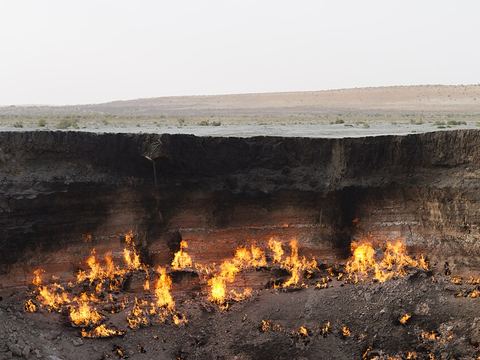 Darvaza gas crater — Crater. Collapsed natural-gas cavern 60–70 m across and about 30 m deep, burning for decades. In 2025 authorities said the fire had shrunk: check before going. 40.2525, 58.4396 · Google Maps
- Yurt camps by the crater — Camp. Yurts have been set up near the crater, at the end of a crude road without signs; the site is about a four-hour drive from Ashgabat. 40.2501, 58.4433 · Google Maps
Local guides at the Darvaza crater
- Garly Abdulla — Ashgabat, Turkmenistan · 4x4 car, 4x4 truck, camper / van, 4x4 van, offroad motorcycle, adventure motorcycle, bicycle / e-bike
- Miras Bazarov — Turkmenistan · 4x4 car
- Guvanch Annagulyyev — Turkmenistan
- Aya Jumanazarova — Ashgabat, Turkmenistan
Overland trips at the Darvaza crater
- 🇹🇲 TURKMENISTAN. 4 DAYS YOU WILL REMEMBER FOR A LONG TIME — 4 days · Turkmenistan
- 3-Day Turkmenistan Tour: From Farap border to Dashoguz border — 3 days · Turkmenistan
- 07 Days Turkmenistan Adventure Tour: Door to Hell, Canyon Hiking & Dinosaur Plateau — 8 days · Turkmenistan
- “Turkmenistan Adventure: Ashgabat & Darvaza” — 5 days · Turkmenistan
- 🏜️ Grand Canyons & Desert Fire: Garabogaz to Shavat 🇹🇲 — 6 days · Turkmenistan
- ✨ Silk Road Highlights: Farap to Khiva 🇹🇲 — 5 days · Turkmenistan
- Treasures of Turkmenistan: Shavat to Ashgabat — 5 days · Turkmenistan
- 2-Day Tour to Dashoguz, Kunya Urgench and Darvaza — 2 days · Turkmenistan
- 2-Days Tour through the Highlights of Ashgabat and Darvaza — 2 days · Turkmenistan
- 3-Day Tour of Turkmenistan(Dashoguz To Lebap Farap Border) — 3 days · Turkmenistan
- UNESCO Silkroad Journey — 4 days · Turkmenistan
- Journey to Darvaza "Gate of Hell" — 3 days · Turkmenistan
When to go
At Yerbent, in the middle of the Karakum, July highs average 39 °C and January lows average −4 °C; rain is scarce, about 119 mm a year. With hot summers and cold winters, spring and autumn are the easier seasons for desert driving.
Before you go
- All guides and trips in Turkmenistan
- Do you need a local guide in Turkmenistan?
- Is Turkmenistan safe to travel?
- Driving and local rules in Turkmenistan
Photo credits
Photos from Wikimedia Commons, under the licences shown.
- Darvaza Gas Crater: Tormod Sandtorv, CC BY-SA 2.0
- 1. Ýerbent: Bjørn Christian Tørrissen, CC BY-SA 4.0
- 2. Water crater: John Pavelka from Austin, TX, USA, CC BY 2.0
- 3. Derweze: Bjørn Christian Tørrissen, CC BY 4.0
- 4. Mud crater: flydime, CC BY 3.0
- 6. Old Derweze: ZhouKerim, CC BY-SA 3.0
- 7. Darvaza gas crater: Benjamin Goetzinger, CC BY-SA 4.0


.jpg)


