Overland region
Bwindi and Queen Elizabeth by 4x4: local guides and trips
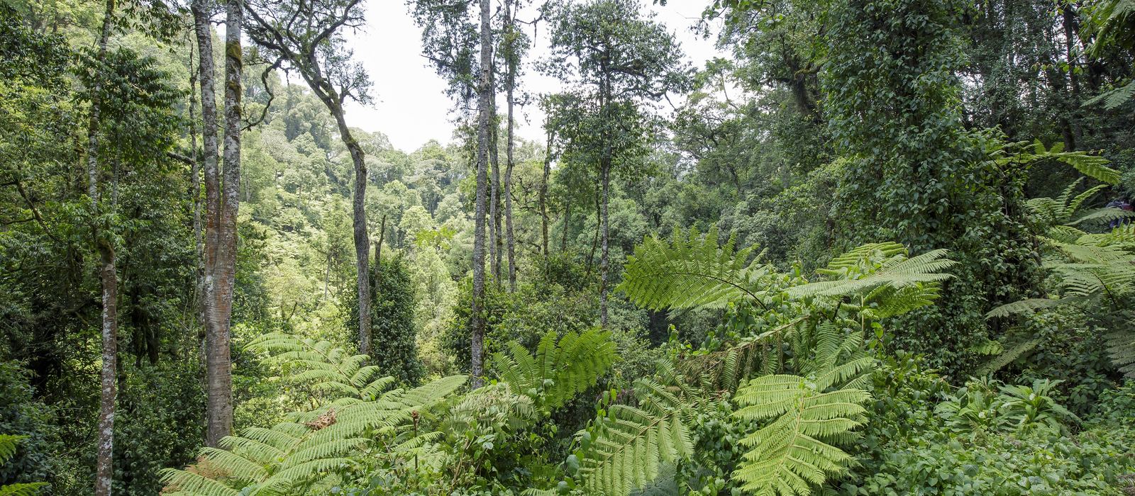
Bwindi Impenetrable National Park, a UNESCO World Heritage forest of 321 km² on the DR Congo border, is home to about half of the world's mountain gorillas, in four sectors: Buhoma, Ruhija, Rushaga and Nkuringo. To the south lie the volcanoes of Mgahinga and Lake Bunyonyi; to the north, Queen Elizabeth National Park runs from Ishasha to the Kazinga Channel, Mweya and the Katwe craters. For anyone travelling with their own vehicle it means hill roads between the sectors and rough tracks like the one along the Katwe crater rims. Here are the local guides who work in the area and the trips that cross it.
8 local guides and 13 trips in Bwindi and Queen Elizabeth on GuideMeet.
On the map
- Mgahinga Gorilla National Park — Park. Small park of 33.9 km² in the Virunga Mountains, with the volcanoes Muhabura, Gahinga and Sabyinyo; altitude runs from 2,227 to 4,127 m. It lies about 15 km by road south of Kisoro. -1.3694, 29.6403 · Google Maps
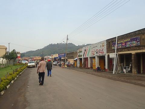 Kisoro — Town. Chief town of Kisoro District, about 15 km by road from Mgahinga. Lake Bunyonyi lies between Kisoro and Kabale, close to the border with Rwanda. -1.2850, 29.6850 · Google Maps
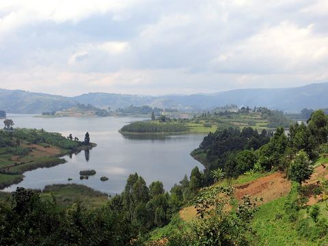 Lake Bunyonyi — Lake. Highland lake at about 1,973 m, 22 km long and up to 6 km wide, with 29 islands. Its name means 'place of many little birds'; Kabale is about 7 km to the east. -1.2833, 29.9167 · Google Maps
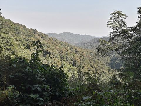 Bwindi Impenetrable National Park — Park. Forest of 321 km² on the border with DR Congo, a UNESCO World Heritage Site and home to about half of the world's mountain gorillas. Gorilla groups live in four sectors: Buhoma, Ruhija, Rushaga and Nkuringo. -1.0167, 29.6833 · Google Maps
- Nkuringo — Village. One of the four sectors of Bwindi where gorilla groups live, on the south-western side of the forest, near the border with DR Congo. -1.0790, 29.6265 · Google Maps
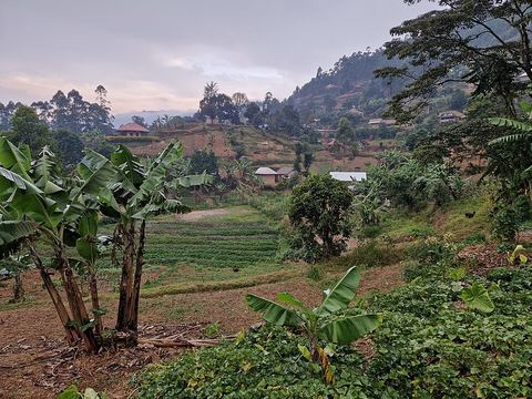 Rushaga — Village. One of the four sectors of Bwindi where gorilla groups live, on the southern side of the forest, with the village of Rushaga on the edge of the park. -1.1275, 29.6923 · Google Maps
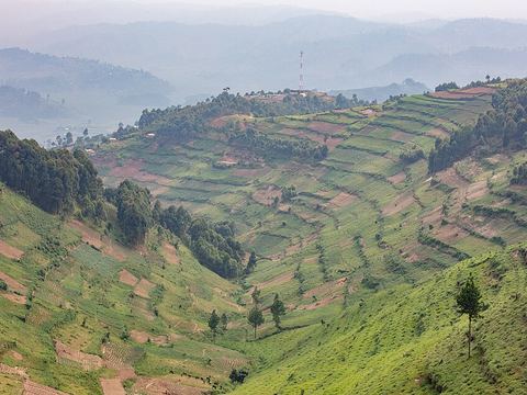 Ruhija — Village. One of the four sectors of Bwindi where gorilla groups live, on the eastern side of the forest. Pictured: the hills around Ruhija. -1.0406, 29.7768 · Google Maps
- Buhoma — Village. Village at the northern entrance of Bwindi, in Kanungu District. Organised gorilla tracking began here in 1993, and the Buhoma Community Rest Camp was one of the first facilities. -0.9661, 29.6140 · Google Maps
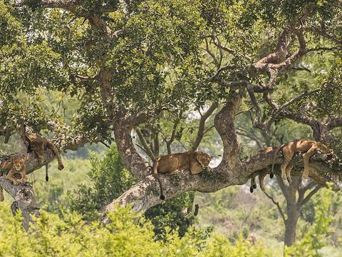 Ishasha — Park. Southern sector of Queen Elizabeth National Park, on the Ishasha River, which marks the border with DR Congo. The area is famous for its tree-climbing lions. Pictured: lions in a tree. -0.6139, 29.6653 · Google Maps
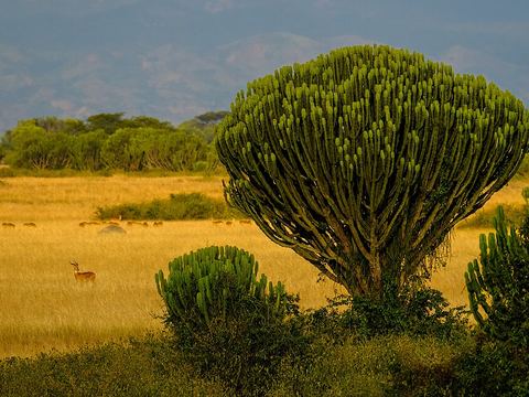 Queen Elizabeth National Park — Park. Park of about 1,978 km², founded in 1952 and renamed after a visit by Queen Elizabeth II two years later. Known for volcanic craters and crater lakes, and for elephants, buffalo, hippos and lions. -0.1372, 30.0411 · Google Maps
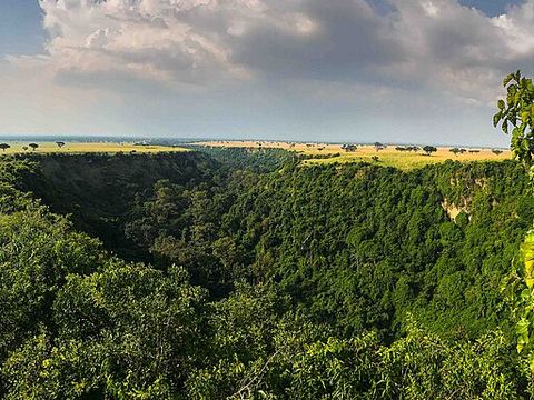 Kyambura Gorge — Gorge. Deep gorge cutting the savanna of the Kyambura reserve, east of the park's main area. Its thick riverine forest, the 'underground forest', is home to chimpanzees, and the gorge links to the Kazinga Channel. -0.1684, 30.0922 · Google Maps
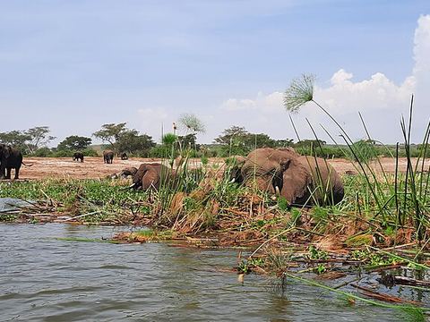 Kazinga Channel — River. Natural channel 32 km long linking Lake Edward and Lake George, with hippos and Nile crocodiles. At Katunguru a bridge joins the two parts of the park. Pictured: elephants feeding on the bank. -0.1405, 30.0204 · Google Maps
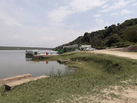 Mweya — Village. Where the Kazinga Channel joins Lake Edward: the park's headquarters and its most visited spot, with accommodation, an airstrip and access to the lake and the channel. Kasese is 55 km by road. -0.1903, 29.8997 · Google Maps
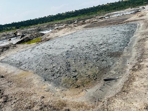 Lake Katwe — Lake. Salt lake in the Katwe explosion craters, north of Mweya. Salt has been made here for centuries and is still worked in ponds. A rough dirt track runs along several crater rims. -0.1333, 29.8667 · Google Maps
Local guides in Bwindi and Queen Elizabeth
- Dianah Legit Holidays — Entebbe, Uganda · 4x4 car, 4x4 van
- Mystery Gorilla Safaris — Kabale, Uganda · 4x4 car, 4x4 van
- Lambula Wild Adventures — Entebbe, Uganda · 4x4 car, 4x4 van
- Ndabahariye Joseph — Kisoro, Uganda · 4x4 car
- Moses Aine — Entebbe International Airport, Uganda · 4x4 car
- Lena Tours — Kampala, Uganda · 4x4 car, 4x4 van, bicycle / e-bike, camper / van
- Car Hire Africa - Drive Your Own Safari — Kampala, Uganda · 4x4 car, 4x4 truck, camper / van, 4x4 van, offroad motorcycle, adventure motorcycle, bicycle / e-bike
- SSEBUNYA ARAPHAT — Kampala, Uganda
Overland trips in Bwindi and Queen Elizabeth
- The Ultimate 21-Day Overland Expedition — 21 days · Uganda
- Pearl of Africa: 16-Day Uganda Wildlife Overland Expedition — 16 days · Uganda
- Uganda Overland Circuit: Wildlife, Forests and Scenic Landscapes — 12 days · Uganda
- Uganda Grand Safari: Murchison Falls to Bwindi — 10 days · Uganda
- Uganda Primate Tracking and Wildlife Overland Adventure — 6 days · Uganda
- Bwindi Gorillas and Queen Elizabeth Wildlife Overland Safari — 4 days · Uganda
- Bwindi Gorilla Trekking Overland Adventure — 3 days · Uganda
- Gorilla Safari Overland Journey: Kigali to Bwindi — 2 days · Uganda, Rwanda
- Uganda, Rwanda expedition — 11 days · Uganda
- 14 Uganda Self Drive Advventure — 16 days · Uganda, Rwanda
- 15 DAYS UGANDA SAFARI EXPERIENCE — 15 days · Uganda
- 3-Day Queen Elizabeth Wildlife & Kazinga Channel Safari – Uganda — 3 days · Uganda
- 15-Day Uganda Self Drive Safari Adventure | Explore Uganda with Car Hire Africa – Drive Your Own Safari — 15 days · Uganda
When to go
There are two rainy seasons, February to May and September to December; at Mgahinga the monthly average ranges from about 10 mm in July to about 250 mm in October. Plan the hill sectors for the drier months.
Before you go
- All guides and trips in Uganda
- Do you need a local guide in Uganda?
- Is Uganda safe to travel?
- Driving and local rules in Uganda
Photo credits
Photos from Wikimedia Commons, under the licences shown.
- Bwindi and Queen Elizabeth: Thomas Fuhrmann, CC BY-SA 4.0
- 2. Kisoro: Faintsmoke, CC BY-SA 4.0
- 3. Lake Bunyonyi: Carine06 from UK, CC BY-SA 2.0
- 4. Bwindi Impenetrable National Park: Josefito123, CC BY-SA 4.0
- 6. Rushaga: Hanay, CC BY-SA 3.0
- 7. Ruhija: Diego Delso, CC BY-SA 4.0
- 9. Ishasha: Charles J. Sharp, CC BY-SA 4.0
- 10. Queen Elizabeth National Park: Jingo Faizal, CC BY-SA 4.0
- 11. Kyambura Gorge: Jim Joel, CC BY-SA 4.0
- 12. Kazinga Channel: Jchambacha, CC BY-SA 4.0
- 13. Mweya: Josefito123, CC BY-SA 4.0
- 14. Lake Katwe: Sandra Aceng, CC BY-SA 4.0


.jpg)

.jpg)

.jpg)


