GuideMeet country page
Senegal – overland guides and trips
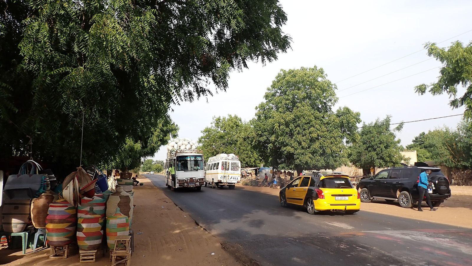
Overland Senegal follows its river and coast: Saint-Louis and the Djoudj, the Pink Lake of the Paris-Dakar, the Sine-Saloum Delta and Niokolo-Koba, by 4x4 and with local support.
Local overland guides and active trips in Senegal on GuideMeet.
As of November 2026: 11 local guides on GuideMeet operating in Senegal — 9 4x4, 5 motorcycle, 6 camper / van, 2 bicycle.
Local overland guides in Senegal
Aliou Fall
Casamance, Sénégal · adventure motorcycleI am Aliou Fall, a tour guide in Senegal in Casamance. We offer tours, excursions, and fishing...
 Sénégalib Tours
Saint-Louis, Sénégal · 4x4 carSénégalib’ Tours is a travel agency based in Saint-Louis, Senegal, specializing in supporting travelers in 4x4s, camper vans, vans, and motorcycles. We offer l...
 Modou sengo Excursions
Saly, Sénégal · 4x4 carMy name is Modou based in Senegal 🇸🇳. Local guide offering day trips or tailor-made tours.
Marcel Sene
Sénégal · 4x4 car, 4x4 truck, camper / van, 4x4 van, offroad motorcycle, adventure motorcycle, bicycle / e-bike🇸🇳🌴 MARCEL SENE – YOUR LOCAL GUIDE IN SENEGAL 🌍 Welcome to Senegal, the land of Teranga! ☀️ I am Marcel Sene, a passionate local guide, and I will accompan...
 Alou Quad
Dakar, Senegal · 4x4 car, 4x4 truck, 4x4 van, offroad motorcycle, adventure motorcycle, bicycle / e-bikeExcursions all over Senegal: Pink Lake, Bandia, Sine Saloum, Saint Louis, Loumpoul, Kayar, Gorée, Fathala and Somone. Rental of quad bikes, buggies, motocross...
 Sogui WADE
Sénégal · 4x4 vanHi , this is Sogui , am your Senegalese best English , Spanish,French and Italian travel . I offer tour around Senegal , Gambia and Guinea Bissau. Are you for...
 Bamba Ndiaye
Dakar, Sénégal · 4x4 car, camper / van, 4x4 van, 4x4 truckMy name is Bamba, I am a local tour guide. I love city and bush travel, meeting local inhabitants and also showing you the parks and reserves.
Kédougou Tourisme
Kédougou, Sénégal · 4x4 car, adventure motorcycle, 4x4 van, offroad motorcycle, camper / vanKédougou Tourisme, a local agency based in Kédougou, in eastern Senegal, has been organizing tailor-made tours in the Bassari-Bédik Country (UNESCO listed), th...
 Aries Moto Tours
Málaga, Spagna · offroad motorcycle, adventure motorcycleOur team is made up of professional motorcycle guides and instructors who have turned their passion into a way of life. Off-road riding, adventure and discover...
- Amadou Lamine Gueye · Dakar, Sénégal
- Amadou SARR · M'bour, Sénégal
Active trips in Senegal
- Circuit TERANGA☀️🏖️ de 8 jours et 7 nuits · 8 days
- 🇸🇳 Sénégal Authentique : 7 Jours d’Aventure, de Découverte et de Liberté sur les Routes Africaines · 7 days
- Découvert la casamance naturelle et ses réalités · 1 days
Past trips
Planning a trip in Senegal?
Browse local guides for Senegal and contact them directly. Or create your own trip and find travel companions.
Are you a local guide in Senegal?
Join GuideMeet and get discovered by overland travelers looking for local knowledge, 4x4 support and expedition expertise in Senegal.
Senegal for overland travelers
Senegal lies at the end of the Atlantic route that runs down from Morocco through Mauritania: the road between Nouakchott and Dakar crosses the Senegal River at Rosso. After the Sahara the landscape changes. River, delta, mangroves, salt pans and savanna take the place of the dunes, and driving becomes a question of roads, ferries, park tracks and the rainy season more than of sand.
Key destinations
Saint-Louis and the Senegal River
The island of Saint-Louis, a UNESCO World Heritage Site since 2000, sits in the Senegal River about 25 km from its mouth and is linked to the Langue de Barbarie by the Faidherbe Bridge. The Langue de Barbarie is a sand spit about 300 meters wide between the river and the ocean. In 2003 a 4-meter channel cut to limit flooding widened until it broke off the southern tip, and by 2020 the breach measured about 6 km: a GPS track from a few years ago may no longer match the coastline. Further north, on the riverbank, the Djoudj National Bird Sanctuary has been a UNESCO World Heritage Site since 1981.
Pink Lake
Lake Retba, about 35 km northeast of Dakar, is separated from the ocean by a ridge of dunes and was for many years the finish of the Paris-Dakar, until the rally moved to South America in 2009. Its pink color comes from an alga, Dunaliella salina, and is less visible in the rainy season, from July to October. On its shores salt is harvested by hand.
Sine-Saloum Delta
A UNESCO World Heritage Site since 2011, the Saloum Delta has more than 200 islands and islets, brackish channels, mangroves, dry forest and 218 shell mounds left by centuries of human presence. In a landscape made of islands and channels a vehicle only gets you so far and the rest is done by boat: a 4x4 itinerary here is built around where to leave it.
Niokolo-Koba
In the southeast, Niokolo-Koba National Park covers about 9,130 km² and is crossed by the upper Gambia River. It has been a UNESCO World Heritage Site since 1981 and in 2024 it came off the List of World Heritage in Danger, which it had joined in 2007. Here the park rules are driving rules: the 1976 internal regulations prohibit leaving the tracks and roads open to the public, driving between sunset and dawn except on the national road, stopping overnight outside authorized camps and hotels, and lighting fires outside authorized camps. Entering with a vehicle requires a "vehicle" permit.
Borders
From Mauritania you enter at Rosso, where you cross the Senegal River by ferry, or at the Diama dam, about 22 km north of Saint-Louis, which carries a road over the river. A bridge is under construction at Rosso: its handover, planned for the end of 2026, has been pushed back to 2027, as announced by the Mauritanian prime minister in January 2026.
The Gambia is a country of its own, with its own borders, and it cuts through Senegal along its river. Since 2019 the Senegambia Bridge, about 10 km south of Farafenni, has carried the Trans-Gambia Highway over the Gambia River, where there used to be a ferry with waits that could last days.
To the east and south, the Italian foreign ministry's Viaggiare Sicuri advice warns against the border areas with Mali and Guinea, and in particular against overland travel from Senegal into those two countries.
Permits and logistics
You need an international driving permit, on the 1949 Geneva or 1968 Vienna model, and third-party liability insurance is taken out at the border. With a carnet de passages, according to Viaggiare Sicuri, customs issues a pass for the vehicle (a "passavant de circulation") valid for 48 working hours, not renewable, which only serves to reach one of the offices in Dakar where the vehicle is registered and receives papers for a longer period. As an alternative to the carnet, the travelers' guide of the Directorate General of Customs provides for a pass issued by the customs office of entry for up to ten days, which can be extended at most twice by fifteen days. Check the conditions with Senegalese Customs (douanes.sn) before you leave.
Best time to go
The dry season is the one to choose. In the south it hardly ever rains from November to May; in Dakar the rains fall roughly from June to October, and in the north, along the Senegal River, mostly in August and September. From August to October flooding makes getting around difficult across the whole country, the capital included.
Safety
Because of the poor state of the road network and the lack of effective roadside emergency response, the Viaggiare Sicuri advice warns against traveling by car within the country; for those who still have to travel by road it recommends an off-road vehicle or an SUV. In Casamance, south of the Gambia, it reports mines in the area south of Ziguinchor and advises against secondary roads and tracks, especially near the borders, and recommends avoiding travel at night and traveling alone. Crime, documents and customs rules are covered in the Senegal safety sheet on GuideMeet.
Why a local guide matters
The same advice recommends relying on operators with proven experience rather than improvised guides. On GuideMeet, local guides and operators have a profile showing their vehicles and the trips they offer, and you contact them directly: you see who you are traveling with before you set off.
Bottom line
Senegal is not mainly a country of dunes like Mauritania: it is a country of river, delta and parks, where the difficulties are the roads, the rainy season, park rules and vehicle paperwork. For anyone arriving from Mauritania or starting from Dakar, guides who know the border crossings, customs and park tracks make the journey realistic.
Travelling with a local guide
Not sure whether you need a guide, or how to pick one you have never met? Travelling with a local guide covers when a guide is genuinely needed, what to check before leaving (permits, vehicle, emergency contacts) and how to agree price and exceptions.
Frequently asked questions
How do I find overland guides in Senegal on GuideMeet?
Browse local guides for Senegal on GuideMeet, compare their experience, vehicles and languages, and message them directly to plan routes, permits and border crossings. As of November 2026, there are 11 local guides on GuideMeet operating in Senegal (9 4x4, 5 motorcycle, 6 camper / van, 2 bicycle).
How much does it cost to contact a guide in Senegal?
Nothing — GuideMeet is free and takes no commission. You contact the guide directly on the platform and agree terms between yourselves, with no middleman.
Are you a local guide in Senegal?
Join GuideMeet and get discovered by overland travelers looking for local knowledge, 4x4 support and expedition expertise in Senegal.