Overland region
The Tadrart Rouge by 4x4: local guides and trips
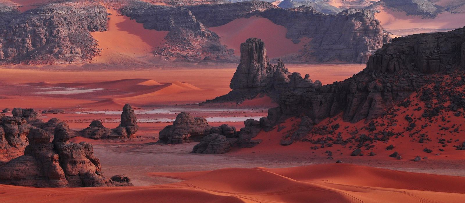
The Tadrart Rouge is a sandstone massif in south-eastern Algeria, 15 to 30 km wide and about 150 km long, the southern extension of the Libyan Tadrart Acacus. Its wadis run from west to east and end in dune fields that shade from red to yellow and white, among dark red rocks, natural arches, cirques and gueltas, with rock art from the Neolithic onwards. For anyone travelling with their own vehicle it means sand tracks between the dunes of Tin Merzouga, Ouan Zaouten and Moul N'Aga, and the wadis of In Djerane and Bouhadian. Here are the local guides who work in the area and the trips that cross it.
3 local guides and 4 trips in the Tadrart Rouge on GuideMeet.
On the map
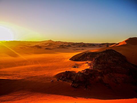 Tin Merzouga — Dunes. One of the dune fields where the wadis of the range end, with sand that shades from red to yellow and white against the dark red rock. 24.2978, 10.9279 · Google Maps
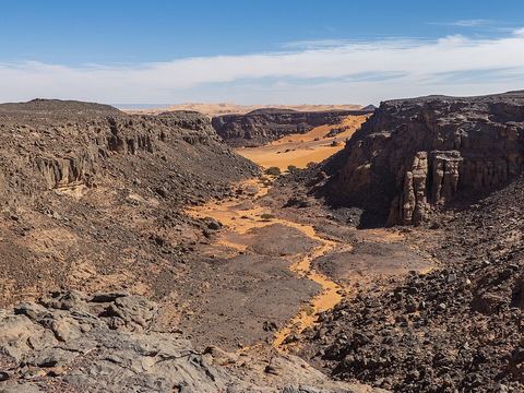 Bouhadian — Rock art. Wadi with rock paintings of figures in headdresses, a natural arch and a guelta, a natural rock pool. 24.2003, 10.8769 · Google Maps
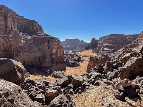 Tisseteka — Canyon. Rocky canyon with a guelta, a natural rock pool; the name is also spelled Tissatka. 24.0765, 10.8037 · Google Maps
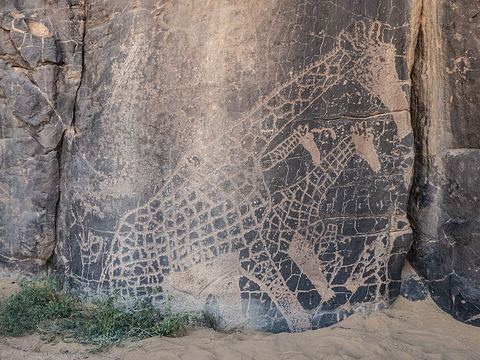 In Djerane — Rock art. The most important wadi of the Tadrart Rouge, also spelled In Djaren; its walls carry engravings and paintings, such as giraffes and cattle. Pictured: giraffe engravings. 24.0640, 10.8199 · Google Maps
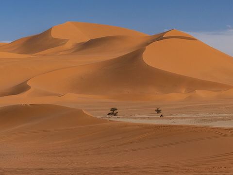 Ouan Zaouten — Dunes. One of the dune fields where the wadis of the range end; the name is also written Ouan Zaouatan. 24.1158, 10.9508 · Google Maps
- In Tehak — Dunes. Two dune fields, In Tehak North and South, each beside a dry lake bed (playa). 24.1296, 10.9655 · Google Maps
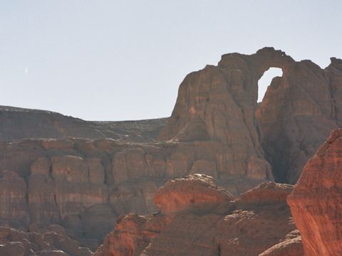 Tamezguida — Rock formation. The natural arch known as the Cathedral, one of the many arches that erosion has carved in the range. 24.0315, 10.9054 · Google Maps
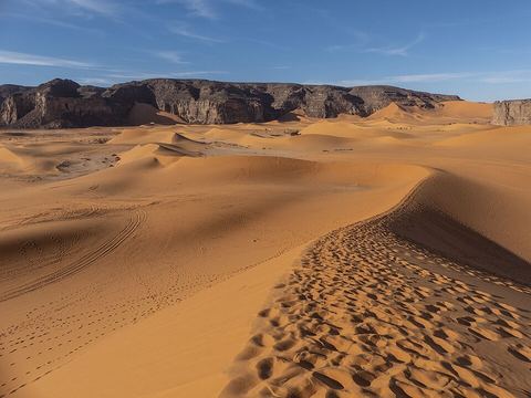 Moul N'Aga — Dunes. One of the dune fields where the wadis of the range end, with rock formations rising from the sand and a dry lake bed (playa) beside it. 24.0172, 10.9560 · Google Maps
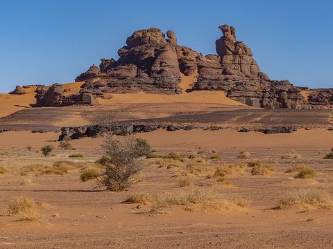 El Berdj — Rock formation. A rock cirque, a natural amphitheatre carved by erosion; cattle are painted and engraved on its walls, and an arch stands nearby. 23.9940, 10.9430 · Google Maps
Local guides in the Tadrart Rouge
- MAURIZIO TURCO — Roma, Italia · 4x4 car, 4x4 truck, 4x4 van, offroad motorcycle, adventure motorcycle, bicycle / e-bike
- La Route du Tassili N’azjjer Voyages — Djanet, Algérie · 4x4 car, 4x4 truck, offroad motorcycle, adventure motorcycle, camper / van
- Desert Magic tours — Djanet, Algeria · 4x4 car, 4x4 truck, adventure motorcycle, offroad motorcycle, camper / van
Overland trips in the Tadrart Rouge
- DISCOVER DJANET & THE MAGIC OF THE ALGERIAN SAHARA — 10 days · Algeria
- ALGERIA 4X4 2026 - Terra Tuareg — 17 days · Tunisia, Algeria
- Tadrart 2027 new year — 8 days · Algeria
Trips already run here
- Tadrart rouge — 6 days · Algeria
When to go
Djanet, the gateway town, has very hot summers and mild winters and only about 15 mm of rain a year, so the cooler months are the comfortable ones for the dunes.
Before you go
- All guides and trips in Algeria
- Do you need a local guide in Algeria?
- Is Algeria safe to travel?
- Driving and local rules in Algeria
Photo credits
Photos from Wikimedia Commons, under the licences shown.
- Tadrart Rouge: gouadjelia issam, CC BY-SA 4.0
- 1. Tin Merzouga: Salim Daouadji, CC BY-SA 4.0
- 2. Bouhadian: Camille Gillet, CC BY-SA 4.0
- 3. Tisseteka: Camille Gillet, CC BY-SA 4.0
- 4. In Djerane: Camille Gillet, CC BY-SA 4.0
- 5. Ouan Zaouten: Camille Gillet, CC BY-SA 4.0
- 7. Tamezguida: Josep M. Gracia, CC BY-SA 4.0
- 8. Moul N'Aga: Naetoru, CC BY-SA 4.0
- 9. El Berdj: Camille Gillet, CC BY-SA 4.0


