Overland region
Skeleton Coast, Kaokoland and Damaraland by 4x4: local guides and trips
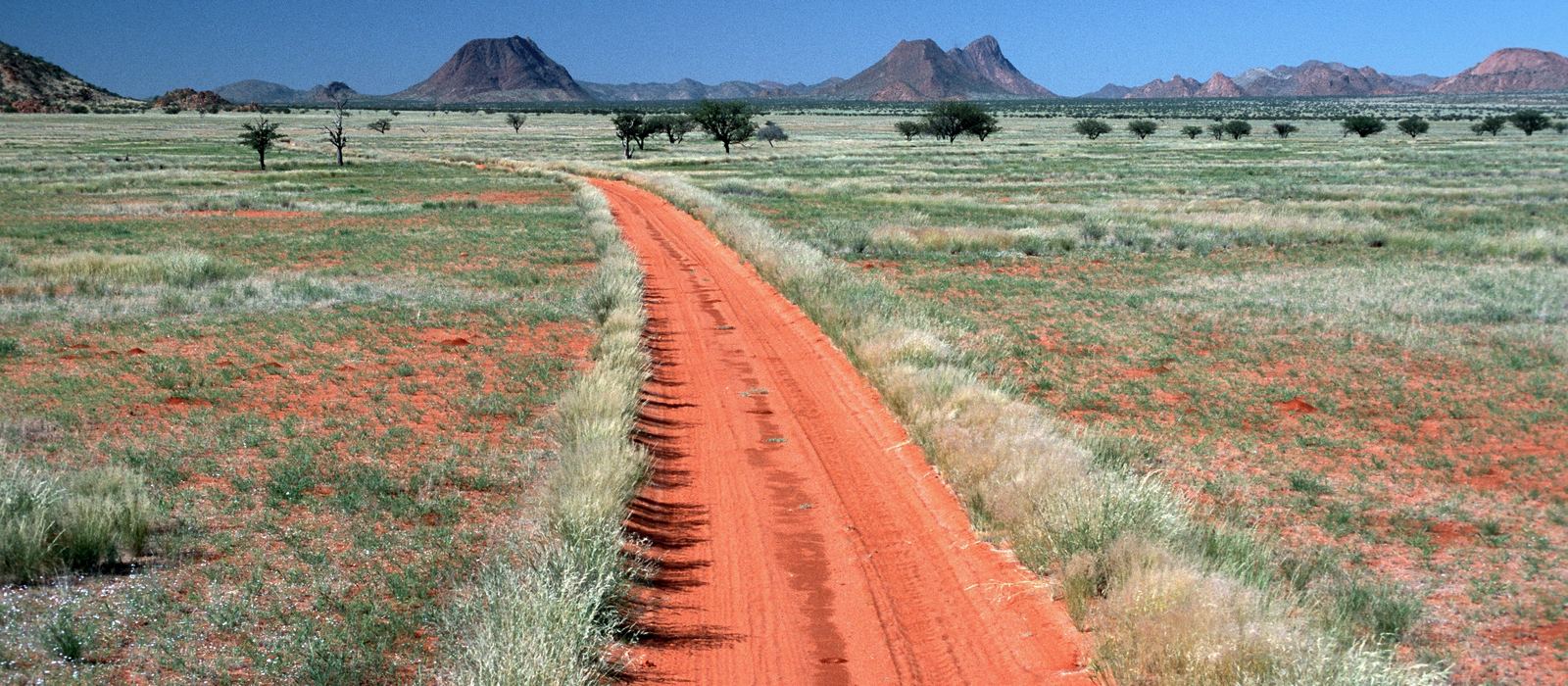
Kaokoland, Damaraland and the Skeleton Coast make up the remote north-west of Namibia, from the Kunene River on the Angolan border down to Cape Cross. The Skeleton Coast National Park follows the foggy Atlantic shore, while inland dry riverbeds like the Hoarusib and the Hoanib cut through mountains and plains; further south come Palmwag, the Brandberg and Twyfelfontein. For anyone travelling with their own vehicle it means sand and rock tracks, riverbeds and passes like Van Zyl's, in one of the least populated parts of Namibia. Here are the local guides who work in the area and the trips that cross it.
3 local guides and 3 trips on the Skeleton Coast, in Kaokoland and Damaraland on GuideMeet.
On the map
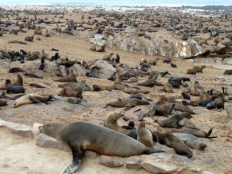 Cape Cross — Coast. Headland with a reserve for Cape fur seals, one of the largest colonies in the world. Diogo Cão raised a Portuguese cross here in the 1480s; two replicas stand on the cape. Pictured: the seal colony. -21.7728, 13.9508 · Google Maps
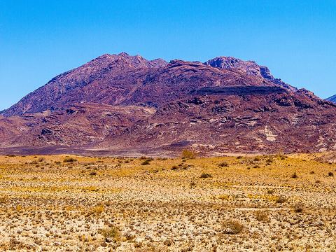 Brandberg — Peak. Namibia's highest mountain: the Königstein reaches 2,573 m. The White Lady rock painting is in the Tsisab ravine at its foot, and the nearest settlement is Uis, about 30 km away. -21.1258, 14.5487 · Google Maps
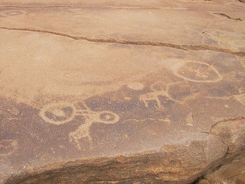 Twyfelfontein — Rock art. Valley with a spring and one of the largest concentrations of rock engravings in Africa: at least 2,500 carved figures. It became Namibia's first UNESCO World Heritage Site in 2007. -20.5956, 14.3726 · Google Maps
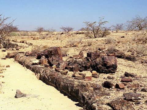 Khorixas — Town. Town of about 9,000 people and former capital of the Damaraland homeland, near the Petrified Forest. The Twyfelfontein valley can be reached from here. Pictured: petrified wood. -20.3667, 14.9667 · Google Maps
- Torra Bay — Camp. Angling camp inside the Skeleton Coast National Park, reached from Swakopmund by the C34 or from Khorixas by the C39. It has a campsite, a shop and fuel, and is open only in December and January. -20.3192, 13.2397 · Google Maps
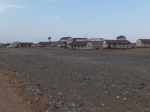 Terrace Bay — Camp. Fishing camp on the Skeleton Coast, once a diamond-mining base: the mine worked from 1969 to 1972. Möwe Bay is about 70 km to the north. -19.9877, 13.0325 · Google Maps
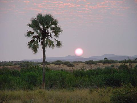 Palmwag — Oasis. Oasis on the Uniab River and a tourism concession of 400,000 hectares in north-western Damaraland, with lions, elephants, Angolan giraffes and black rhinos. It sits on the Red Line veterinary fence. -19.8844, 13.9480 · Google Maps
- Möwe Bay — Coast. Bay and settlement 10 km north of the Hoanib mouth, the unofficial border between Damaraland and Kaokoland, and the administrative seat of the Skeleton Coast National Park. -19.3729, 12.7089 · Google Maps
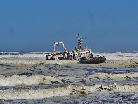 Skeleton Coast National Park — Park. National park on Namibia's north-west coast, established in 1971, 16,845 km², with a shore dotted with shipwrecks. Its northern half is a designated wilderness area, closed to vehicles and reached by fly-in safari. -19.1900, 12.7200 · Google Maps
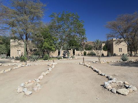 Sesfontein — Village. Settlement named for its six springs, with Fort Sesfontein, built in 1896 as a German police post and rebuilt in the 1990s to host visitors. Opuwo is 150 km away. -19.1253, 13.6167 · Google Maps
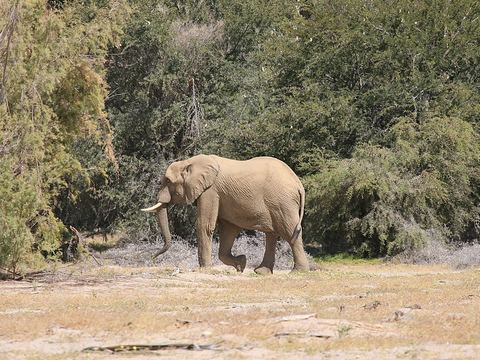 Purros — Village. Small settlement in Kaokoland on the Hoarusib, an ephemeral river whose dry bed is one of those where the desert elephants roam. Pictured: a desert elephant in the canyon. -18.7722, 12.9519 · Google Maps
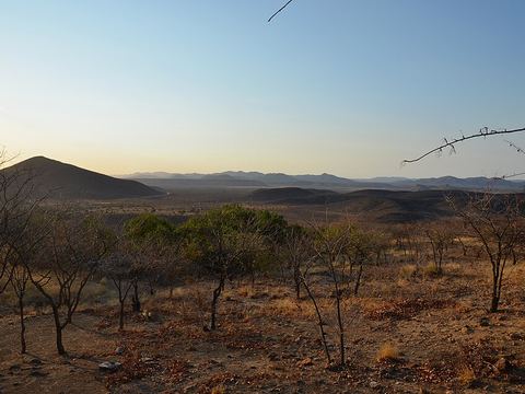 Opuwo — Town. Capital of the Kunene Region and its commercial hub, at the junction of the C41 and C43, about 720 km north-north-west of Windhoek. -18.0556, 13.8406 · Google Maps
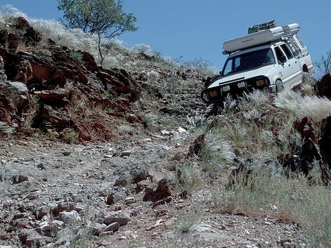 Van Zyl's Pass — Mountain pass. Mountain pass in the Otjihipa Mountains, regarded as the most demanding pass for vehicles in Namibia. It was built by hand in the early 1960s; the D3703 goes down it from Okangwati. -17.6392, 12.7082 · Google Maps
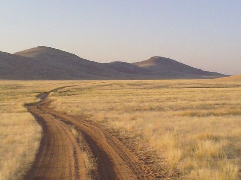 Hartmann Valley — Valley. Valley west of the Hartmann Mountains, at the edge of the Skeleton Coast; the Marienfluss valley lies to their east. From Opuwo it is reached over Van Zyl's Pass. -17.3369, 12.1890 · Google Maps
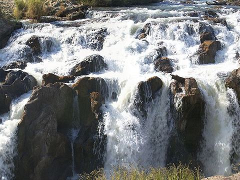 Epupa Falls — Waterfall. Waterfalls of the Kunene on the Angolan border: the river, about 0.5 km wide, drops over 1.5 km, with a biggest single drop of 37 m. A 4x4 is recommended from Opuwo. -17.0016, 13.2447 · Google Maps
Local guides on the Skeleton Coast, in Kaokoland and Damaraland
- MAURIZIO TURCO — Roma, Italia · 4x4 car, 4x4 truck, 4x4 van, offroad motorcycle, adventure motorcycle, bicycle / e-bike
- Charel Schreuder — Cape Town, South Africa · 4x4 car, camper / van, 4x4 van, 4x4 truck
- ACTIVE 4X4 ADVENTURES — United Kingdom · 4x4 car, 4x4 truck, 4x4 van
Overland trips on the Skeleton Coast, in Kaokoland and Damaraland
- Namibia Fly Drive 4x4 - Mille colori dell'Africa — 15 days · Namibia
- Namibia 4X4 Wildlife Safari — 15 days · Namibia
- Namibia Desert Crossing — 10 days · Namibia
When to go
Along the coast fog is frequent and rainfall rarely exceeds 10 mm a year. Inland, rivers such as the Hoarusib carry water only now and then, in the rainy season from November to February or March, when the dry riverbeds can come down in flood.
Before you go
- All guides and trips in Namibia
- Do you need a local guide in Namibia?
- Is Namibia safe to travel?
- Driving and local rules in Namibia
Photo credits
Photos from Wikimedia Commons, under the licences shown.
- Skeleton Coast, Kaokoland and Damaraland: Hans Stieglitz, CC BY-SA 3.0
- 1. Cape Cross: Willyman, CC BY-SA 4.0
- 2. Brandberg: Angliers, CC BY-SA 4.0
- 3. Twyfelfontein: Mike from Vancouver, Canada, CC BY 2.0
- 4. Khorixas: Joaquín Romero Redondo, CC BY-SA 4.0
- 6. Terrace Bay: Ian Cochrane from Melbourne, Australia, CC BY 2.0
- 7. Palmwag: eftejo, CC BY 3.0
- 9. Skeleton Coast National Park: Zairon, CC BY-SA 4.0
- 10. Sesfontein: Martin Cígler, CC BY-SA 3.0
- 11. Purros: Engelsberger, CC BY-SA 3.0
- 12. Opuwo: Pavel Špindler, CC BY 3.0
- 13. Van Zyl's Pass: Hans Stieglitz, CC BY-SA 3.0
- 14. Hartmann Valley: whatleydude, CC BY 2.0
- 15. Epupa Falls: Hans Hillewaert, CC BY-SA 3.0


.JPG)

.jpg)
.jpg)


.jpg)