Overland region
Kenya's Rift Valley lakes by 4x4: local guides and trips
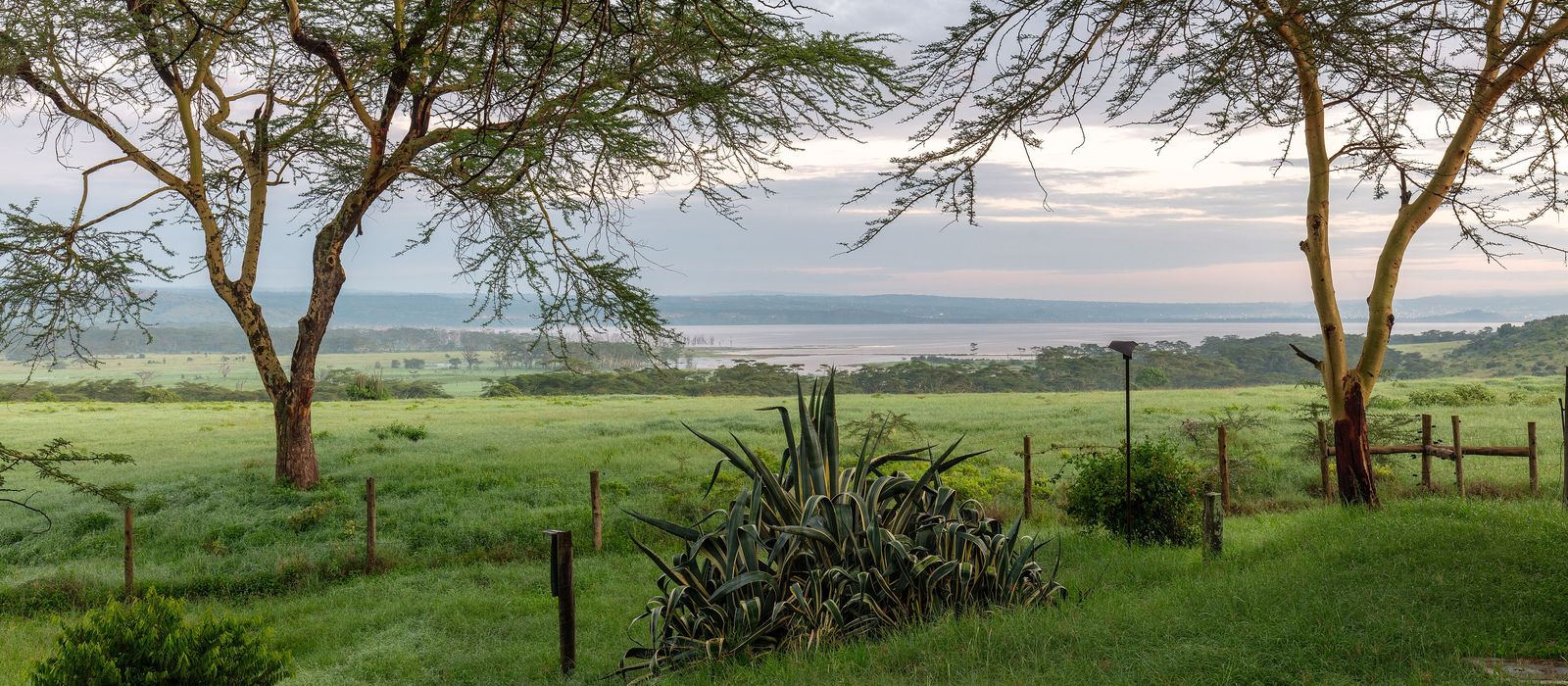
North-west of Nairobi, along the A104, the floor of Kenya's Rift Valley holds a chain of lakes: Lake Naivasha, fresh water with hippos and Crescent Island, then Elementaita and Nakuru, two of the three lakes of the Kenya Lake System, a UNESCO World Heritage site since 2011. Around them rise Hell's Gate, Mount Longonot and the Menengai crater above Nakuru. For anyone travelling with their own vehicle it means Naivasha about 90 km from Nairobi and Nakuru about 160 km, Hell's Gate with hiking and cycling trails, and Lake Nakuru National Park entered by the Main, Lanet or Nderit gates, open from 6am to 6pm. Here are the local guides who work in the area and the trips that cross it.
9 local guides and 17 trips around the Rift Valley lakes on GuideMeet.
On the map
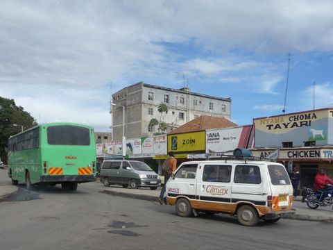 Naivasha — Town. Town in Nakuru County on the shore of Lake Naivasha, on the A104 Nairobi–Nakuru highway, about 90 km by road north-west of Nairobi. Agriculture, especially floriculture, is its main industry. -0.7167, 36.4333 · Google Maps
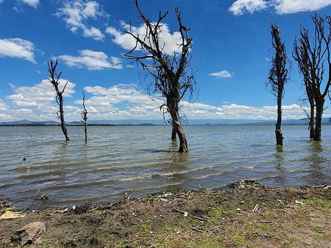 Lake Naivasha — Lake. Freshwater lake with an average depth of 6 m and up to 30 m at Crescent Island. It has more than 400 bird species and a sizeable hippo population, and has been a Ramsar site since 1995. Pictured: the shore seen from a campsite. -0.7685, 36.3506 · Google Maps
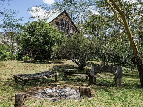 Crescent Island — Island. Island on the eastern side of Lake Naivasha, mapped as the Crescent Island Wildlife Sanctuary; the lake reaches its greatest depth, 30 m, beside it. A boat trip on the lake can be combined with a transfer to the island. -0.7770, 36.4087 · Google Maps
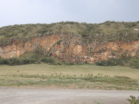 Hell's Gate National Park — Park. Park of about 68 km² south of Lake Naivasha, gazetted in 1984, with red cliffs, gorges, the extinct Olkaria and Hobley's volcanoes and the Olkaria geothermal power stations. KWS lists hiking and cycling trails, rock climbing and campsites; the entrance is Elsa Gate. -0.9158, 36.3133 · Google Maps
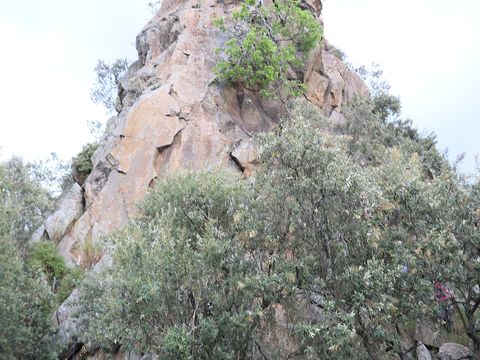 Fischer's Tower — Rock formation. One of the two volcanic plugs in the Hell's Gate gorge, near the park entrance; the other is Central Tower. KWS lists it as popular for rock climbing. The explorers Gustav Fischer and Joseph Thomson named Hell's Gate in 1883. -0.8595, 36.3625 · Google Maps
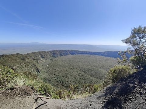 Mount Longonot — Peak. Volcano of 2,776 m south-east of Lake Naivasha, with a 1.8 km summit crater inside a larger 8 x 12 km caldera; it is thought to have last erupted in the 1860s. The national park around it, about 52 km², was gazetted in 1983. -0.9153, 36.4569 · Google Maps
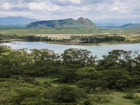 Lake Elementaita — Lake. Soda lake of 18 km² at 1,670 m, between Naivasha and Nakuru, a Ramsar site since 2005 and part of the Kenya Lake System, with a breeding colony of great white pelicans. Soysambu ranch covers two-thirds of its shore, on the western side, and the Kekopey hot springs lie at the southern end. -0.4500, 36.2500 · Google Maps
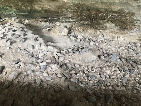 Kariandusi — Archaeological site. Early Stone Age site on Lake Elementaita, dated to about 1 million years ago, where Louis Leakey found Acheulean handaxes, mostly of obsidian, in 1928. The National Museums of Kenya run a museum beside it. Pictured: tools at the excavation. -0.4566, 36.2834 · Google Maps
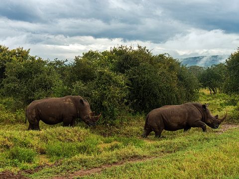 Lake Nakuru National Park — Park. Park of 188 km², 156 km north-west of Nairobi on the A104, entered by the Main Gate, 4 km from Nakuru, or by Lanet and Nderit gates. In 1987 it became Kenya's first government-run rhino sanctuary, with black and white rhinos, and it has about 450 bird species. -0.3667, 36.0833 · Google Maps
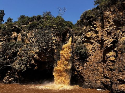 Makalia Falls — Waterfall. Waterfall in the southern part of Lake Nakuru National Park, listed by KWS among the park's attractions together with its viewpoints and picnic sites. -0.4921, 36.0805 · Google Maps
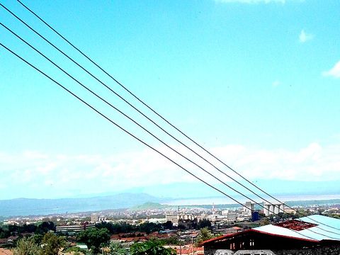 Nakuru — Town. Capital of Nakuru County and a city since December 2021, with 570,674 urban residents in the 2019 census. It lies at 1,850 m, about 160 km from Nairobi on the Nairobi–Nakuru highway, with Lake Nakuru on its southern edge. -0.3000, 36.0667 · Google Maps
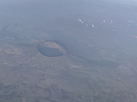 Menengai Crater — Crater. Shield volcano 10 km north of Nakuru, with a 12 x 8 km caldera formed about 8,000 years ago and a floor covered by later lava flows. The Geothermal Development Company has a geothermal power project there. -0.2000, 36.0700 · Google Maps
Local guides around the Rift Valley lakes
Serval Tours
Nairobi, Kenya · 4x4 car Denis Galabuzi
Kampala, Uganda · bicycle / e-bike, 4x4 car, 4x4 van Bienvenido Safaris
Nairobi, Kenya · 4x4 van Emmanuel Ndeleva
Nairobi, Kenya · 4x4 car George Muriungi
Nairobi, Kenya · 4x4 car, bicycle / e-bike Centric Safaris
Nairobi, Kenya · 4x4 car, 4x4 van, 4x4 truck Nancy Yogo
Nairobi, Kenya · 4x4 truck- Back of Africa Adventure Limited
Nairobi, Kenya · 4x4 car - Robert Murigi
Nairobi, Kenya · 4x4 car, 4x4 truck, 4x4 van
Kenya: guides by vehicle
Overland trips around the Rift Valley lakes
- THE GRAND 7-DAY WILDLAND EXPEDITION: KENYA’S TRIPLE CROWN — 7 days · Kenya
- 8 Days Kenya Budget Safari: Suggested Itinerary and Costs — 8 days · Kenya
- 14 Days Amboseli, Naivasha, Samburu, Meru, Sweetwaters, Aberdare, Nakuru and Masai Mara Private… — 14 days · Kenya
- 13 Days Masai mara/ lake nakuru/ samburu/ Aberdare/ Lake Naivasha/ Amboseli/Tsavo East Mombasa $2850 — 13 days · Kenya
- 9 Days Amboseli, Naivasha, Samburu, Nakuru and Masai Mara Private Safari — 9 days · Kenya
- 11 Days Amboseli, Naivasha, Samburu, Sweetwaters, Nakuru and Masai Mara Private Safari — 11 days · Kenya
- 10 Days Kenya – Tanzania Budget Safari $1960 — 10 days · Kenya, Tanzania
- 5 Days Masai Mara, Nakuru Naivasha Safari $430 — 5 days · Kenya
- Rift Valley Lakes & Masai Mara Wildlife Safari — 6 days · Kenya
- 6 Days Masai Mara, Lake Nakuru and Amboseli Kenya budget Safari $535 — 6 days · Kenya
- 2-Day Lake Naivasha and Lake Nakuru — 2 days · Kenya
- 6 days Mara Nakuru Amboseli Group safari — 6 days · Kenya
- 7-Day Masai Mara Nakuru Hell's Gate Naivasha Amboseli4X4 $985 pp (USD) — 7 days · Kenya
- 5 Days Sweetwaters, Lake Nakuru & Masai Mara Safari — 5 days · Kenya
- 14 Days Overland Kenya and Tanzania safari — 14 days · Kenya
- 4 days safari. Nairobi - Maasai Mara – Nakuru - Nairobi. — 4 days · Kenya
- 11 DAYS MASAI MARA WILDBEEST MIGRATION — 12 days · Kenya
When to go
Kenya's rainy seasons run from March to May and from October to December. At Nakuru rain is spread through the year: about 963 mm on average, from 29 mm in January, the driest month, to 141 mm in April, the wettest, and July and August also get over 90 mm.
Before you go
- All guides and trips in Kenya
- Do you need a local guide in Kenya?
- Is Kenya safe to travel?
- Driving and local rules in Kenya
Photo credits
Author and licence (or permission) for each photo.
- Rift Valley lakes: Diego Delso, CC BY-SA 4.0
- 1. Naivasha: Rotsee2, CC BY-SA 3.0
- 2. Lake Naivasha: Kenenock, CC BY-SA 4.0
- 3. Crescent Island: Nina R from Africa, CC BY 2.0
- 4. Hell's Gate National Park: Shadychiri, CC BY 4.0
- 5. Fischer's Tower: Shadychiri, CC BY 4.0
- 6. Mount Longonot: Baldfatchris, CC BY-SA 4.0
- 7. Lake Elementaita: Ninara, CC BY 2.0
- 8. Kariandusi: Xmd5a, CC BY-SA 4.0
- 9. Lake Nakuru National Park: Daniel Case, CC BY-SA 4.0
- 10. Makalia Falls: Letherian3, CC BY-SA 4.0
- 11. Nakuru: SuSanA Secretariat, CC BY 2.0
- 12. Menengai Crater: Mkenyampoa, CC BY-SA 4.0


