Overland region
Makgadikgadi and the Central Kalahari by 4x4: local guides and trips
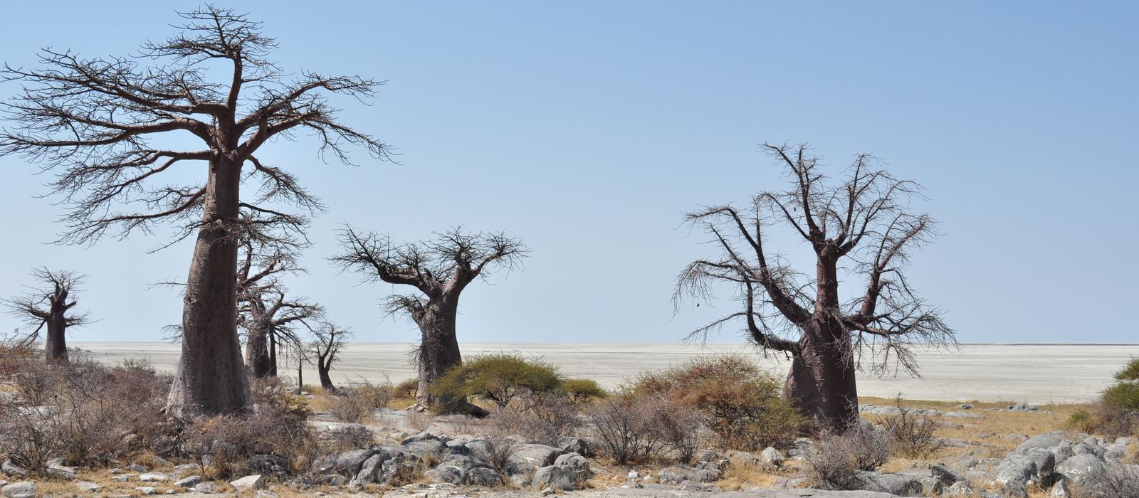
Makgadikgadi is one of the largest salt flats in the world, what remains of an ancient lake: a mosaic of pans, among them Ntwetwe, Sua and Nxai, with the granite island of Kubu and the baobabs of Nxai Pan. To the south-west the Central Kalahari Game Reserve, established in 1961, covers 52,800 km² of flat bush country with fossil river valleys and salt pans, Deception Valley among them. For anyone travelling with their own vehicle it means sandy tracks across the pans and into the reserve, with Nata and Gweta on the main road as the gateways. Here are the local guides who work in the area and the trips that cross it.
7 local guides and 6 trips in Makgadikgadi and the Central Kalahari on GuideMeet.
On the map
- Nata — Village. Village on the Nata River at the crossroads of the routes to Maun and Kasane, with services for travellers. In the rainy season the river carries its water to the pans. -20.2106, 26.1806 · Google Maps
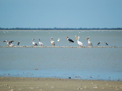 Nata Bird Sanctuary — Reserve. Community-managed sanctuary of 230 km² at the edge of Sua Pan. Flamingos arrive after the rains, and a raised wooden platform gives a view over the pan. -20.3174, 26.2522 · Google Maps
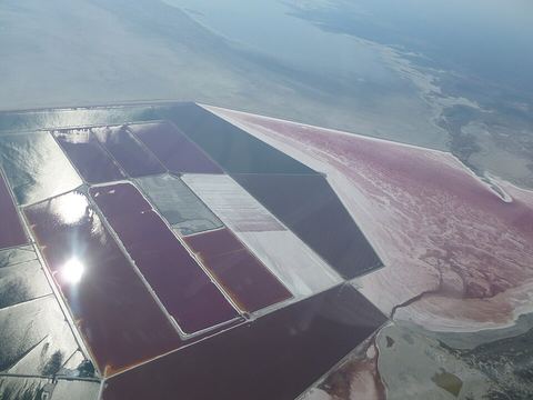 Sua Pan — Salt pan. Also written Sowa Pan: one of the three big pans of Makgadikgadi and the lowest point of the basin, at 890 m. Soda ash is mined on the pan, near the village of Sowa. -20.7500, 25.9500 · Google Maps
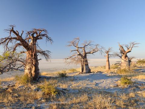 Kubu Island — Island. Granite island in the south-west of Sua Pan, a national monument and a sacred site, with baobabs and a basic campsite run for the local community. Reached by 4x4. -20.8930, 25.8190 · Google Maps
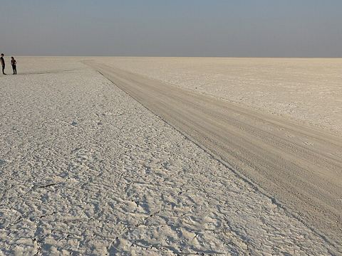 Ntwetwe Pan — Salt pan. One of Makgadikgadi's three big pans: a dry salty crust for most of the year, a seasonal lake in the rains. David Livingstone first described it to Europeans. -20.6500, 25.2200 · Google Maps
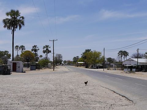 Gweta — Village. Small village about 205 km from Maun and 100 km from Nata, generally seen as the gateway to the Makgadikgadi Pans. Its name recalls the croaking of bullfrogs. -20.1833, 25.2333 · Google Maps
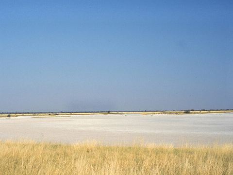 Nxai Pan — Park. National park just north of the Maun–Nata road, around a fossil lake bed of about 40 km². Roads can be difficult after heavy rain; the dry season, May to September, is easier. -20.0417, 24.7689 · Google Maps
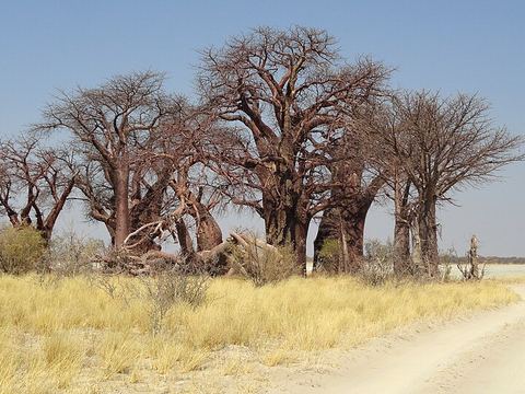 Baines' Baobabs — Viewpoint. A cluster of baobabs thousands of years old in Nxai Pan National Park, named after the 19th-century British artist Thomas Baines, who painted them. -20.1129, 24.7701 · Google Maps
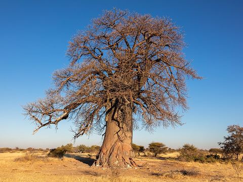 Makgadikgadi Pans National Park — Park. National park that adjoins Nxai Pan National Park to the south, in the wider Makgadikgadi pans landscape. Pictured: a baobab on its plains. -20.5108, 24.8106 · Google Maps
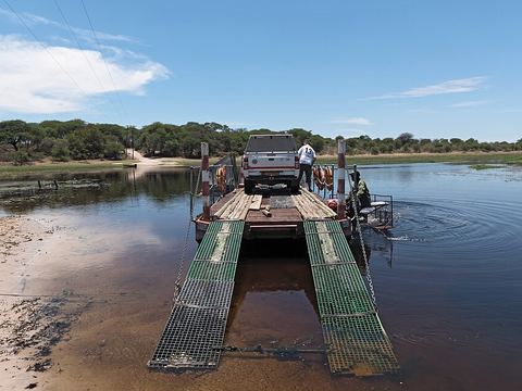 Boteti River — River. River that brings water from the Okavango towards Ntwetwe Pan, passing Khumaga and Rakops. In the dry season it draws wildlife, but its lower reaches can run dry. -21.2711, 24.7949 · Google Maps
- Rakops — Village. Village on the Boteti River south-west of the Makgadikgadi Pan, also known as Tsienyane. The Central Kalahari Game Reserve lies to the south-west. -21.0369, 24.4092 · Google Maps
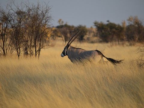 Central Kalahari Game Reserve — Reserve. Established in 1961, 52,800 km² of flat bush country, one of the largest game reserves in the world. Four fossil rivers cross it, and many valleys hold salt pans. -21.8895, 23.7565 · Google Maps
- Deception Valley — Valley. One of the reserve's four fossil river valleys, which began to form around 16,000 years ago. The pin marks Deception Pan. -21.5079, 23.8328 · Google Maps
- Piper Pan — Salt pan. A pan in the Central Kalahari Game Reserve, where the valleys of the fossil rivers are dotted with salt pans. -21.7749, 23.2245 · Google Maps
Local guides in Makgadikgadi and the Central Kalahari
- JACQ TRAVEL AGENCY — Maun, Botswana · 4x4 car, 4x4 van, adventure motorcycle
- ACTIVE 4X4 ADVENTURES — United Kingdom · 4x4 car, 4x4 truck, 4x4 van
- Ultimate Adventures — Pretoria, South Africa · 4x4 truck, 4x4 van, 4x4 car
- Casper Swarts — Cape Town, South Africa · 4x4 car
- Olefile Kopang — Maun Botswana, Botswana
- Letlhogile Lets Ngoma — Maun, Botswana
- Marvelous Mobile Safari — Maun, Botswana
Overland trips in Makgadikgadi and the Central Kalahari
- RIDE ON THE WILD SIDE | BOTSWANA — 6 days · Botswana
- Cape Town to Victoria Falls — 21-Day Self-Drive Holiday — 21 days · South Africa, Botswana, Zimbabwe
- Botswana 4X4 Wildlife Safari — 15 days · Botswana
- Nxai Pans Experience- Full Day Trip — 1 days · Botswana
- Makgadikgadi Game Drive- Full Day Adventure — 1 days · Botswana
Trips already run here
- Okavango Delta Adventure Sept 2026 — 12 days · Botswana, South Africa
When to go
May to September, the dry season, is the easiest time to travel. In the rainy months, from November to April, the pans can fill with water and heavy rain can make roads difficult, especially on black cotton soil.
Before you go
- All guides and trips in Botswana
- Do you need a local guide in Botswana?
- Is Botswana safe to travel?
- Driving and local rules in Botswana
Photo credits
Photos from Wikimedia Commons, under the licences shown.
- Makgadikgadi and the Central Kalahari: abi.bhattachan, CC BY 2.0
- 2. Nata Bird Sanctuary: Joachim Huber from Switzerland, CC BY-SA 2.0
- 3. Sua Pan: ~ souTH AFRica ~, CC BY 3.0
- 4. Kubu Island: Stefan Huchler, CC BY-SA 3.0
- 5. Ntwetwe Pan: Fabio Achilli from Milano, Italy, CC BY 2.0
- 6. Gweta: Erdkröte, CC BY-SA 3.0
- 7. Nxai Pan: Ralf Ellerich, CC BY-SA 3.0
- 8. Baines' Baobabs: Fabio Achilli from Milano, Italy, CC BY 2.0
- 9. Makgadikgadi Pans National Park: Diego Delso, CC BY-SA 4.0
- 10. Boteti River: EinfachFrankfurt1955, CC BY-SA 4.0
- 12. Central Kalahari Game Reserve: Benjamin Hollis from Seattle, WA, USA, CC BY 2.0

.jpg)
_altitude._-_panoramio.jpg)

.jpg)


.jpg)
,_parque_nacional_Makgadikgadi_Pans,_Botsuana,_2018-07-30,_DD_02.jpg)

.jpg)