Overland region
Kruger National Park by 4x4: local guides and trips
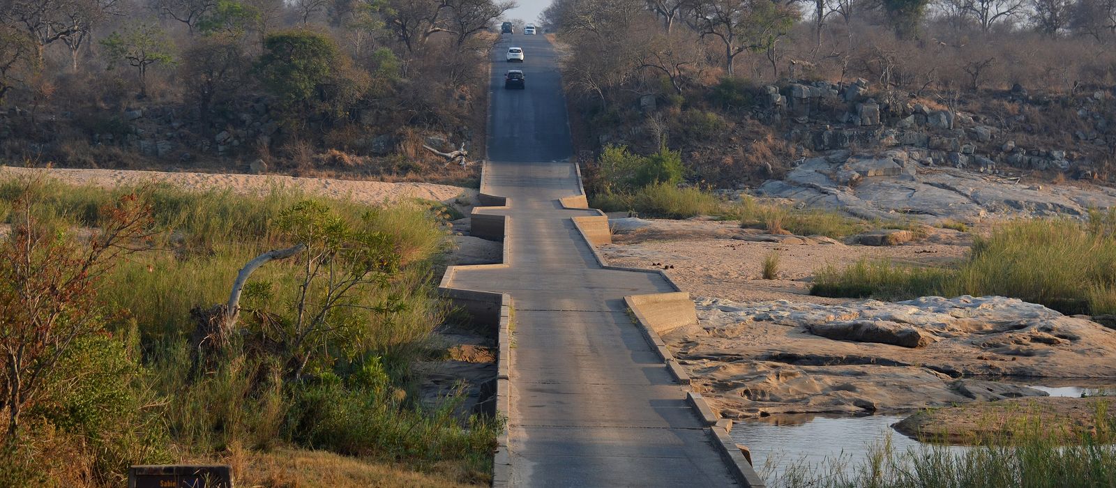
Kruger National Park stretches about 360 km from north to south along the border with Mozambique, in the lowveld of Limpopo and Mpumalanga. First protected in 1898 as the Sabi Game Reserve and a national park since 1926, it is home to all of the Big Five and has its headquarters at Skukuza, on the Sabie River. Roads link the rest camps, from Crocodile Bridge and Lower Sabie in the south through Satara, Olifants, Letaba and Shingwedzi to Punda Maria, and on to Pafuri on the Limpopo. You drive it yourself, but SANParks requires you to stay on the designated roads and does not allow driving outside gate hours. Here are the local guides who work in the area and the trips that cross it.
0 local guides and 0 trips in Kruger National Park on GuideMeet.
On the map
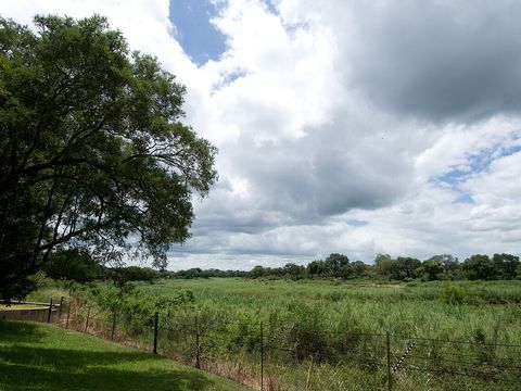 Skukuza — Town. Administrative headquarters of the park and its largest rest camp, on the south bank of the Sabie River where the N'waswitshaka joins it, near Paul Kruger Gate. Skukuza Airport, about 5 km away, has flights from Johannesburg and Cape Town; the old Selati Railway bridge can still be seen from the camp. -24.9958, 31.5919 · Google Maps
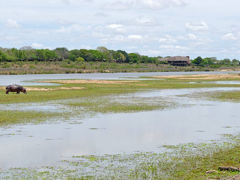 Lower Sabie — Camp. Main rest camp on the south bank of the Sabie River, in the south-east of the park, established in the 1930s. Skukuza is 43 km away on the tarred H4-1, the Sabie River road built between 1928 and 1931. Pictured: the Sabie bridge on the H10, south of the camp. -25.1197, 31.9150 · Google Maps
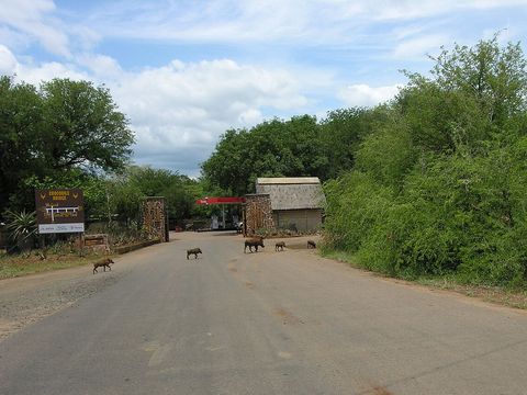 Crocodile Bridge — Camp. Rest camp and entrance gate on the north-west bank of the Crocodile River, on the park's southern border, where the road crosses on a low-water bridge. It began as a pontoon crossing for rangers; the first eight rondavels went up in 1931 and the causeway replaced the park's last pontoon in 1945. Pictured: warthogs in front of the camp gate. -25.3585, 31.8926 · Google Maps
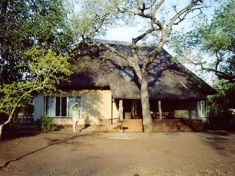 Satara — Camp. The park's second-largest camp, in the centre of Kruger, surrounded by open plains that draw plenty of game and predators. It has a fuel station. Pictured: a cottage in the camp. -24.3931, 31.7798 · Google Maps
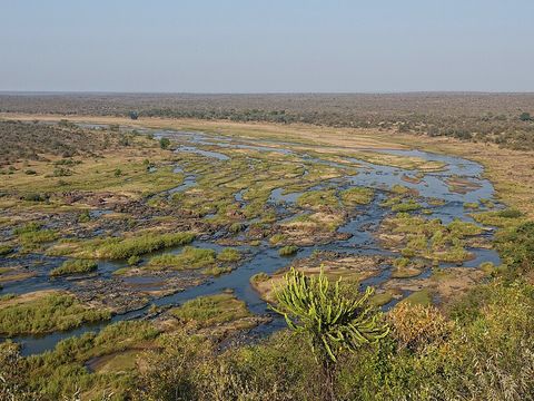 Olifants — Camp. Camp on a hill above the Olifants River, in the centre of the park, with a fuel station. 'Olifant' is Afrikaans for elephant; the river crosses the lowveld and enters Mozambique through the Lebombo Mountains by the Olifants Gorge. Pictured: the river from the camp. -24.0052, 31.7402 · Google Maps
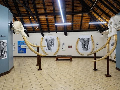 Letaba — Camp. Main rest camp on the south bank of the Letaba River, where the H1-5, the park's main road north, meets the H9 west to Phalaborwa Gate. It has 60 tent and caravan sites and a filling station, and the only Elephant Hall in Kruger, with the tusks of the 'Magnificent Seven' bull elephants. Pictured: the Elephant Hall. -23.8544, 31.5767 · Google Maps
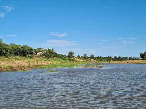 Shingwedzi — Camp. Quiet camp in the far north, near the Shingwedzi River and Kanniedood Dam, with a fuel station. Herds of 50 to 60 elephants are common in the river's basin. Pictured: the bridge on the S135, east of the camp. -23.1083, 31.4355 · Google Maps
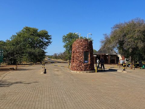 Punda Maria — Camp. The northernmost main camp, on a hill and known for its birdlife. Its fuel station is the closest to the Makuleke area, which has none. The Punda Maria gate is reached on the R524. Pictured: the gate. -22.6915, 31.0160 · Google Maps
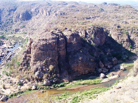 Makuleke (Pafuri) — Park. The northernmost section of the park, a wedge of land where the Limpopo and Luvuvhu rivers join at Crook's Corner, the point where South Africa, Zimbabwe and Mozambique meet. Taken from the Makuleke people in 1969, it was returned to them in 1998 and became a Ramsar wetland in 2007. Pictured: Lanner Gorge on the Luvuvhu. -22.4014, 31.1969 · Google Maps
South Africa: guides by vehicle
Overland trips in Kruger National Park
No trips published here yet.
When to go
Rain falls mostly in summer: at Skukuza the monthly average ranges from about 9 mm in June and August to about 111 mm in January, for about 635 mm a year. In the rainy season gravel roads and bridges can close because of flooding; in the dry months from May to August animals gather at the water sources.
Before you go
- All guides and trips in South Africa
- Do you need a local guide in South Africa?
- Is South Africa safe to travel?
- Driving and local rules in South Africa
Photo credits
Author and licence (or permission) for each photo.
- Kruger National Park: Pavel Špindler, CC BY 3.0
- 1. Skukuza: Chris Eason from London, CC BY 2.0
- 2. Lower Sabie: Bernard DUPONT from FRANCE, CC BY-SA 2.0
- 3. Crocodile Bridge: Chris Eason from London, CC BY 2.0
- 4. Satara: Chris Eason from London, CC BY 2.0
- 5. Olifants: Bjørn Christian Tørrissen, CC BY-SA 4.0
- 6. Letaba: Bjørn Christian Tørrissen, CC BY-SA 4.0
- 7. Shingwedzi: Bernard DUPONT from FRANCE, CC BY-SA 2.0
- 8. Punda Maria: Bjørn Christian Tørrissen, CC BY-SA 4.0
- 9. Makuleke (Pafuri): Lee R. Berger (Profberger), CC BY 2.5


