Overland region
The Georgian Caucasus by 4x4 and motorbike: local guides and trips
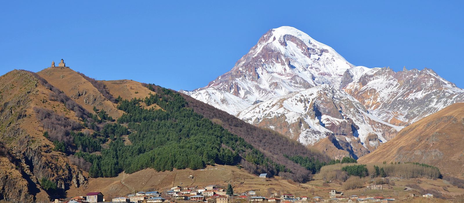
The Greater Caucasus runs along Georgia's northern border, and on the Georgian side it holds several of the country's high mountain valleys: Svaneti in the north-west, with Mestia and the medieval tower villages of Ushguli; the Georgian Military Road to Stepantsminda and Mount Kazbek; Khevsureti with the fortified village of Shatili; and Tusheti in the north-east. For anyone travelling with their own vehicle it means high passes such as the Jvari, the Zagari and the Abano, mountain tracks and villages that snow can cut off. Here are the local guides who work in the area and the trips that cross it.
3 local guides and 4 trips in the Georgian Caucasus on GuideMeet.
On the map
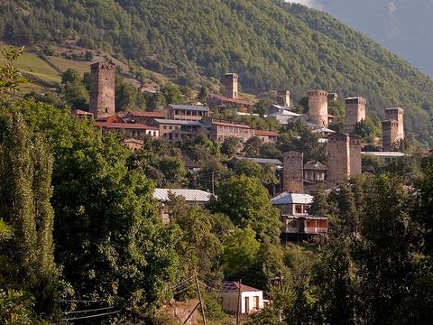 Mestia — Town. Highland townlet at 1,500 m in the Svaneti Caucasus, part of the Upper Svaneti UNESCO World Heritage Site, listed in 1996. 43.0456, 42.7297 · Google Maps
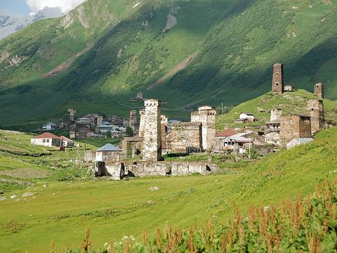 Ushguli — Village. Community of five medieval villages at the head of the Enguri gorge, one of the highest continuously inhabited settlements in Europe, with Svan tower houses. 42.9178, 43.0157 · Google Maps
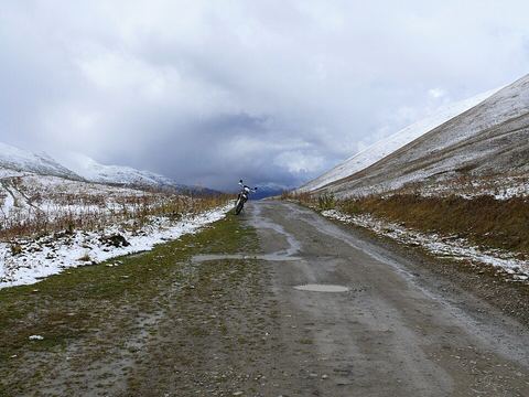 Zagari Pass — Mountain pass. Pass at about 2,600 m east of Ushguli, linking the Enguri and Tskhenistskali valleys on the boundary between Svaneti and Racha-Lechkhumi. 42.9155, 43.1022 · Google Maps
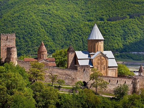 Ananuri — Archaeological site. Castle complex on the Aragvi river, about 72 km from Tbilisi, which the Georgian Military Road passes on its way north. 42.1636, 44.7039 · Google Maps
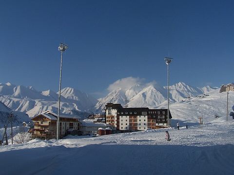 Gudauri — Village. Ski resort at 2,200 m on the Georgian Military Road near the Jvari Pass; the ski season runs from December to April. 42.4758, 44.4786 · Google Maps
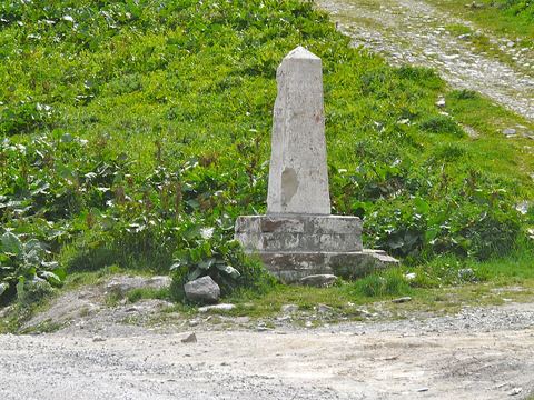 Jvari Pass — Mountain pass. Highest point of the Georgian Military Road, at 2,379 m, on the stretch between Gudauri and Stepantsminda. 42.5042, 44.4538 · Google Maps
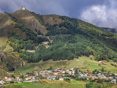 Stepantsminda — Town. Townlet formerly called Kazbegi, centre of the Kazbegi Municipality, with Mount Kazbek rising just west of it. 42.6575, 44.6453 · Google Maps
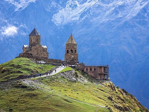 Gergeti Trinity Church — Monastery. Church at 2,170 m on the right bank of the Chkheri, under Mount Kazbek and near Stepantsminda, with a belltower and a surrounding wall. 42.6625, 44.6203 · Google Maps
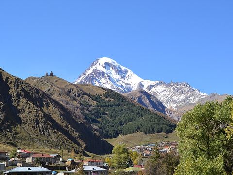 Mount Kazbek — Peak. Dormant volcano, 5,054 m: the highest mountain in eastern Georgia, with its last eruption around 750 BCE. 42.6992, 44.5183 · Google Maps
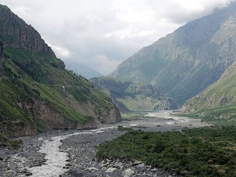 Darial Gorge — Gorge. River gorge about 13 km long, carved by the Terek on the border with Russia; the Georgian Military Road runs through it, between walls up to 1,800 m high. 42.7447, 44.6225 · Google Maps
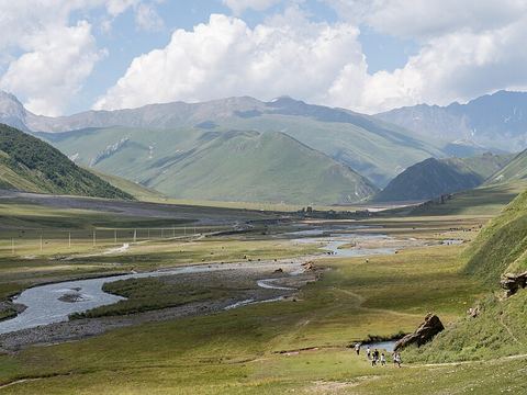 Truso Valley — Valley. High-altitude trough valley in Kazbegi National Park, source of the Terek, with Georgian cultural and historical heritage. 42.5728, 44.4819 · Google Maps
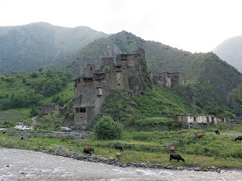 Shatili — Village. Fortified village in the Arghuni gorge at about 1,400 m, near the border with Chechnya: some 60 towers cluster into a single chain of fortifications. 42.6583, 45.1569 · Google Maps
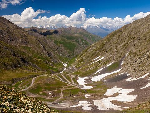 Abano Pass — Mountain pass. At 2,826 m, one of the highest drivable passes in the Caucasus, linking Kakheti and Tusheti; closed mid-October to mid-June, and 4x4 only. 42.2781, 45.5086 · Google Maps
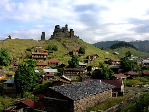 Omalo — Village. Main village of Tusheti, between the Greater Caucasus and the Pirikita range; the only access road crosses the Abano Pass. Keselo fortress stands in Upper Omalo. 42.3789, 45.6300 · Google Maps
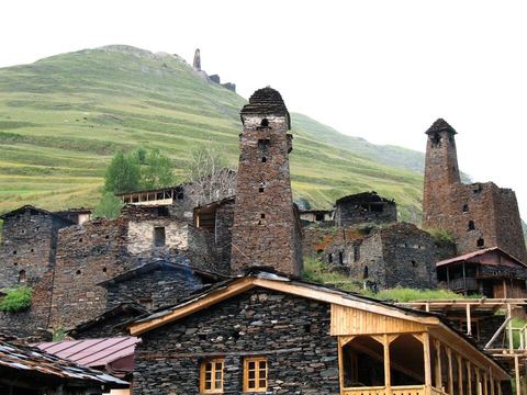 Dartlo — Village. Village about 12 km from Omalo, known for its historic stone towers and houses and its church. 42.4394, 45.5811 · Google Maps
Local guides in the Georgian Caucasus
- Luka Kakhiani — Mestia, Georgia · 4x4 car, 4x4 van
- George Tsiskarishvili — Tbilisi, Georgia · offroad motorcycle, adventure motorcycle, 4x4 car
- EDVINS BAUERS — Rīga, Latvija · 4x4 car, 4x4 truck, 4x4 van
Overland trips in the Georgian Caucasus
- Mestia Ushguli day trip — 1461 days · Georgia
- FROM DESERT TO THE CAUCASUS — 6-DAY ADVENTURE MOTORCYCLE TOUR — 6 days · Georgia
- 6 Day Enduro trip - TUSHETI ALPS-KAKHETI WINE REGION — 6 days · Georgia
Trips already run here
- Georgia with 4×4 Centrs: “From Vineyards to Glaciers” — 8 days · Georgia
When to go
The high passes are for summer: the Abano Pass to Tusheti is closed from mid-October to mid-June, depending on snow, and the road to Shatili is cut off in winter.
Before you go
- All guides and trips in Georgia
- Do you need a local guide in Georgia?
- Is Georgia safe to travel?
- Driving and local rules in Georgia
Photo credits
Photos from Wikimedia Commons, under the licences shown.
- Georgian Caucasus: Svaneti, Kazbegi and Tusheti: MaxBenidze, CC BY-SA 4.0
- 1. Mestia: Gytis, CC BY 2.0
- 2. Ushguli: Florian Pinel, CC BY-SA 3.0
- 3. Zagari Pass: Karel61, CC BY-SA 4.0
- 4. Ananuri: Vadim Tolbatov, CC BY-SA 3.0
- 5. Gudauri: rugbyxm, CC BY 2.0
- 6. Jvari Pass: franek2, CC BY-SA 3.0
- 7. Stepantsminda: Supanut Arunoprayote, CC BY 4.0
- 8. Gergeti Trinity Church: Supanut Arunoprayote, CC BY 4.0
- 9. Mount Kazbek: Аліна Семенець, CC BY-SA 4.0
- 10. Darial Gorge: Vyacheslav Argenberg, CC BY 4.0
- 11. Truso Valley: Alexkom000, CC BY 4.0
- 12. Shatili: Vyacheslav Argenberg, CC BY 4.0
- 13. Abano Pass: Moahim, CC BY-SA 4.0
- 14. Omalo: Abramia Giorgi, CC BY-SA 4.0
- 15. Dartlo: Lidia Ilona, CC BY 2.0


.JPG)

.jpg)


.JPG)
.jpg)