Overland region
Etosha by 4x4: local guides and trips
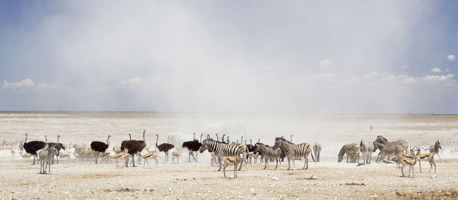
Etosha National Park, in north-western Namibia, covers 22,270 km² of savanna and mopane woodland around a vast salt pan. For anyone travelling with their own vehicle it means mostly unpaved park roads past the waterholes between the rest camps of Okaukuejo, Halali and Namutoni, with gates at Andersson (south), Von Lindequist (east), King Nehale (north) and Galton (west); you may leave the vehicle only in the fenced camps and at a few marked spots. Outjo and Tsumeb are the usual gateway towns. Here are the local guides who work in the area and the trips that cross it.
3 local guides and 3 trips in Etosha on GuideMeet.
On the map
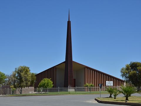 Outjo — Town. Town of about 15,000 on the C38 and the main gateway to Etosha: Andersson Gate is about 90 km away. From here the C39 leads to Khorixas and Damaraland, and the C40 to Kamanjab and the Kaokoveld. -20.1089, 16.1547 · Google Maps
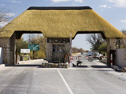 Andersson Gate — Park. Southern entrance of the park, where the paved C38 leads on to Okaukuejo. The dolomite hills near the gate are known in English as the Leopard Hills. -19.3313, 15.9401 · Google Maps
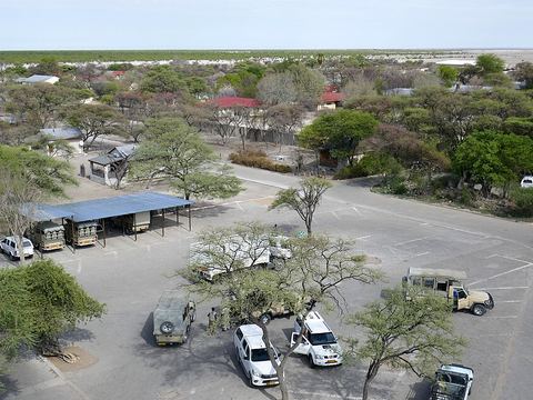 Okaukuejo — Camp. The park's administrative centre, with a tourist camp and a floodlit waterhole that draws elephants, lions and black rhinos. The round tower is a remnant of a German fort built in 1901. -19.1779, 15.9166 · Google Maps
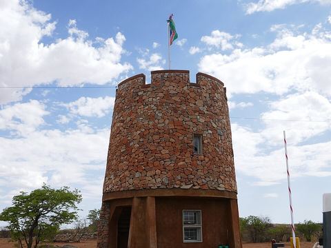 Galton Gate — Park. Western entrance to the park, open to all visitors since early 2014. Western Etosha is dominated by dolomite hills and is the only part of the park with mountain zebra. -19.3147, 14.4816 · Google Maps
- Dolomite Camp — Camp. Rest camp in the western part of the park, built in 2010–2011 in an area that had been closed to the public; the way in is through Galton Gate. -19.0102, 14.4740 · Google Maps
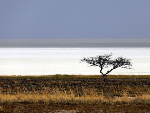 Etosha Pan — Salt pan. Salt pan of about 4,760 km², almost a quarter of the park. It is usually dry and fills briefly in summer, when pelicans and flamingos arrive. Etosha means 'Great White Place'. -18.7853, 16.2639 · Google Maps
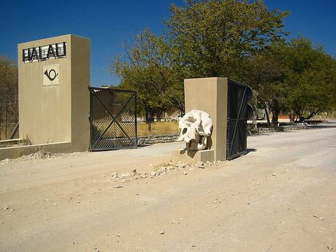 Halali — Camp. Rest camp opened to tourism in 1967, about 70 km from both Okaukuejo and Namutoni. A dolomite hill rises inside the camp, and Twee Koppies lies just outside. -19.0356, 16.4722 · Google Maps
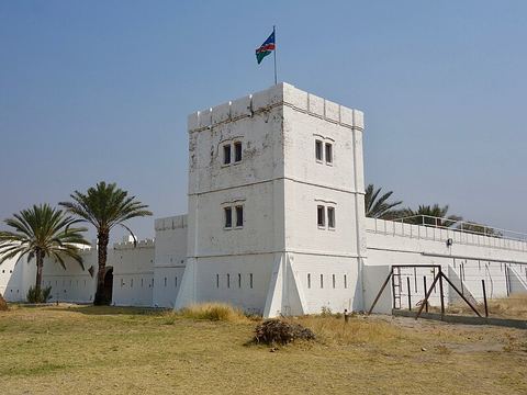 Namutoni — Camp. Rest camp on the eastern edge of the pan, with Fort Namutoni, a German police post destroyed in 1904 and rebuilt; it has been a national monument since 1947. -18.8059, 16.9405 · Google Maps
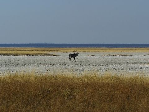 Fisher's Pan — Salt pan. Pan at the eastern end of the park, near Namutoni. In very good rain years it fills, sometimes almost completely, and hosts thousands of water birds, flamingos among them. Pictured: a gemsbok on the pan. -18.7502, 16.9808 · Google Maps
- Von Lindequist Gate — Park. Eastern entrance, about 10 km east of Namutoni, where the paved C38 runs into the eastern part of the park. -18.8034, 17.0433 · Google Maps
- King Nehale Gate — Park. Northern entrance, also marked on maps as Nehale Iya Mpingana Gate; it gives access to the north-eastern part of the park. -18.5009, 16.7442 · Google Maps
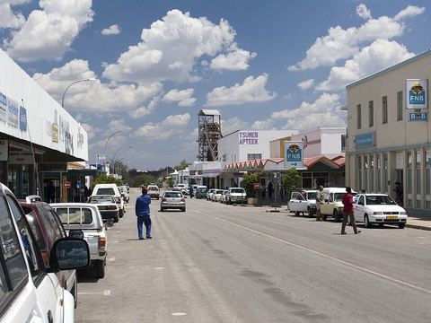 Tsumeb — Town. Mining town founded in 1905, known as the gateway to the north of Namibia and the town closest to Etosha. Its museum shows war material recovered from Lake Otjikoto. -19.2500, 17.7000 · Google Maps
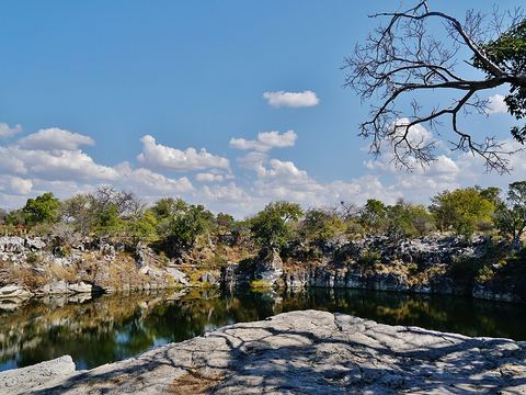 Lake Otjikoto — Lake. Sinkhole lake formed by a collapsed karst cave, 20 km north-west of Tsumeb and 100 m from the B1. German troops dumped war material in it in 1915; it has been a national monument since 1972. -19.1947, 17.5497 · Google Maps
Local guides in Etosha
- MAURIZIO TURCO — Roma, Italia · 4x4 car, 4x4 truck, 4x4 van, offroad motorcycle, adventure motorcycle, bicycle / e-bike
- Charel Schreuder — Cape Town, South Africa · 4x4 car, camper / van, 4x4 van, 4x4 truck
- ACTIVE 4X4 ADVENTURES — United Kingdom · 4x4 car, 4x4 truck, 4x4 van
Overland trips in Etosha
- Namibia Fly Drive 4x4 - Mille colori dell'Africa — 15 days · Namibia
- Namibia 4X4 Wildlife Safari — 15 days · Namibia
- Namibia Desert Crossing — 10 days · Namibia
When to go
Winters are dry, with almost no rain and cold nights of around 10 °C, and in the long dry season the animals gather at the waterholes. In summer temperatures often hover around 40 °C, and the pan can fill briefly with water.
Before you go
- All guides and trips in Namibia
- Do you need a local guide in Namibia?
- Is Namibia safe to travel?
- Driving and local rules in Namibia
Photo credits
Photos from Wikimedia Commons, under the licences shown.
- Etosha: Yathin S Krishnappa, CC BY-SA 3.0
- 1. Outjo: Pavel Špindler, CC BY 3.0
- 2. Andersson Gate: namibia.11-300mm.de, CC BY-SA 2.0 de
- 3. Okaukuejo: Ji-Elle, CC BY-SA 4.0
- 4. Galton Gate: Ji-Elle, CC BY-SA 4.0
- 6. Etosha Pan: Alchemist-hp (talk) (www.pse-mendelejew.de), FAL
- 7. Halali: mroszewski, CC BY-SA 3.0
- 8. Namutoni: Sonse, CC BY 2.0
- 9. Fisher's Pan: Hans Hillewaert, CC BY-SA 4.0
- 12. Tsumeb: greg willis, CC BY-SA 2.5
- 13. Lake Otjikoto: Zairon, CC BY-SA 4.0


.jpg)


.jpg)
.jpg)


