Overland region
Death Valley and the Mojave Road by 4x4: local guides and trips
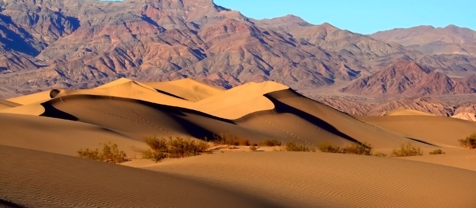
Death Valley, in eastern California, is a land of salt flats, dunes, canyons and dry lakes, with Badwater Basin, the lowest point in North America, 86 m below sea level. To the south-east the Mojave Road, a 147-mile (237 km) unmaintained dirt road, crosses the Mojave National Preserve, and a 4x4 is needed almost all the way. For anyone travelling with their own vehicle it means rough gravel roads like the one to the Racetrack, the one-way Titus Canyon, dry lakes and long tracks across sand and gravel. Here are the local guides who work in the area and the trips that cross it.
1 local guide and 1 trip in Death Valley and on the Mojave Road on GuideMeet.
On the map
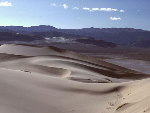 Eureka Dunes — Dunes. Dunes at the southern end of Eureka Valley, about 210 m high and among the tallest in North America; they are 'booming' dunes. Foot travel only: no vehicles. A primitive campground sits at the north end. 37.0960, -117.6750 · Google Maps
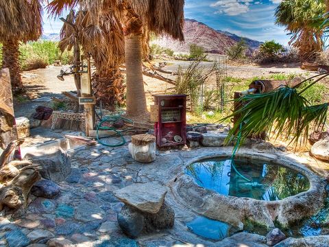 Saline Valley — Valley. Arid valley about 43 km long, north-west of Death Valley. Hot springs lie in its north-east corner, along the Warm Springs Road. Roads here are extremely rough, for high-clearance 4WD only. 36.7500, -117.8100 · Google Maps
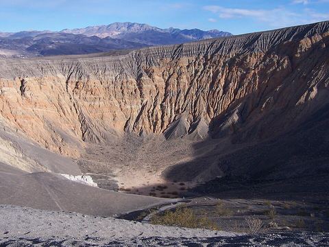 Ubehebe Crater — Crater. Volcanic crater about 1 km wide and up to 237 m deep, formed by steam explosions. From here the 28-mile gravel Racetrack Road heads south-west. 37.0097, -117.4503 · Google Maps
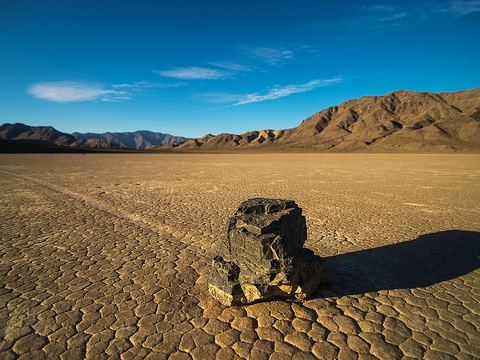 Racetrack Playa — Lake. Dry lake at 1,132 m, known for the 'sailing stones' that leave long tracks. The 28-mile gravel road from Ubehebe Crater is rough and needs high clearance. No phone signal; fuel is over 60 miles away. 36.6813, -117.5627 · Google Maps
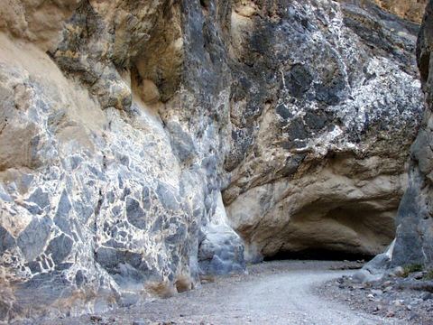 Titus Canyon — Canyon. Deep, narrow gorge in the Grapevine Mountains, with limestone walls and petroglyphs. The rough dirt road is one-way, east to west only, from Daylight Pass Road in Nevada to Death Valley. 36.8228, -117.1733 · Google Maps
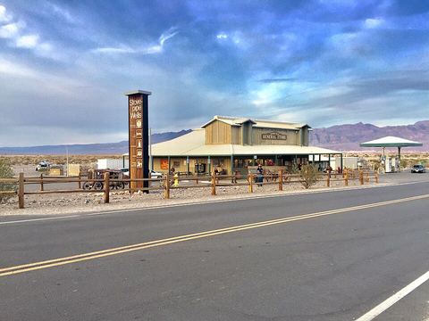 Stovepipe Wells — Village. Way-station on State Route 190 in northern Death Valley, named after a stovepipe once used to mark the well in the sand. It has a hotel, a general store, a gas station and a ranger station. 36.6061, -117.1464 · Google Maps
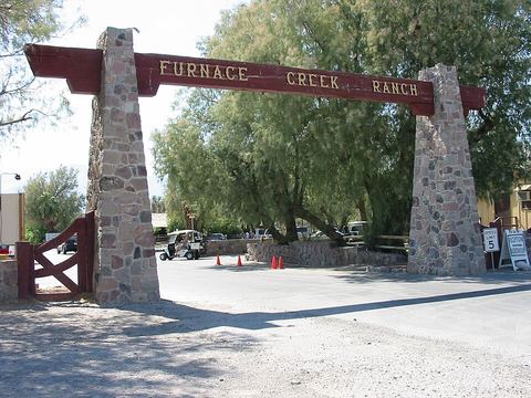 Furnace Creek — Village. Village 58 m below sea level with the visitor center, museum and headquarters of Death Valley National Park. Springs created a natural oasis here, once the site of Greenland Ranch. 36.4581, -116.8708 · Google Maps
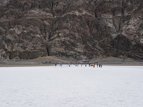 Badwater Basin — Salt pan. Lowest point in North America, 86 m below sea level. The salt flat is in many places only a thin crust over mud: the low-point sign stands at the spring-fed pool by the road. 36.2503, -116.8258 · Google Maps
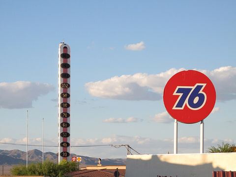 Baker — Town. Small town where Interstate 15 meets State Route 127, the nearest town to the Kelso Dunes. Its 134-foot (41 m) thermometer recalls the 134 °F recorded in Death Valley in 1913. 35.2769, -116.0717 · Google Maps
- Fort Piute — Oasis. Site of a fort built to protect wagon traffic on the Mojave Road, where the surface flow of Piute Creek ends: Piute Spring makes an oasis here. Mile 23 of the road, at 862 m. 35.1150, -114.9853 · Google Maps
- Rock Spring — Spring. Described as the biggest watering hole on the Mojave Road, at about mile 49: a stream runs down large boulders and an old cabin stands beside it. 35.1528, -115.3273 · Google Maps
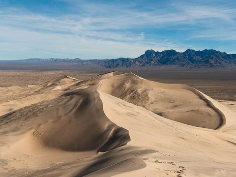 Kelso Dunes — Dunes. The largest field of sand dunes in the Mojave Desert, 120 km², with dunes up to 200 m high that 'boom' when dry. Closed to vehicles: the trailhead is at the end of a 3-mile graded dirt road. 34.9035, -115.7181 · Google Maps
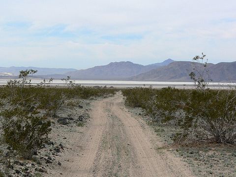 Soda Lake — Lake. Dry lake at the end of the Mojave River, a remnant of the ancient Lake Mojave. The Mojave Road crosses it: proceed with caution, in winter you may have to drive around. Pictured: the road towards the lake. 35.1652, -116.0714 · Google Maps
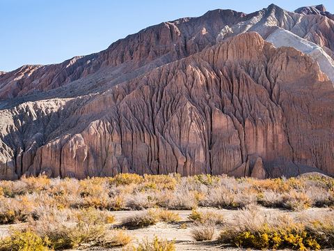 Afton Canyon — Canyon. Deep canyon of the Mojave River, 60 km north-east of Barstow, in the Mojave Trails National Monument and managed by the BLM. The Mojave Road runs through it; its only water crossing comes soon after. 35.0427, -116.3095 · Google Maps
Local guides in Death Valley and on the Mojave Road
- Todd Rogers — Las Vegas, USA
Overland trips in Death Valley and on the Mojave Road
- Death Valley 5 day overland 4x4 adventure or 3 day overland intensive training. — 5 days · United States
When to go
Go in the cooler months: at Furnace Creek the average daytime temperature runs from about 19 °C in December to 47 °C in July, and in remote spots summer heat can pass 49 °C. On the Mojave Road, Soda Lake may have to be driven around in winter.
Before you go
- All guides and trips in the United States
- Do you need a local guide in United States?
- Is the United States safe to travel?
- Driving and local rules in the United States
Photo credits
Photos from Wikimedia Commons, under the licences shown.
- Death Valley and Mojave Road: Brocken Inaglory, CC BY-SA 3.0
- 1. Eureka Dunes: G. Thomas at English Wikipedia, Public domain
- 2. Saline Valley: Peretz Partensky from San Francisco, USA, CC BY-SA 2.0
- 3. Ubehebe Crater: Jim Gordon, CC BY 2.0
- 4. Racetrack Playa: National Park Service / Kurt Moses, Public domain
- 5. Titus Canyon: National Park Service, Public domain
- 6. Stovepipe Wells: Warren LeMay from Cincinnati, OH, United States, CC0
- 7. Furnace Creek: Tobias1983, CC BY-SA 3.0
- 8. Badwater Basin: Christian David, CC BY-SA 4.0
- 9. Baker: Downtowngal, CC BY-SA 3.0
- 12. Kelso Dunes: Joshua Tree National Park, Public domain
- 13. Soda Lake: Stan Shebs, CC BY-SA 3.0
- 14. Afton Canyon: blmcalifornia, Public domain


.jpg)


.jpg)


.jpg)

.jpg)