GuideMeet country page
Panama – overland guides and trips
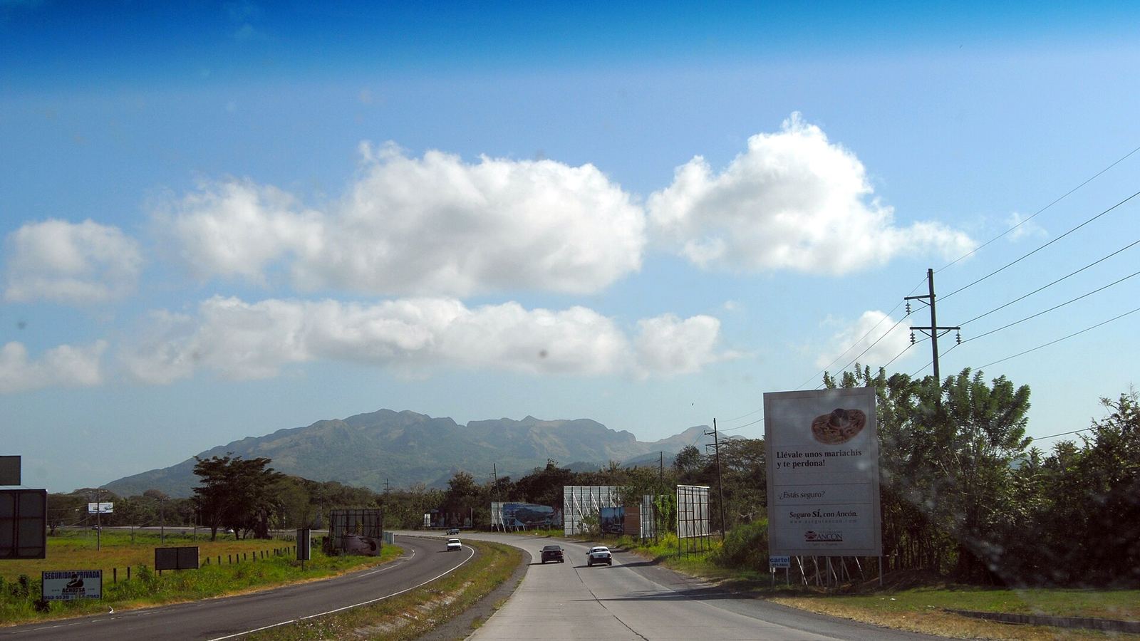
In Panama you travel along the Pan-American Highway, from Paso Canoas to the Canal, with detours into the Chiriquí highlands, the Azuero Peninsula, Santa Fe and El Valle de Antón, by motorcycle or 4x4.
Local overland guides and active trips in Panama on GuideMeet.
As of November 2026: 2 local guides on GuideMeet operating in Panama — 1 4x4, 1 motorcycle.
Local overland guides in Panama
 Overland Motorcycles
Panama · offroad motorcycle, adventure motorcycleAt Overland Motorcycles Panama, we specialize in adventure motorcycle travel and self-guided overland experiences across one of the most diverse countries in C...
- Kevin OBrien · Panama City, Panama
Past trips
- Cross Country · 7 days
Planning a trip in Panama?
Browse local guides for Panama and contact them directly. Or create your own trip and find travel companions.
Are you a local guide in Panama?
Join GuideMeet and get discovered by overland travelers looking for local knowledge, 4x4 support and expedition expertise in Panama.
Panama for overland travelers
Panama is the isthmus between Costa Rica and Colombia, between the Caribbean and the Pacific, cut in two by the Canal. The backbone is the Pan-American Highway, here also called the Interamericana: from Paso Canoas, on the Costa Rican border, it crosses the country to the capital and continues east as far as Yaviza, where it breaks off. A trip with your own vehicle is built around this road and its detours.
Key destinations
The Pan-American and the Canal
According to the Italian foreign ministry's Viaggiare Sicuri advice, the Pan-American, four-lane for one stretch and then two-lane, is the country's only motorway. The Pan-American crosses the Canal on the Centennial Bridge, inaugurated in 2004, which took over that role from the Bridge of the Americas, opened in 1962. In Colón, at the Atlantic entrance to the Canal, the Atlantic Bridge has stood since 2019.
The Chiriquí highlands
In Chiriquí Province, where you enter from Costa Rica at Paso Canoas, the Barú volcano is the highest mountain in Panama and has been a national park since 1976. Boquete lies on its eastern slope, Volcán and Cerro Punta on its western one.
The Azuero Peninsula
The Azuero Peninsula, with the provinces of Herrera and Los Santos and the south of Veraguas, stretches out into the Pacific. The road on the eastern side branches off the Pan-American at Divisa and leads to Chitré, Las Tablas and Pedasí; the one on the western side branches off a little east of Santiago.
Santa Fe
Santa Fe District, in northern Veraguas, reaches as far as the Caribbean coast; the road from Santiago is paved.
El Valle de Antón
El Valle de Antón, in Coclé Province, lies in the caldera of an inactive volcano and is reached from the Pan-American on a two-lane road.
Guna Yala and the Cartí road
The comarca of Guna Yala, on the Caribbean coast, is an indigenous territory with its own political and administrative organization, and its highest political authority is the Guna General Congress. The only land access is the road from El Llano, east of the capital, to Cartí, with some very steep climbs. At the entrance, according to the Spanish government, you show your passport and pay an entry fee; check the conditions for vehicles with the comarca authorities before you set off.
Borders
Toward Costa Rica, the crossing on the Pan-American is Paso Canoas. The UK government warns that protests can block roads and affect access to this crossing; the Spanish government adds that blockades on the Interamericana can last hours or days.
To the east, the Pan-American breaks off at Yaviza, in Darién Province: there is no road link between Panama and Colombia. The Viaggiare Sicuri advice describes the road in that direction as being in worse condition and advises against travel to the eastern part of Darién Province, on the border with Colombia, where remnants of Colombian guerrilla and paramilitary groups are reportedly still present. The UK government reports a risk of violence east of the Punta Carreto (Guna Yala)–Yaviza–Punta Piña (Pacific) line, where foreigners and Panamanians have been victims of kidnapping and murder.
To continue to Colombia, the vehicle is shipped by sea. In Colombia, temporary import of a tourist's vehicle is requested online from the Colombian customs authority, DIAN.
Permits and logistics
According to the Viaggiare Sicuri advice, a tourist stay is 90 days, with no extensions. Ask Panamanian customs, the Autoridad Nacional de Aduanas, about the conditions for temporary entry of the vehicle (documents, duration, extensions) before you reach the border.
The Viaggiare Sicuri advice states that an Italian license is valid and recommends third-party liability insurance. The UK and Spanish governments set a limit of 3 months for their citizens' licenses, and drivers carry their passport with the entry stamp (for the UK, a copy is enough). After an accident, according to the advice, you must not move a rental car until the police arrive.
Best time to go
The Viaggiare Sicuri advice places the rainy season roughly between late April and late December, with the heaviest rain in October and November, and recommends avoiding remote areas in those months, particularly on the Atlantic coast, because of frequent flooding, landslides and roads being cut off. Secondary roads are often passable only by off-road vehicle, especially in the rains, and road maps are very approximate. The season to choose is the dry one, outside those months.
Safety
The Viaggiare Sicuri advice describes the main roads as in fair condition, but considers night driving very dangerous, especially outside the capital, because vehicles and farm carts travel without lights: it advises avoiding out-of-town travel after sunset. It reports crime, including kidnappings, that has also affected tourists, and in Colón it advises against non-essential stays and getting around in the evening and at night. Neighborhoods to avoid, curfews, local laws and customs rules are covered in the Panama safety sheet on GuideMeet.
Why a local guide matters
Which secondary roads stay passable in the rains, how far you get before sunset, how to drive up to Cartí: it changes from season to season. On GuideMeet, local guides and operators have a profile showing their vehicles and the trips they offer, and you contact them directly: you see who you are traveling with before you set off.
Bottom line
Panama is a long road between Costa Rica and Yaviza, with the Canal in the middle: the difficulties are the rains, night driving, roadblocks, the vehicle paperwork and a road that runs out toward Colombia. From Paso Canoas to the Canal, out to Chiriquí, the Azuero, Santa Fe and El Valle, guides who know the back roads, border crossings and seasons make the journey realistic.
Travelling with a local guide
Not sure whether you need a guide, or how to pick one you have never met? Travelling with a local guide covers when a guide is genuinely needed, what to check before leaving (permits, vehicle, emergency contacts) and how to agree price and exceptions.
Frequently asked questions
How do I find overland guides in Panama on GuideMeet?
Browse local guides for Panama on GuideMeet, compare their experience, vehicles and languages, and message them directly to plan routes, permits and border crossings. As of November 2026, there are 2 local guides on GuideMeet operating in Panama (1 4x4, 1 motorcycle).
How much does it cost to contact a guide in Panama?
Nothing — GuideMeet is free and takes no commission. You contact the guide directly on the platform and agree terms between yourselves, with no middleman.
Are you a local guide in Panama?
Join GuideMeet and get discovered by overland travelers looking for local knowledge, 4x4 support and expedition expertise in Panama.