Overland region
Wadi Rum by 4x4: local guides and trips
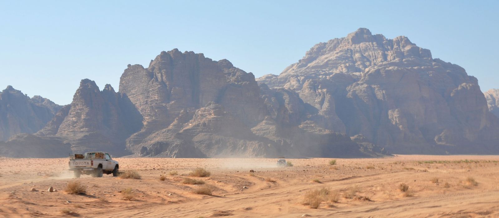
Wadi Rum is a valley cut into sandstone and granite in southern Jordan, about 60 km east of Aqaba and close to the Saudi border; its protected area has been a UNESCO World Heritage site since 2011. For anyone travelling by 4x4 it means sand tracks between tall sandstone mountains, rock bridges, canyons with ancient petroglyphs and Jordan's highest peak, Jebel Umm ad Dami. Bedouin communities, mainly the Zalabieh, run camps and provide meals and transport across the desert. Here are the local guides who work in the area and the trips that cross it.
2 local guides and 4 trips in Wadi Rum on GuideMeet.
On the map
- Disi — Village. Village in Quweira District, north-east of Wadi Rum village, with about 3,000 inhabitants (2017 estimate). The Disi aquifer, which shares its name, supplies water to Aqaba and, by pipeline, to Amman. 29.6535, 35.5143 · Google Maps
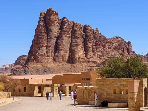 Wadi Rum Visitor Centre — Park. Visitor centre of the protected area, on the road in, north of the village. Near the entrance stands the rock formation known as the Seven Pillars (pictured). 29.6392, 35.4344 · Google Maps
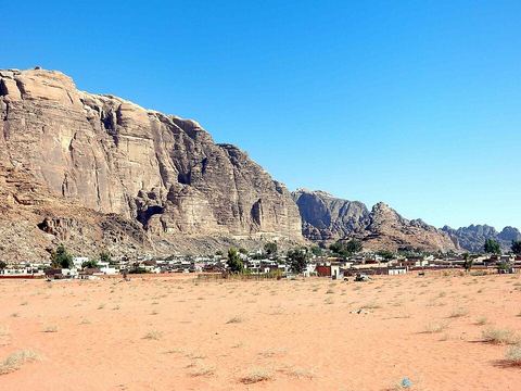 Wadi Rum Village — Village. Bedouin village of several hundred people, with a few shops and the headquarters of the Desert Patrol. The Zalabieh tribe runs eco-adventure tourism in the protected area: camps, 4x4 tours, camel rides. 29.5748, 35.4218 · Google Maps
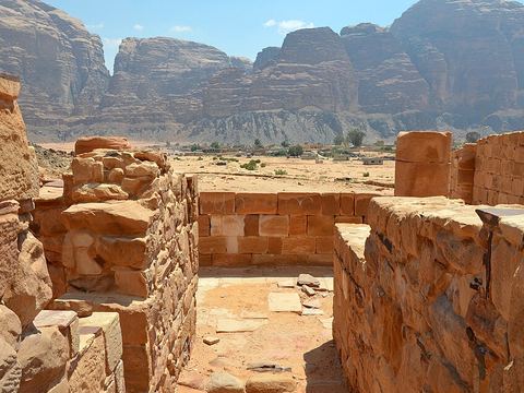 Nabataean Temple — Archaeological site. Ruins of a Nabataean temple within walking distance of the Rest House, found in 1933. A French team of archaeologists finished the excavations in 1997. 29.5780, 35.4153 · Google Maps
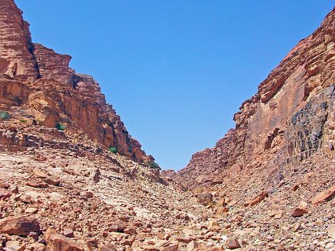 Lawrence's Spring — Spring. Spring named after T. E. Lawrence, who passed through Wadi Rum several times during the Arab Revolt of 1917–18. It lies about 2 km south-west of the village, at the top of a short scramble. 29.5598, 35.4102 · Google Maps
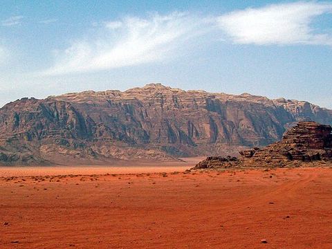 Jebel Rum — Peak. At 1,734 m, the second-highest peak in Jordan, rising right above the Rum valley. Traditional climbing routes on its east face make it one of the main attractions for climbers. 29.5833, 35.4000 · Google Maps
- Jebel Umm Ishrin — Peak. Peak facing Jebel Rum across the valley, possibly one metre lower. The mountains of Wadi Rum are largely Umm Ishrin Sandstone: iron-rich and resistant to erosion. 29.5856, 35.4403 · Google Maps
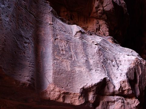 Khazali Canyon — Canyon. Canyon with petroglyphs of people and antelopes carved in the cave walls, dating back to Thamudic times. Pictured: engravings in the siq of Jebel Khazali. 29.5180, 35.4235 · Google Maps
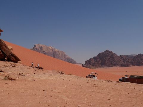 Red Sand Dunes — Dunes. Red dunes in the Wadi Rum desert. The sand here forms barchans and climbing dunes, sand ramps that reach the tops of hills. 29.5290, 35.4217 · Google Maps
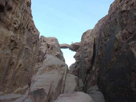 Burdah Rock Bridge — Rock formation. Natural rock bridge on Jebel Burdah, south-east of the village: one of the sandstone arches shaped by wind and erosion in Wadi Rum. 29.4685, 35.4967 · Google Maps
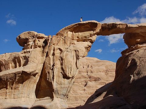 Um Fruth Rock Bridge — Rock formation. Natural rock bridge on Jebel Umm Fruth, south of the village: another of the sandstone arches shaped by wind and erosion in Wadi Rum. 29.4686, 35.4492 · Google Maps
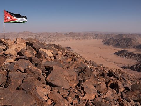 Jebel Umm ad Dami — Peak. The highest mountain in Jordan, roughly 1,850 m, 30 km south of Wadi Rum village. From the top, on a clear day, you can see the Red Sea and the Saudi border. 29.3083, 35.4292 · Google Maps
Local guides in Wadi Rum
- Adam Alhasanat — وادي موسى, وادي موسى، الأردن · 4x4 car, 4x4 truck, camper / van, 4x4 van, offroad motorcycle, adventure motorcycle, bicycle / e-bike
- Ramzi Kharbat — Amman, Jordan
Overland trips in Wadi Rum
- Jordan Motorcycle adventure tour — 5 days · Jordan
- Jordan Desert & Petra Adventure — 4 days · Jordan
- Jordan Overland Expedition — 7 days · Jordan
- Jordan Overland Expedition – From Forests to Deserts: Jordan Overland Expedition — 9 days · Jordan
When to go
Wadi Rum has a desert climate, with scant rain that falls in thunderstorms and often comes as flash floods: check the weather before entering canyons and dry riverbeds. In nearby Aqaba winters are mild and summers very hot and dry.
Before you go
- All guides and trips in Jordan
- Do you need a local guide in Jordan?
- Is Jordan safe to travel?
- Driving and local rules in Jordan
Photo credits
Photos from Wikimedia Commons, under the licences shown.
- Wadi Rum: Jorge Láscar from Australia, CC BY 2.0
- 2. Wadi Rum Visitor Centre: Mustang Joe, CC0
- 3. Wadi Rum Village: FLASHPACKER TRAVELGUIDE, CC BY-SA 2.0
- 4. Nabataean Temple: Carole Raddato from FRANKFURT, Germany, CC BY-SA 2.0
- 5. Lawrence's Spring: Daniel Case, CC BY-SA 3.0
- 6. Jebel Rum: Daniel Case, CC BY-SA 3.0
- 8. Khazali Canyon: Berthold Werner, CC BY-SA 3.0
- 9. Red Sand Dunes: Steffen 962, CC BY-SA 4.0
- 10. Burdah Rock Bridge: Cadouf, CC BY-SA 4.0
- 11. Um Fruth Rock Bridge: twiga-swala, CC BY-SA 2.0
- 12. Jebel Umm ad Dami: Horizon Dweller, CC BY-SA 4.0
.jpg)
.jpg)
.jpg)
.jpg)


