Overland region
Victoria Falls and the Zambezi by 4x4: local guides and trips
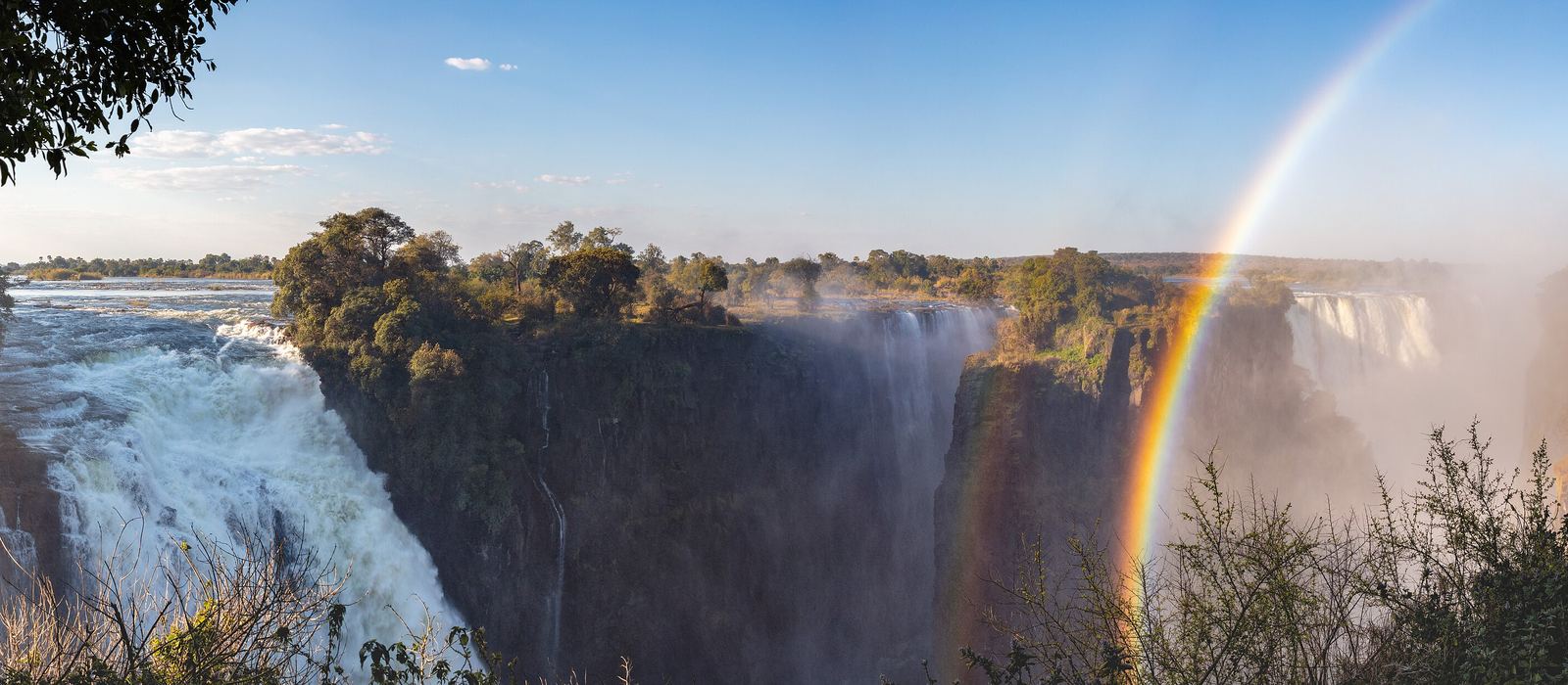
Victoria Falls, called Mosi-oa-Tunya, "the smoke that thunders", in Lozi, is a waterfall 1,708 m wide on the Zambezi, on the border between Zimbabwe and Zambia, and a World Heritage Site. The town of Victoria Falls stands on the Zimbabwean side and Livingstone a few kilometres away in Zambia, linked by the 1905 bridge over the Second Gorge. For anyone travelling with their own vehicle it means the border crossing on the bridge, the game drives of Zambezi National Park along the river and across Chamabonda Vlei, and the road to Livingstone. Here are the local guides who work in the area and the trips that cross it.
5 local guides and 5 trips at Victoria Falls on GuideMeet.
On the map
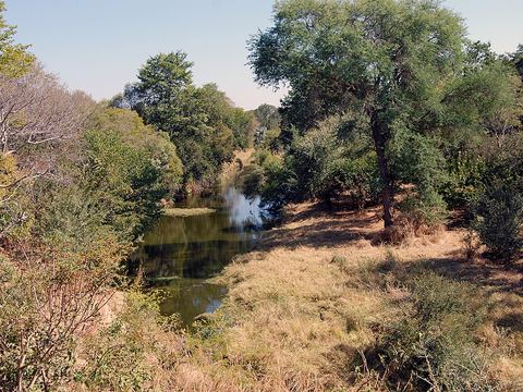 Zambezi National Park — Park. Park of 56,000 ha upstream of the falls, on the Zimbabwean side. The Zambezi River Game Drive follows the bank; elephant and buffalo are regularly seen. -17.9265, 25.6344 · Google Maps
- Chamabonda Vlei — Valley. The southern part of Zambezi National Park, away from the river. The 25 km Chamabondo Game Drive starts 5 km south of the town, just off the A8. -17.9833, 25.6667 · Google Maps
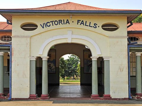 Victoria Falls, Zimbabwe — Town. Resort town on the Zimbabwean bank of the Zambezi, at the western end of the falls, surrounded by national parks. Tourism is its main industry. Pictured: the railway station. -17.9333, 25.8333 · Google Maps
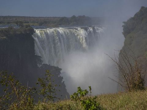 Mosi-oa-Tunya / Victoria Falls — Waterfall. The falls: 1,708 m wide and up to 108 m high, split into the Devil's Cataract, Main Falls, Rainbow Falls and Eastern Cataract, from the Zimbabwean to the Zambian side. -17.9244, 25.8567 · Google Maps
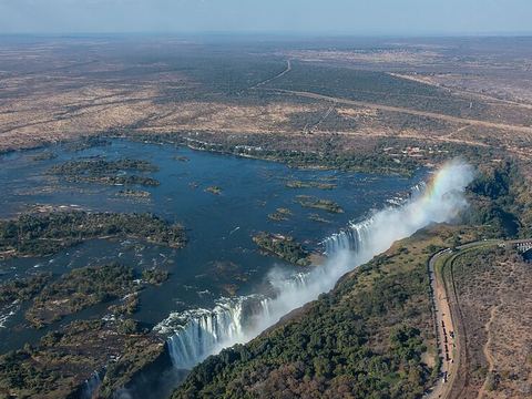 Livingstone Island — Island. Island at the crest of the falls, near the Zambian shore. On 16 November 1855 David Livingstone saw the falls from here, the first European recorded to do so. -17.9236, 25.8547 · Google Maps
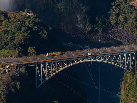 Victoria Falls Bridge — Border crossing. Steel arch bridge of 1905 over the Second Gorge, with border posts at both ends. It carries road, railway and footway, and is one of three road links between Zambia and Zimbabwe. -17.9283, 25.8572 · Google Maps
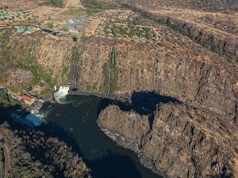 Batoka Gorge — Gorge. Basalt gorge cut by the Zambezi below the falls, a zigzag of six gorges. The deepest, the Songwe Gorge, 5.3 km downstream, reaches 140 m. -17.9640, 25.8554 · Google Maps
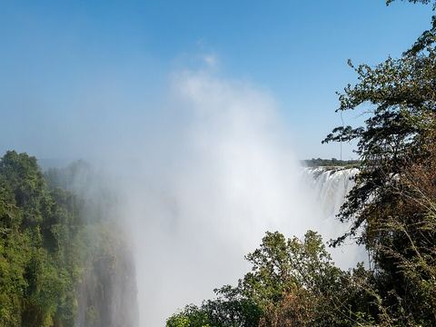 Mosi-oa-Tunya National Park — Park. Zambia's park at the falls, 66 km² in two sections with separate entrances: the land beside the falls and a wildlife park with giraffe, zebra and other game. -17.8667, 25.8333 · Google Maps
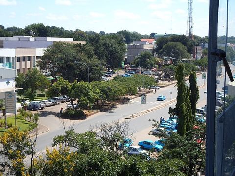 Livingstone — Town. City 10 km north of the Zambezi, the Zambian base for the falls, with 177,393 inhabitants in 2022. It was the first capital of Northern Rhodesia, from 1911 to 1935. -17.8500, 25.8667 · Google Maps
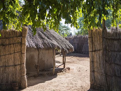 Mukuni — Village. Village about 10 km south-east of Livingstone, the largest in the area before the city was founded. Its Baleya people came under Chief Mukuni, who arrived from the Congo in the 16th century. -17.9070, 25.9413 · Google Maps
Local guides at Victoria Falls
- Charel Schreuder — Cape Town, South Africa · 4x4 car, camper / van, 4x4 van, 4x4 truck
- Ultimate Adventures — Pretoria, South Africa · 4x4 truck, 4x4 van, 4x4 car
- Haward Muhamubi — Livingstone, Zambia · 4x4 car, 4x4 van, 4x4 truck
- Golden Chela — Livingstone, Zambia
- Kondo Mobile Safaris — Lusaka / Livingstone, Zambia · 4x4 car
Overland trips at Victoria Falls
- Cape Town to Victoria Falls — 21-Day Self-Drive Holiday — 21 days · South Africa, Botswana, Zimbabwe
- Zambia Migration Adventure November 2026 — 15 days · South Africa, Botswana, Zambia
- Zambia Safari & Falls — 9 days · Zambia
- Zimbabwe & Victoria Falls Circuit — 7 days · Zimbabwe
- 10 Nights Northern Circuit Heritage Waterfalls and South Luangwa — 11 days · Zambia
When to go
The Zambezi is in flood from February to May, peaking in April, when spray hides the foot of the falls; from September to January the flow drops and part of the rock face runs dry, with the lowest flow in November.
Before you go
- All guides and trips in Zimbabwe
- Do you need a local guide in Zimbabwe?
- Is Zimbabwe safe to travel?
- Driving and local rules in Zimbabwe
Photo credits
Photos from Wikimedia Commons, under the licences shown.
- Victoria Falls: Diego Delso, CC BY-SA 4.0
- 1. Zambezi National Park: Harvey Barrison from Massapequa, NY, USA, CC BY-SA 2.0
- 3. Victoria Falls, Zimbabwe: LBM1948, CC BY-SA 4.0
- 4. Mosi-oa-Tunya / Victoria Falls: Ninara from Helsinki, Finland, CC BY 2.0
- 5. Livingstone Island: Diego Delso, CC BY-SA 4.0
- 6. Victoria Falls Bridge: Diego Delso, CC BY-SA 4.0
- 7. Batoka Gorge: Diego Delso, CC BY-SA 4.0
- 8. Mosi-oa-Tunya National Park: Matti Blume, CC BY-SA 4.0
- 9. Livingstone: YWAM Livingstone, CC BY-SA 4.0
- 10. Mukuni: Ninara, CC BY 2.0

.jpg)

.jpg)


.jpg)

.jpg)