Overland region
The Pamir Highway by 4x4 and motorbike: local guides and trips
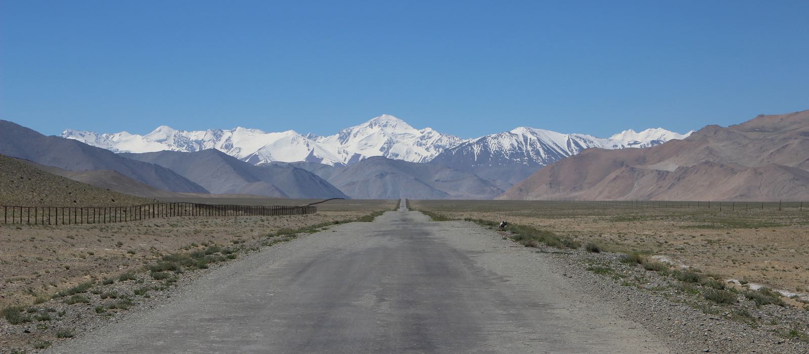
The Pamir Highway, or M41, is a road of over 1,200 km across the Pamir Mountains that ends in Osh, in Kyrgyzstan. In Tajikistan it follows the Panj river past Qal'ai Khumb and Khorog, climbs to Murghob, at 3,650 m the highest town in the country, and crosses the Ak-Baital Pass at 4,655 m, then Lake Karakul and the Kyzylart Pass into Kyrgyzstan. A southern variant runs through the Wakhan valley, from Ishkoshim to Langar. The Tajik part of the road crosses Gorno-Badakhshan (GBAO), which needs a permit: check the current rules before you go. Here are the local guides who work in the area and the trips that cross it.
2 local guides and 1 trip on the Pamir Highway on GuideMeet.
On the map
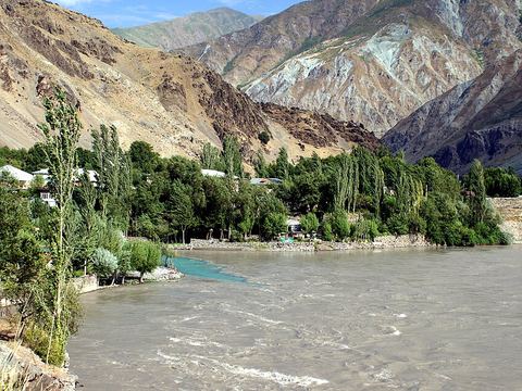 Qal'ai Khumb — Town. Border town on the Panj where the Pamir Highway meets the river: an overnight stop on the way from Kulob to Khorog, 235 km from Khorog. Pictured: the Khumb flowing into the Panj. 38.4664, 70.7967 · Google Maps
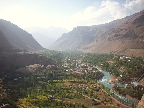 Khorog — Town. Capital of Gorno-Badakhshan, at 2,200 m where the Ghunt flows into the Panj. The Pamir Highway continues east to Murghob, about 310 km away. 37.4833, 71.5500 · Google Maps
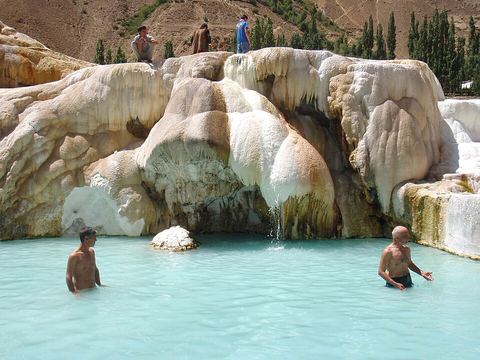 Garm Chashma — Spring. Hot spring at 2,325 m in the Ishkoshim Range, 40 km from Khorog: the water reaches 50–75 °C and rises in small geysers up to 1 m high. 37.2035, 71.5377 · Google Maps
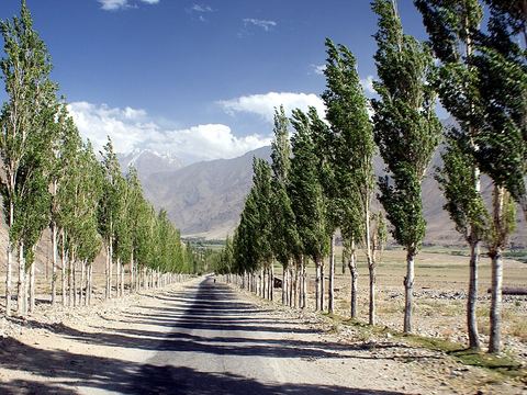 Ishkoshim — Village. Seat of Ishkoshim District, on the Panj, opposite the Afghan town of the same name. From here the road follows the Panj into the Wakhan valley, towards Langar. 36.7272, 71.6117 · Google Maps
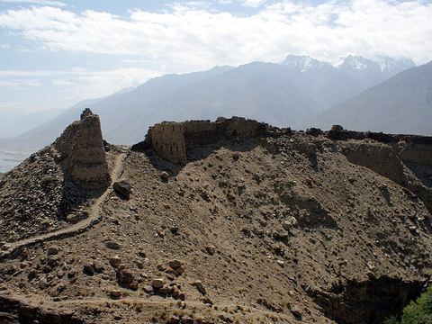 Yamchun Fortress — Archaeological site. Ruins of a Silk Road fort built about 400 m above the Wakhan valley: three rings of double walls, with 36 towers along the perimeter. 36.9697, 72.2608 · Google Maps
- Langar — Village. Small village in the Wakhan, in Ishkoshim District, on the road from Ishkoshim to the Khargush post and on towards Murghob. 37.0510, 72.6760 · Google Maps
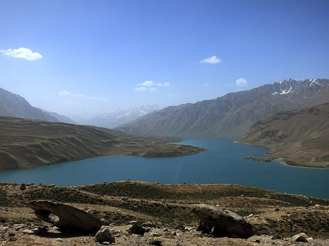 Yashilkul — Lake. Freshwater lake in the upper Gunt valley, up to 52 m deep, 130 km east of Khorog. Bulunkul lake is 1.5 km away; the village of Bulunkul is known as one of the coldest in Central Asia. 37.7665, 72.9359 · Google Maps
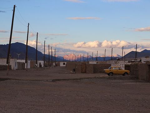 Alichur — Village. Village in Murghob District, in the Alichur valley along the highway. Its name means 'Ali's curse': tradition links it to the harsh climate and the winds. 37.7523, 73.2630 · Google Maps
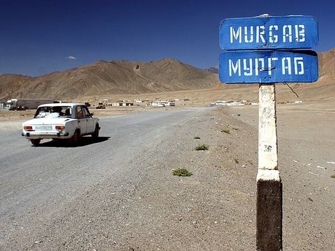 Murghob — Town. At 3,650 m, the highest town in Tajikistan and the only significant one in the eastern half of Gorno-Badakhshan. The Pamir Highway runs north to Sary-Tash and south-west to Khorog. 38.1689, 73.9650 · Google Maps
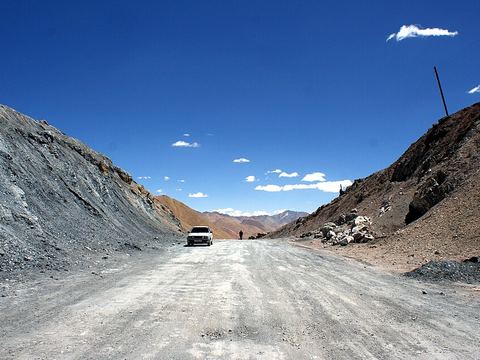 Ak-Baital Pass — Mountain pass. At 4,655 m, the highest point of the M41. The road crosses it between Murghob and Lake Karakul, in Gorno-Badakhshan. 38.5609, 73.5975 · Google Maps
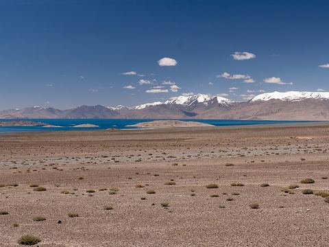 Karakul — Lake. Brackish lake at 3,960 m, 25 km across and with no outlet, inside a 52 km depression interpreted as an impact crater. It lies in the Tajik National Park. 39.0400, 73.4200 · Google Maps
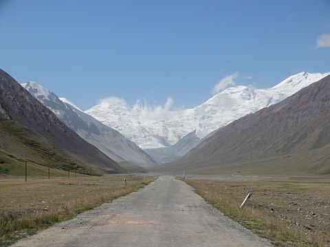 Kyzylart Pass — Border crossing. Pass and border crossing between Kyrgyzstan and Tajikistan in the Trans-Alay Range, at 4,280 m. The Kyrgyz checkpoint is Bor-Döbö; the area is rugged and dry. 39.3843, 73.3225 · Google Maps
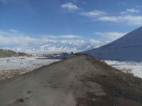 Sary-Tash — Village. Village and crossroads in the Alay Valley: the M41 goes north over the Taldyk Pass to Osh and south up to the Kyzylart Pass, and another road leads east towards China. 39.7300, 73.2500 · Google Maps
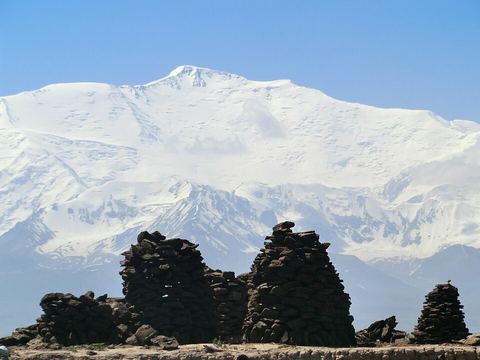 Lenin Peak — Peak. 7,134 m on the Kyrgyz–Tajik border, the tallest mountain of the Trans-Alay Range, which closes the Alay Valley to the south. Pictured from Sary-Mogol. 39.3425, 72.8775 · Google Maps
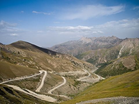 Taldyk Pass — Mountain pass. Pass at 3,615 m in the Alay Mountains, crossed by the M41 between Osh and the Alay Valley. A monument at the top remembers the manager who built the road. 39.7651, 73.1683 · Google Maps
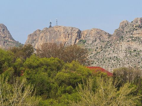 Osh — Town. Second-largest city in Kyrgyzstan and the terminus of the Pamir Highway. Pictured: Sulayman Mountain, a UNESCO World Heritage Site. 40.5300, 72.8000 · Google Maps
Local guides on the Pamir Highway
Overland trips on the Pamir Highway
- Pamir Highway- Tajikistan — 10 days · Tajikistan
When to go
Murghob has an alpine tundra climate: July averages 8.7 °C and January −18.7 °C. Plan the high plateau for the warm months and check the passes before crossing them; September is the driest month there, May the wettest.
Before you go
- All guides and trips in Tajikistan
- Do you need a local guide in Tajikistan?
- Is Tajikistan safe to travel?
- Driving and local rules in Tajikistan
Photo credits
Photos from Wikimedia Commons, under the licences shown.
- Pamir Highway: Hylgeriak / Wikipedia, CC BY-SA 3.0
- 1. Qal'ai Khumb: Kondephy, CC BY-SA 4.0
- 2. Khorog: Zack Knowles, CC BY-SA 3.0
- 3. Garm Chashma: Raki_Man, CC BY 3.0
- 4. Ishkoshim: Kondephy, CC BY-SA 4.0
- 5. Yamchun Fortress: Kondephy, CC BY-SA 4.0
- 7. Yashilkul: DaMitti, CC BY-SA 4.0
- 8. Alichur: Hylgeriak / Wikipedia, CC BY-SA 3.0
- 9. Murghob: Kondephy, CC BY-SA 4.0
- 10. Ak-Baital Pass: Kondephy, CC BY-SA 4.0
- 11. Karakul: Ekrem Canli, CC BY-SA 3.0
- 12. Kyzylart Pass: Benoît Vicart, CC0
- 13. Sary-Tash: SyntaxTerror, Public domain
- 14. Lenin Peak: Nihongarden, CC BY-SA 3.0
- 15. Taldyk Pass: Gustavo Jeronimo from Aranjuez, Spain, CC BY 2.0
- 16. Osh: A.Savin, FAL


.jpg)
