Overland region
The Murzuq Erg and the Acacus by 4x4: local guides and trips
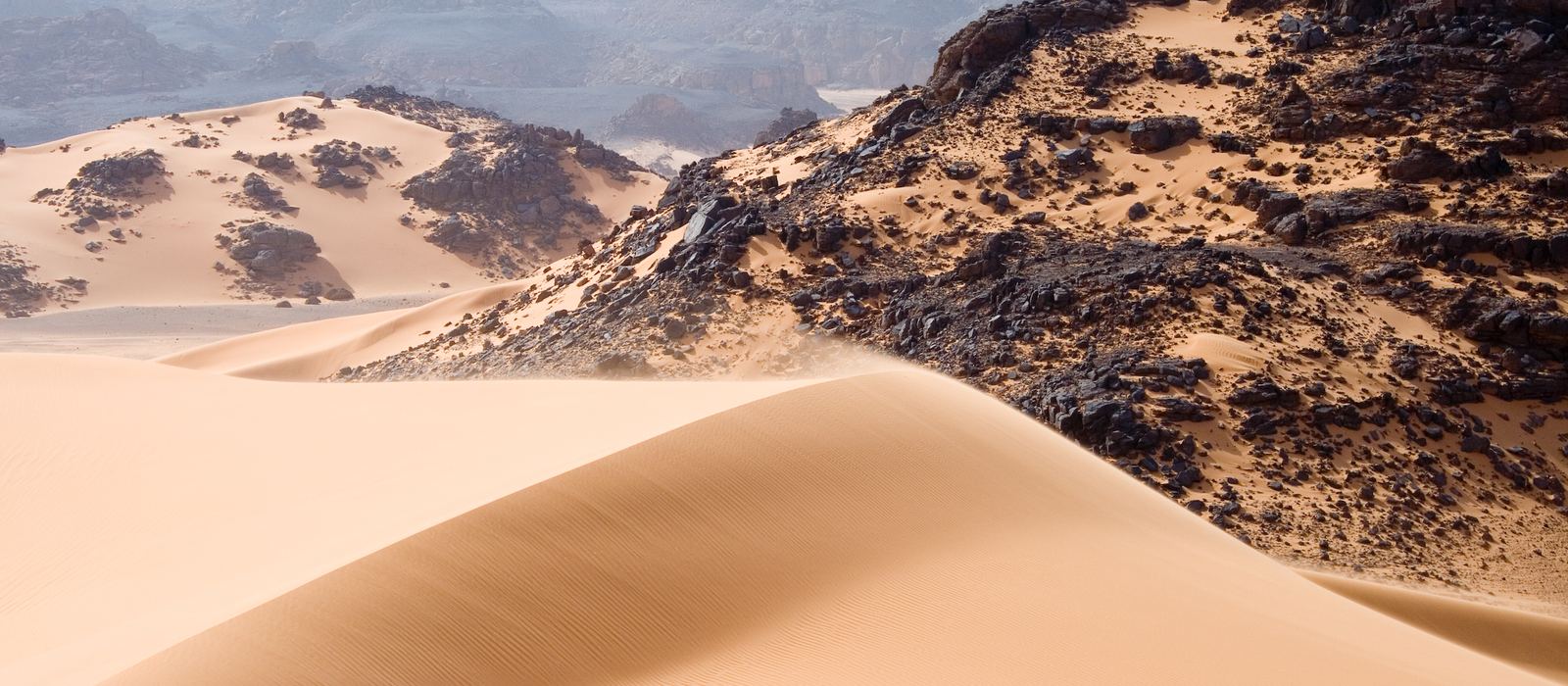
The south-west of Libya, in the Fezzan, holds the Tadrart Acacus east of Ghat and close to the Algerian border: a mountain range of arches, gorges and prehistoric rock art, a UNESCO World Heritage Site since 1985. Further east lie the engravings of Wadi Mathendous, the oasis lakes of the Ubari sand sea at Gaberoun and Um al-Maa, the ruins of Garama, once capital of the Garamantes, and the Murzuq Desert, an erg of about 58,000 km² beside the oasis town of Murzuk. Here are the local guides who work in the area and the trips that cross it.
1 local guide and 1 trip in the Murzuq Erg and the Acacus on GuideMeet.
On the map
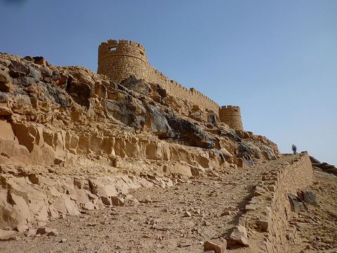 Ghat — Town. Oasis town just east of the Algerian border, a stronghold of the Kel Ajjer Tuareg and a terminus of the trans-Saharan trade. Pictured: the fortress on Koukemen hill. 24.9594, 10.1758 · Google Maps
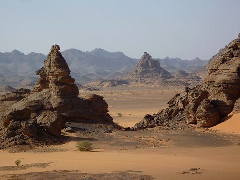 Acacus Mountains — Rock art. Mountain range east of Ghat, stretching north from the Algerian border for about 100 km, with dunes, arches, gorges and prehistoric rock art; a UNESCO World Heritage Site since 1985. 24.8333, 10.3333 · Google Maps
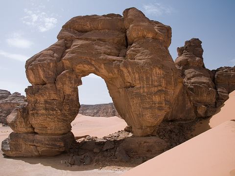 Afzejare Arch — Rock formation. One of the main landmarks of the Acacus: a natural arch standing among the dunes, also written Fozzigiaren. 24.6842, 10.6339 · Google Maps
- Uan Muhuggiag — Archaeological site. Rock shelter in the Tadrart Acacus, on the bank of Wadi Teshuinat, inhabited from at least the 6th millennium BC to about 2700 BC; the Tashwinat mummy was found here. 24.9000, 10.3667 · Google Maps
- Awis — Rock formation. Rock arch named Awis in the northern part of the Acacus, one of the many arches that erosion has carved in the range. 25.3380, 10.5472 · Google Maps
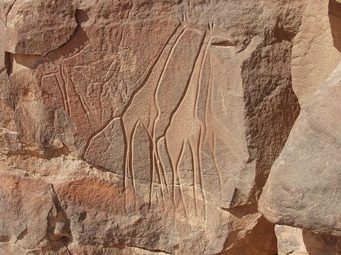 Wadi Mathendous — Rock art. Prehistoric site on the Messak Settafet escarpment, with Neolithic engravings of elephants, giraffes, aurochs, wildcats and crocodiles, dated to about 6000 BC; also spelled Methkandoush. 25.7634, 12.1704 · Google Maps
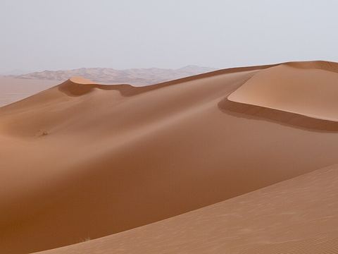 Ubari — Town. Oasis town and capital of the Wadi al Hayaa District, between the Messak plateau and the dunes and lakes of the Idehan Ubari. Pictured: dunes of the Idehan Ubari. 26.5833, 12.7667 · Google Maps
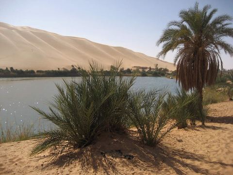 Gaberoun — Lake. Oasis with a large, very salty lake among the dunes of the Idehan Ubari; the ruins of the old settlement lie among the palms on the north-western shore. 26.8031, 13.5353 · Google Maps
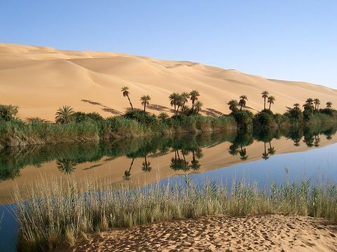 Um al-Maa — Lake. Oasis lake in the Ubari sand sea, near Gaberoun and the Mandara lakes; the name means 'mother of water'. 26.7096, 13.3333 · Google Maps
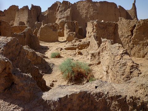 Germa — Archaeological site. Ruins of ancient Garama, capital of the Garamantes, a Saharan people whose power peaked in the 2nd and 3rd centuries AD. 26.5440, 13.0640 · Google Maps
- Murzuq Desert — Dunes. Erg of about 58,000 km² in south-west Libya, named after the town of Murzuk; in its western part huge 'draa' dunes alternate with smooth basins. 24.7500, 13.0000 · Google Maps
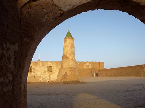 Murzuk — Town. Oasis town on the northern edge of the Murzuq Desert, a stop on the old north-south trade route across the Sahara; the fortress is in ruins. Pictured: the mosque. 25.9136, 13.9169 · Google Maps
Local guides in the Murzuq Erg and the Acacus
- abdurazzag gherwash — Tripoli, Libya · 4x4 car, 4x4 truck, camper / van, 4x4 van
Overland trips in the Murzuq Erg and the Acacus
- **Authentic. Ancient. Unforgettable.** — 15 days · Libya
When to go
Average highs at Ghat reach about 40 °C from June to August; October to May is the milder season, with very little rain (about 8 mm a year at Ghat). Government advisories warn against travel to most of Libya, the Fezzan included: read your government's official advice before planning anything.
Before you go
- All guides and trips in Libya
- Do you need a local guide in Libya?
- Is Libya safe to travel?
- Driving and local rules in Libya
Photo credits
Photos from Wikimedia Commons, under the licences shown.
- Murzuq Erg and Acacus: Luca Galuzzi, CC BY-SA 2.5
- 1. Ghat: Franzfoto, CC BY-SA 3.0
- 2. Acacus Mountains: Franzfoto, CC BY-SA 3.0
- 3. Afzejare Arch: Luca Galuzzi (Lucag), CC BY-SA 2.5
- 6. Wadi Mathendous: ruba_ch/Rudolf Baumann, CC BY 2.0
- 7. Ubari: Luca Galuzzi (Lucag), CC BY-SA 2.5
- 8. Gaberoun: David Stanley from Nanaimo, Canada, CC BY 2.0
- 9. Um al-Maa: Sfivat, Public domain
- 10. Germa: Franzfoto, CC BY-SA 3.0
- 12. Murzuk: Franzfoto, CC BY-SA 3.0


.jpg)

_-_Ruinen_der_antiken_Stadt_Garma_02.jpg)
