Overland region
Amboseli and Tsavo by 4x4: local guides and trips
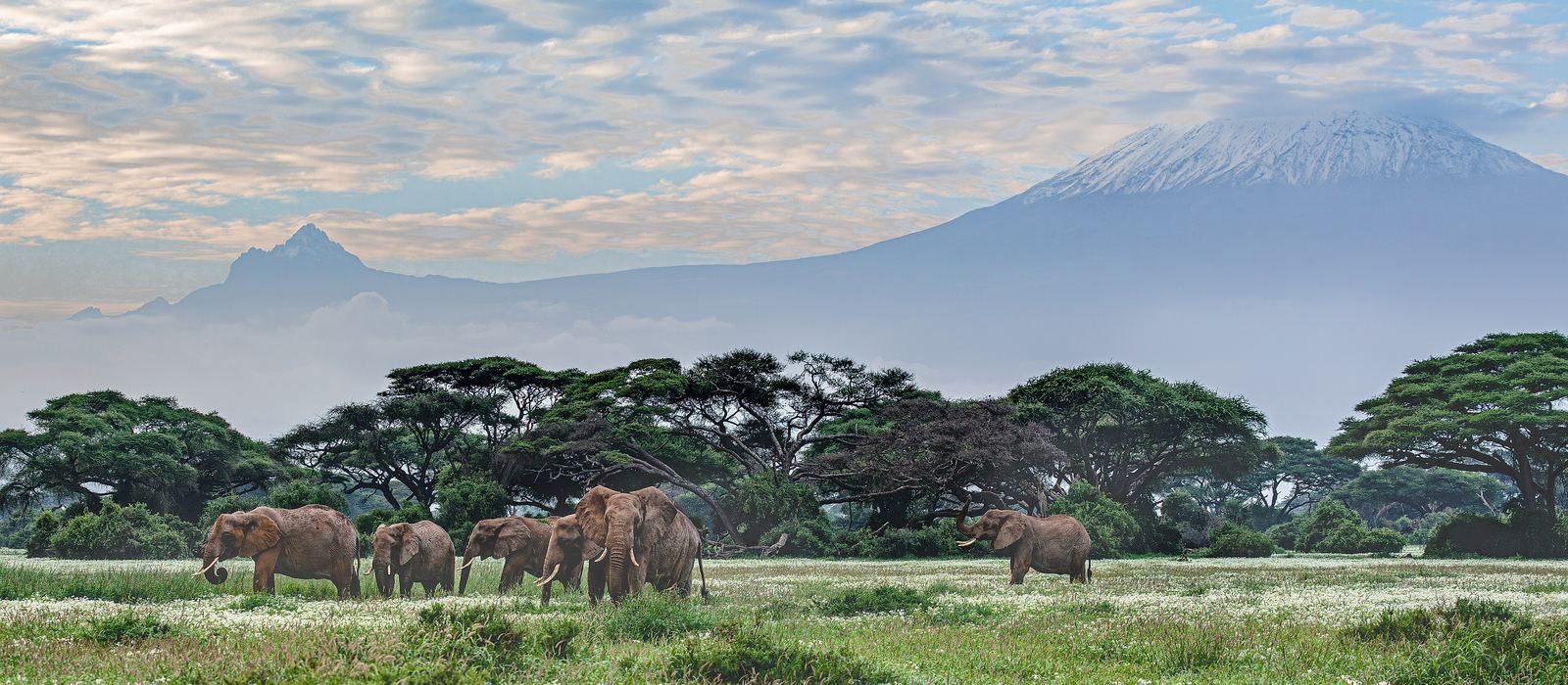
Amboseli, an 8,000 km² ecosystem across the Kenya–Tanzania border with Mount Kilimanjaro on the horizon, and Tsavo, whose east and west parks together cover about 22,000 km², are separated by the volcanic Chyulu Hills. For anyone travelling with their own vehicle it means the springs and lava flows of Tsavo West, the dry plains and rock lookouts of Tsavo East along the Galana River, the Taita Hills, and Lake Chala and Lake Jipe on the Tanzanian border. Here are the local guides who work in the area and the trips that cross it.
6 local guides and 11 trips in Amboseli and Tsavo on GuideMeet.
On the map
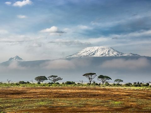 Amboseli National Park — Park. 392 km² at the heart of an 8,000 km² ecosystem that crosses into Tanzania; known for its elephants, studied since 1972. Kilimanjaro rises across the border. -2.6414, 37.2481 · Google Maps
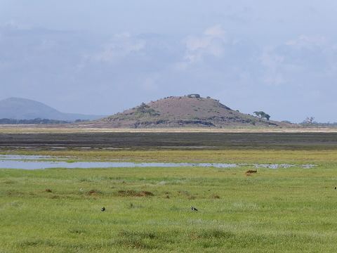 Observation Hill — Viewpoint. Small hill inside the park with a lookout. The park protects two of the five main swamps of its ecosystem and the bed of a dried-up Pleistocene lake. -2.6721, 37.2383 · Google Maps
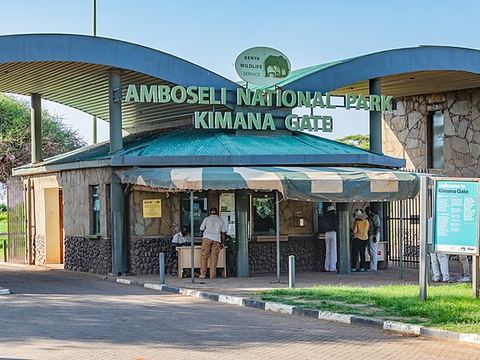 Kimana — Village. Small town in Kajiado County, east of Amboseli, in a semi-arid area where farming is difficult. Pictured: Kimana Gate, one of the park entrances. -2.8000, 37.5333 · Google Maps
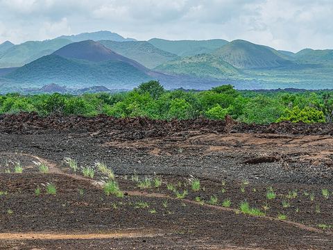 Chyulu Hills — Park. A volcanic range 100 km long between the Tsavo and Amboseli plains, up to 2,188 m. No permanent rivers: its rain feeds Mzima Springs and the Tsavo and Galana rivers. -2.6000, 37.8500 · Google Maps
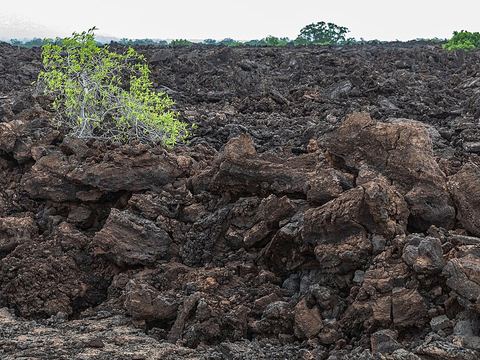 Shetani Lava Flow — Rock formation. A field of black lava in Tsavo West, at the foot of the Chyulu Hills, from the area's latest eruptions in the mid-19th century. The volcanoes there are still considered active. -2.9167, 37.9998 · Google Maps
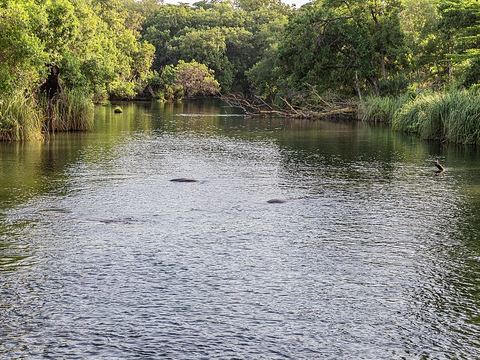 Mzima Springs — Spring. Four springs in Tsavo West fed by rain that filters through the Chyulu Hills for up to 25 years. Famous for the hippos and Nile crocodiles in their clear pools. -2.9833, 38.0217 · Google Maps
- Mtito Andei — Town. Small town on the Nairobi–Mombasa road, 233 km from Nairobi, at the western edge of Tsavo with two park gates. From here to Voi it is 96 km. -2.6900, 38.1700 · Google Maps
 Lake Chala — Lake. Crater lake on the Kenya–Tanzania border, formed about 250,000 years ago, 8 km north of Taveta, inside a crater rim up to 170 m high. -3.3167, 37.7000 · Google Maps
- Lake Jipe — Lake. Shallow lake of about 30 km² straddling the Kenya–Tanzania border, fed by the Lumi River from Kilimanjaro; Tsavo West protects part of its northern shore. -3.6019, 37.7648 · Google Maps
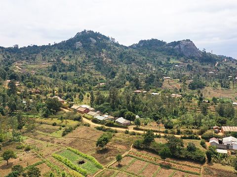 Taita Hills — Peak. Range of three massifs; the tallest, Dawida, peaks at Vuria, 2,228 m. Only about 6 km² of moist forest remain, home to endemic plants and birds. -3.4167, 38.3333 · Google Maps
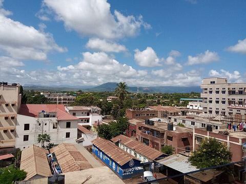 Voi — Town. Largest town in Taita-Taveta County, at the western edge of the Taru Desert, south and west of Tsavo East. It began in 1897 as a railway camp. -3.3906, 38.5769 · Google Maps
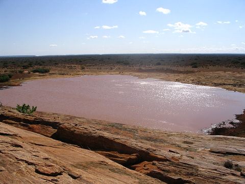 Mudanda Rock — Rock formation. Inselberg of stratified rock in Tsavo East that catches rain and feeds a natural dam below: a lookout over the elephants and other animals that come to drink in the dry season. -3.1773, 38.5257 · Google Maps
- Lugard Falls — Waterfall. Series of white-water rapids on the Athi-Galana-Sabaki River in Tsavo East, named after Frederick Lugard. -3.0405, 38.6965 · Google Maps
Local guides in Amboseli and Tsavo
- KT & Safaris — Mombasa, Kenya · 4x4 car, 4x4 van
- Nancy Yogo — Nairobi, Kenya · 4x4 truck
- Emmanuel Ndeleva — Nairobi, Kenya · 4x4 car
- Felix Kiwia — Safari Masters, Tanzania · 4x4 truck, camper / van, 4x4 car
- BIENVENIDO SAFARIS — Nairobi, Kenya · 4x4 van
- Robert Murigi — Nairobi, Kenya · 4x4 car, 4x4 truck, 4x4 van
Overland trips in Amboseli and Tsavo
- 7-Day Masai Mara Nakuru Hell's Gate Naivasha Amboseli4X4 $985 pp (USD) — 7 days · Kenya
- 2 Days Amboseli Safari (Group Joining Tour) $420 — 2 days · Kenya
- 3 Days Nairobi Amboseli Tsavo East Mombasa/Diani Private Safari $870 — 3 days · Kenya
- 14 Days Overland Kenya and Tanzania safari — 14 days · Kenya
- 4 Days Safari Kenya — 4 days · Kenya
- 7 Days Safari Kenya — 7 days · Kenya
- 3 Days Safari Tsavo East and West — 3 days · Kenya
- 3 Days Safari Tsavo East — 3 days · Kenya
- 3 Days Safari Tsavo East and Taita hills/ Saltlick lodge — 3 days · Kenya
- 2 Days safari Tsavo East — 2 days · Kenya
- 11 DAYS MASAI MARA WILDBEEST MIGRATION — 12 days · Kenya
When to go
Tsavo is hot and semi-arid: in the dry season animals gather at permanent water such as Mzima Springs and the Mudanda Rock dam, and severe droughts, like those of 2009 and 2022, put wildlife and grazing under strain. The hills, such as the Taita Hills with their moist forests, are wetter than the plains.
Before you go
- All guides and trips in Kenya
- Do you need a local guide in Kenya?
- Is Kenya safe to travel?
- Driving and local rules in Kenya
Photo credits
Photos from Wikimedia Commons, under the licences shown.
- Amboseli and Tsavo: Ninaras, CC BY 4.0
- 1. Amboseli National Park: Sergey Pesterev, CC BY-SA 4.0
- 2. Observation Hill: Regina Hart from Industry, United States, CC BY 2.0
- 3. Kimana: Ninaras, CC BY 4.0
- 4. Chyulu Hills: Ninara, CC BY 2.0
- 5. Shetani Lava Flow: Ninara, CC BY 2.0
- 6. Mzima Springs: Ninara, CC BY 2.0
- 8. Lake Chala: Joachim Huber, CC BY-SA 2.0
- 10. Taita Hills: Tish Madesh, CC0
- 11. Voi: TTC dude, CC BY-SA 4.0
- 12. Mudanda Rock: CT Cooper, Public domain


.jpg)


